MyTopo
Ancram New York US Topo Map
Couldn't load pickup availability
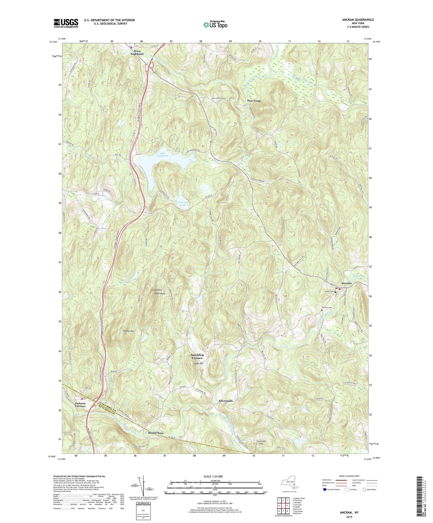
2019 topographic map quadrangle Ancram in the state of New York. Scale: 1:24000. Based on the newly updated USGS 7.5' US Topo map series, this map is in the following counties: Columbia, Dutchess. The map contains contour data, water features, and other items you are used to seeing on USGS maps, but also has updated roads and other features. This is the next generation of topographic maps. Printed on high-quality waterproof paper with UV fade-resistant inks.
Quads adjacent to this one:
West: Clermont
Northwest: Hudson South
North: Claverack
Northeast: Hillsdale
East: Copake
Southeast: Millerton
South: Pine Plains
Southwest: Rock City
Contains the following named places: Ancram, Ancram Cemetery, Ancram Post Office, Ancram Volunteer Fire Company, Chrysler Pond Outlet, Fall Kill, Gallatin Church, Gallatinville, Green Hill, Ham Brook, Jackson Corners, Lake Taghkanic, Lake Taghkanic State Park, Milan Fire Department Station 1, Mount Ross, New Forge, Pond Lily Pond, Roeliff Jansen Kill State Multiple Use Area, Saint John's Lutheran Church, School Number 10, School Number 4, Shekomeko Creek, Signal Rock, Silvernails, Silvernails Field, Snake Hill, Snydam Creek, Spaulding Furnace, Taghkanic Volunteer Fire Company 1 West Taghkanic Station 1, Tiffany Hill, Town of Gallatin, Union Cemetery, West Taghkanic, ZIP Code: 12502