MyTopo
Andover New York US Topo Map
Couldn't load pickup availability
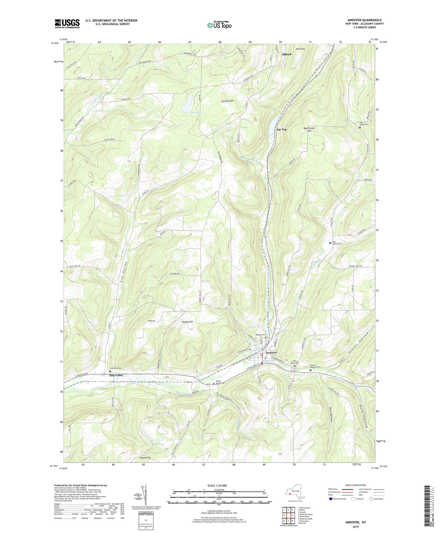
2019 topographic map quadrangle Andover in the state of New York. Scale: 1:24000. Based on the newly updated USGS 7.5' US Topo map series, this map is in the following counties: Allegany. The map contains contour data, water features, and other items you are used to seeing on USGS maps, but also has updated roads and other features. This is the next generation of topographic maps. Printed on high-quality waterproof paper with UV fade-resistant inks.
Quads adjacent to this one:
West: Wellsville North
Northwest: West Almond
North: Alfred
Northeast: Hornell
East: Greenwood
Southeast: Rexville
South: Whitesville
Southwest: Wellsville South
Contains the following named places: Andover, Andover First Baptist Church, Andover Free Library, Andover Pond, Andover Post Office, Andover School, Andover United Methodist Church, Andover Volunteer Fire Department and Ambulance, Ben Socker Hill, Best Hollow, Blessed Sacrament Catholic Church, Cole Dike Cemetery, East Valley Cemetery, East Valley Creek, Elm Valley, Foster Lake, Gate of Heaven Cemetery, Hillside Cemetery, Indian Creek, Jericho Hill, Kent Farms, Pingry Hill, Quig Hollow, Railroad Brook, Saint Johns Cemetery, School Number 1, School Number 2, School Number 3, School Number 4, School Number 5, School Number 7, School Number 8, School Number 9, Shovel Hollow, Sunny Cove Farm, Tip Top, Town of Alfred, Town of Andover, Valley Brook Cemetery, Village of Andover, ZIP Code: 14806