MyTopo
Wellsville South New York US Topo Map
Couldn't load pickup availability
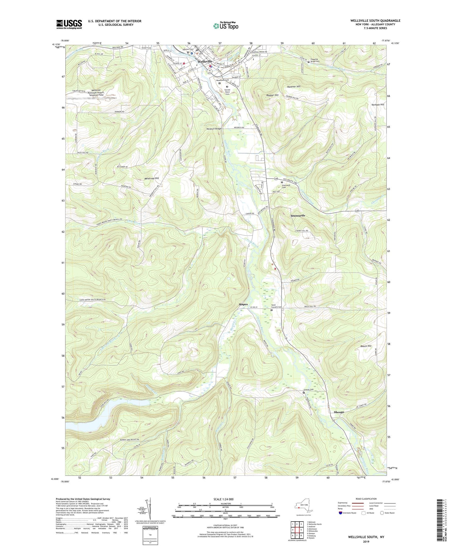
2023 topographic map quadrangle Wellsville South in the state of New York. Scale: 1:24000. Based on the newly updated USGS 7.5' US Topo map series, this map is in the following counties: Allegany. The map contains contour data, water features, and other items you are used to seeing on USGS maps, but also has updated roads and other features. This is the next generation of topographic maps. Printed on high-quality waterproof paper with UV fade-resistant inks.
Quads adjacent to this one:
West: Allentown
Northwest: Belmont
North: Wellsville North
Northeast: Andover
East: Whitesville
Southeast: Ulysses
South: Ellisburg
Southwest: Oswayo
This map covers the same area as the classic USGS quad with code o42077a8.
Contains the following named places: Alfred State College Wellsville Campus, Babcock Theatre, Brandes Farms, Brimmer Brook School, Brooklyn Avenue Grade School, Calvary Baptist Church, Camp Owaissa, Chenunda Creek, David A Howe Public Library, Dyke Creek, Dyke Street Engine Company Number 2, Fanton Farm, First Congregational Church, First United Methodist Church, Ford Brook, Ford Brook Church, Ford Brook School, Full Gospel Mission, Gospel Tabernacle, Grant Duke Hose Company, Graves Cemetery, Graves Crossing, Hanover Hill, Highland Healthcare Center, Immaculate Conception Roman Catholic Church, Immaculate Conception School, Island Park, Johnson Cemetery, Jones Memorial Hospital, Kingdom Hall of Jehovahs Witnesses, Level Acres Mobile Home Park, Mapes, Marsh Creek, Memorial Park, Meservey Hill, Orebed Creek, Pasquale Block, Rauber Hill, Redwater Creek, Sacred Heart Cemetery, Saint John's Episcopal Church, School Number 1, School Number 10, School Number 2, School Number 5, School Number 8, Seventh Day Adventist Church, Shepherd of the Valley Lutheran Church, Shongo, South Branch Ford Brook, Stannards, Stannards Cemetery, Stannards Census Designated Place, Stone Dam, The Christian Temple, Thornton Building, Town of Wellsville, Town of Willing, Trapping Brook Cemetery, Trinity First Evangelical Lutheran Church, Tullar Field, Village of Wellsville, Village of Wellsville Water Works Pumping Station, Washington School, Weidrich Bridge, Wellsville, Wellsville Elementary School, Wellsville Fire Department, Wellsville Full Gospel Church, Wellsville High School, Wellsville Middle School, Wellsville Municipal Airport Tarantine Field, Wellsville Municipal Building, Wellsville Post Office, Wellsville Presbyterian Church, Wellsville Student Activities Center, Wellsville Volunteer Ambulance Corps, Wesleyan Methodist Church, Willing Volunteer Hose Company 1, WLSV-AM (Wellsville), Woodlawn Cemetery, York Corners, Yorks Corners Cemetery, Yorks Corners Mennonite Church, ZIP Code: 14895