MyTopo
Barnes Corners New York US Topo Map
Couldn't load pickup availability
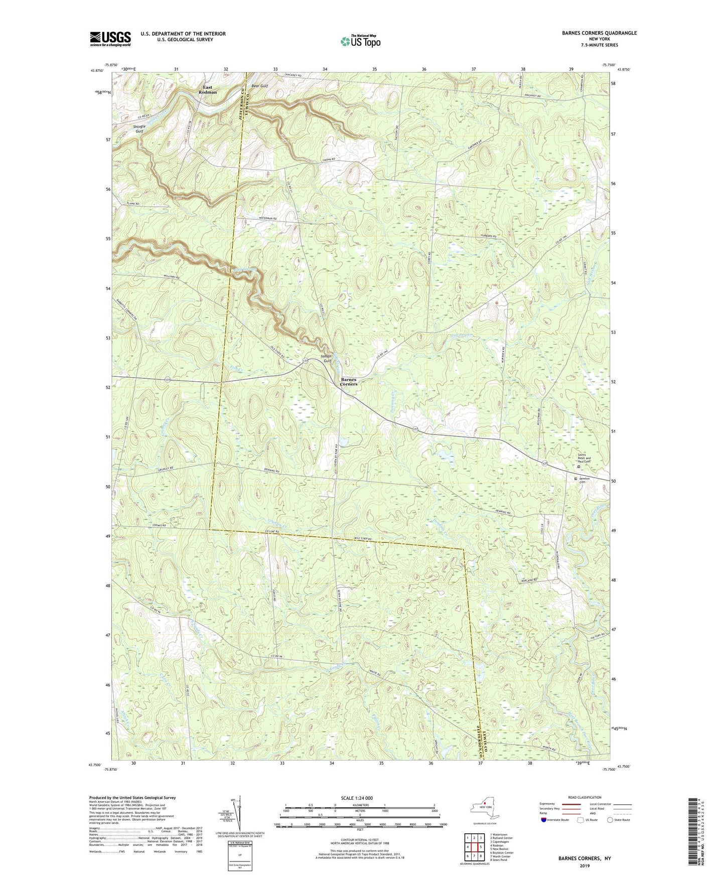
2019 topographic map quadrangle Barnes Corners in the state of New York. Scale: 1:24000. Based on the newly updated USGS 7.5' US Topo map series, this map is in the following counties: Lewis, Jefferson. The map contains contour data, water features, and other items you are used to seeing on USGS maps, but also has updated roads and other features. This is the next generation of topographic maps. Printed on high-quality waterproof paper with UV fade-resistant inks.
Quads adjacent to this one:
West: Rodman
Northwest: Watertown
North: Rutland Center
Northeast: Copenhagen
East: New Boston
Southeast: Sears Pond
South: Worth Center
Southwest: Boylston Center
Contains the following named places: Babbits Corners, Barnes Corners, Bear Gulf, Cronk Corners, Denning Creek, East Rodman, Forks Number Two, Newton Cemetery, Pigeon Creek, Rainbow Falls, Saints Peter and Paul Cemetery, School Number 1, School Number 11, School Number 2, School Number 3, School Number 4, School Number 6, School Number 7, School Number 8, School Number 9, Seven by Nine Corners, Shingle Gulf, Town of Pinckney, West Branch Deer River