MyTopo
Rodman New York US Topo Map
Couldn't load pickup availability
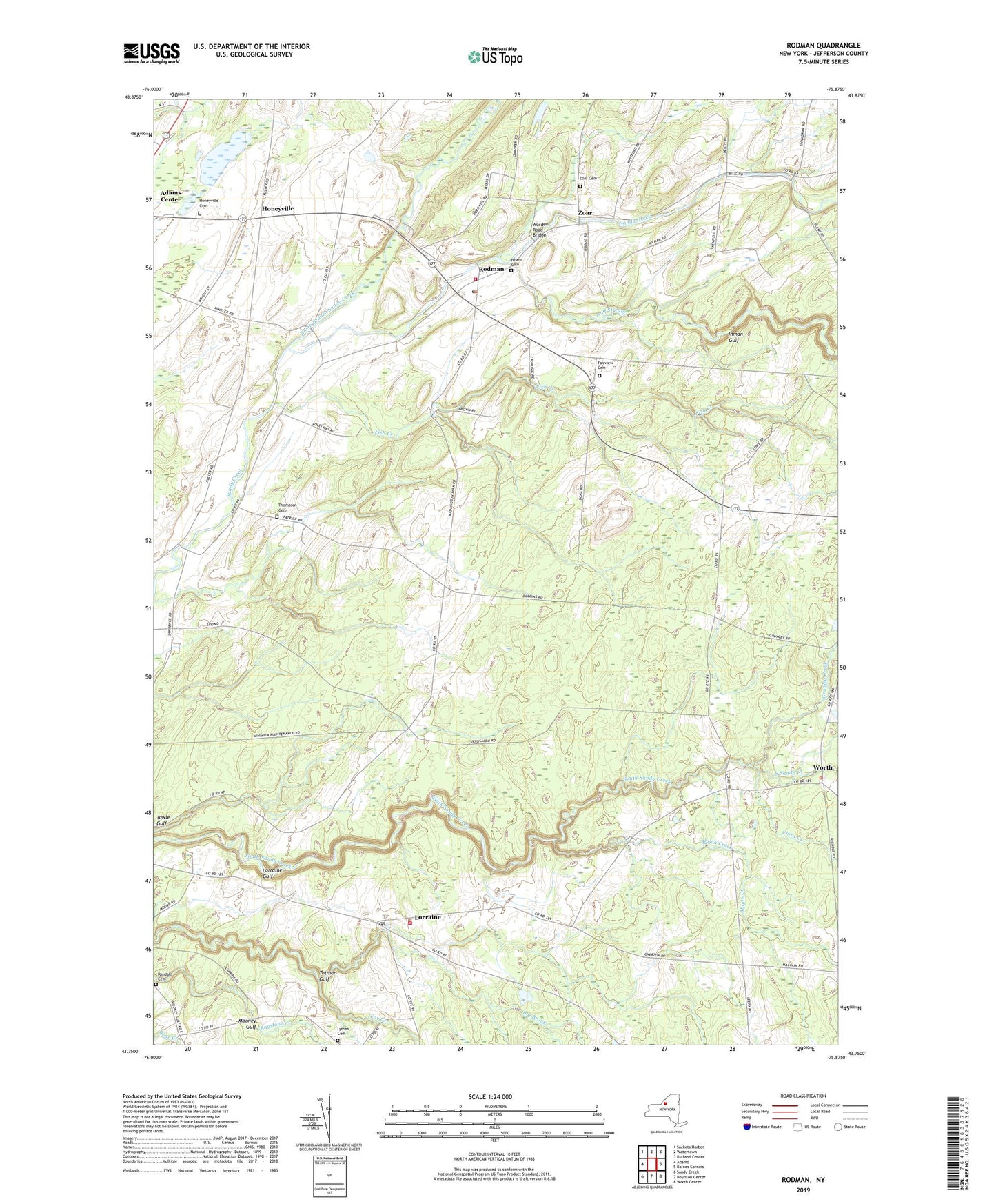
2023 topographic map quadrangle Rodman in the state of New York. Scale: 1:24000. Based on the newly updated USGS 7.5' US Topo map series, this map is in the following counties: Jefferson. The map contains contour data, water features, and other items you are used to seeing on USGS maps, but also has updated roads and other features. This is the next generation of topographic maps. Printed on high-quality waterproof paper with UV fade-resistant inks.
Quads adjacent to this one:
West: Adams
Northwest: Sackets Harbor
North: Watertown
Northeast: Rutland Center
East: Barnes Corners
Southeast: Worth Center
South: Boylston Center
Southwest: Sandy Creek
This map covers the same area as the classic USGS quad with code o43075g8.
Contains the following named places: Abijah Creek, Adams State Road Cemetery, Big Brook, Bullock Corners, Clora Creek, Fairview Cemetery, Fish Creek, Gould Corners, Grunley Creek, Gulf Stream, Honeyville, Honeyville Baptist Church, Inman Gulf, Isham Cemetery, Kings Quarry, Lorraine, Lorraine Census Designated Place, Lorraine Gulf, Lorraine Post Office, Lorraine Volunteer Fire Company, Lyman Cemetery, North Branch Sandy Creek, Porterdale Farms, Randall Cemetery, Rodman, Rodman Census Designated Place, Rodman Fire Department, Rodman Post Office, Rodman Public Library, Ross Corners, School Number 10, School Number 11, School Number 2, School Number 3, School Number 4, School Number 5, School Number 6, School Number 7, School Number 8, Stears Corners, Thompson Cemetery, Towle Gulf, Town of Rodman, Tremaines Corners, Whitford Corners, Worden Road Bridge, Worth, Zoar, Zoar Cemetery, ZIP Code: 13682