MyTopo
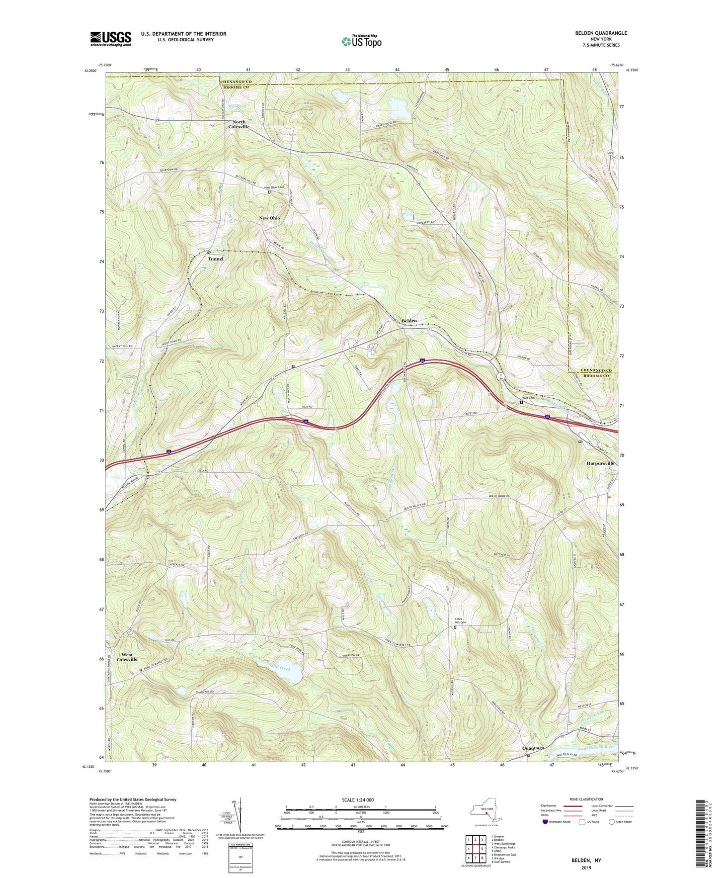
Belden New York US Topo Map
Couldn't load pickup availability
2019 topographic map quadrangle Belden in the state of New York. Scale: 1:24000. Based on the newly updated USGS 7.5' US Topo map series, this map is in the following counties: Broome, Chenango. The map contains contour data, water features, and other items you are used to seeing on USGS maps, but also has updated roads and other features. This is the next generation of topographic maps. Printed on high-quality waterproof paper with UV fade-resistant inks.
Quads adjacent to this one:
West: Chenango Forks
Northwest: Greene
North: Brisben
Northeast: West Bainbridge
East: Afton
Southeast: Gulf Summit
South: Windsor
Southwest: Binghamton East
Contains the following named places: Belden, Belden Hill, Belden Hill Campground, Belden Hill Golf Course, Coles Hill Cemetery, Colesville Town Hall, Colesville Volunteer Ambulance Service, Country Manor, Creekside Village, Flannerys Mobile Home Park, Hapursville Fire Department Station 2, Harpursville Baptist Church, Harpursville Post Office, Mill Pond, New Ohio, New Ohio Cemetery, North Colesville, Ouaquaga, Ouaquaga Creek, Ouaquaga Fire Company, Ouaquaga Post Office, Ouaquaga United Methodist Church, Pratt Cemetery, Town of Colesville, Tunnel, Tunnel Post Office, Watersnake Creek, West Colesville, West Colesville Baptist Church, West Colesville Fire Company, Windy Hill Farms, Wooded Estates, ZIP Code: 13787