MyTopo
Windsor New York US Topo Map
Couldn't load pickup availability
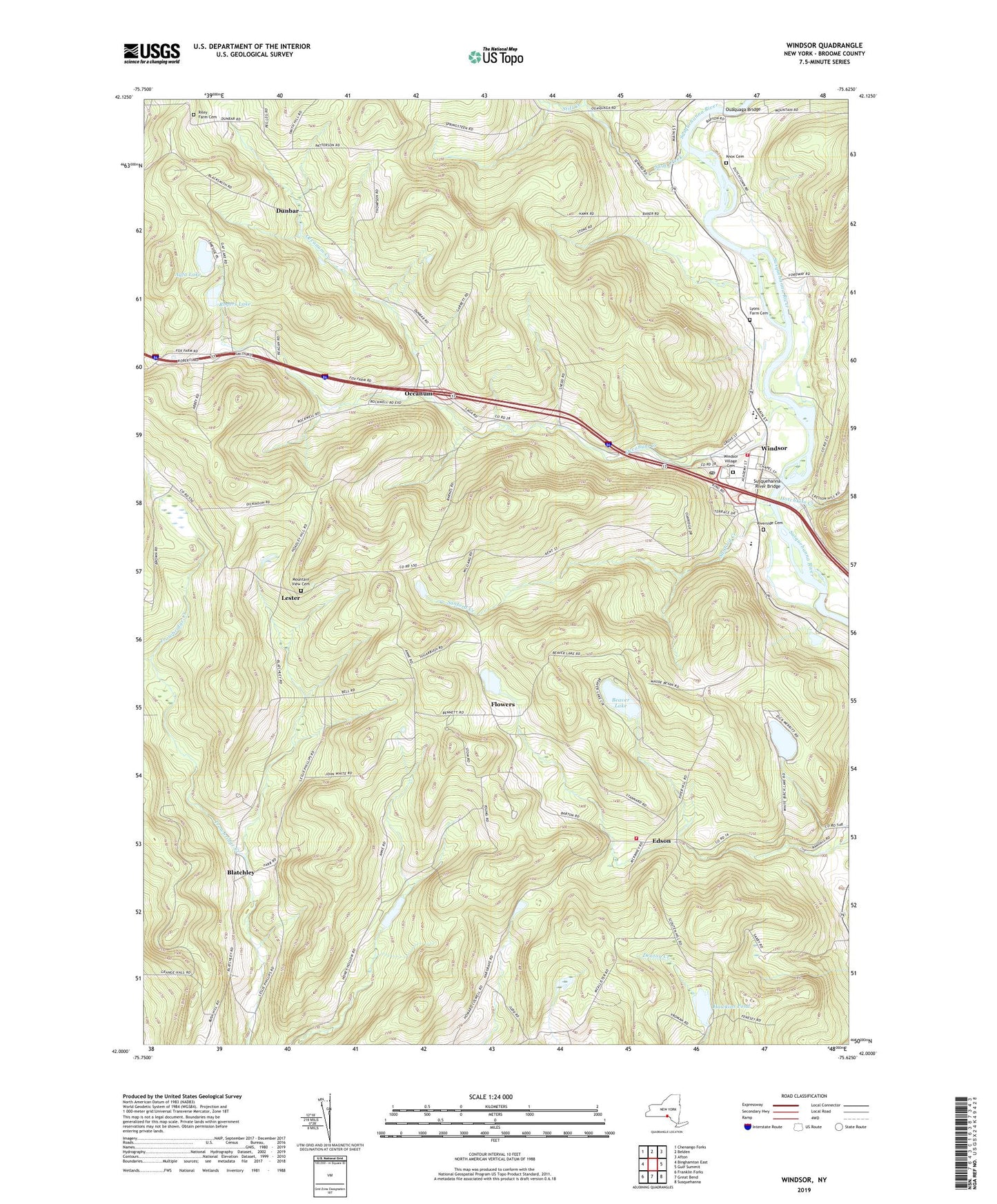
2023 topographic map quadrangle Windsor in the state of New York. Scale: 1:24000. Based on the newly updated USGS 7.5' US Topo map series, this map is in the following counties: Broome. The map contains contour data, water features, and other items you are used to seeing on USGS maps, but also has updated roads and other features. This is the next generation of topographic maps. Printed on high-quality waterproof paper with UV fade-resistant inks.
Quads adjacent to this one:
West: Binghamton East
Northwest: Chenango Forks
North: Belden
Northeast: Afton
East: Gulf Summit
Southeast: Susquehanna
South: Great Bend
Southwest: Franklin Forks
This map covers the same area as the classic USGS quad with code o42075a6.
Contains the following named places: Agfa Lake, Beaver Lake, Bell Road Quarry, Blatchley, Dunbar, Edson, Flowers, Forest View Mobile Home Park, Free Methodist Church, Hawkins Pond, Hawkins Pond Quarry, Hotchkiss Creek, Knox Cemetery, Lakeside Campground, Lester, Lester Baptist Church, Lyons Farm Cemetery, Mountain View Cemetery, Occanum, Occanum Community Church, Occanum Creek, Occanum Falls Mobile Home Park, Old Stone House Museum, Ouaquaga Bridge, Our Lady of Lourdes Roman Catholic Church, Riley Farm Cemetery, Riverside Cemetery, Rogers Lake, Sage Creek, Sanford Creek, Still Creek, Sunshine Valley Wesleyan Church, Susquehanna River Bridge, Town of Windsor, Village of Windsor, White Birch Lake, Windsor, Windsor Central High School, Windsor Elementary School, Windsor Fire Company Station 1, Windsor Fire Company Station 2, Windsor Pilgrim Holiness Church, Windsor Post Office, Windsor Presbyterian Church, Windsor Town Hall, Windsor Village Cemetery, ZIP Code: 13826