MyTopo
Belfort New York US Topo Map
Couldn't load pickup availability
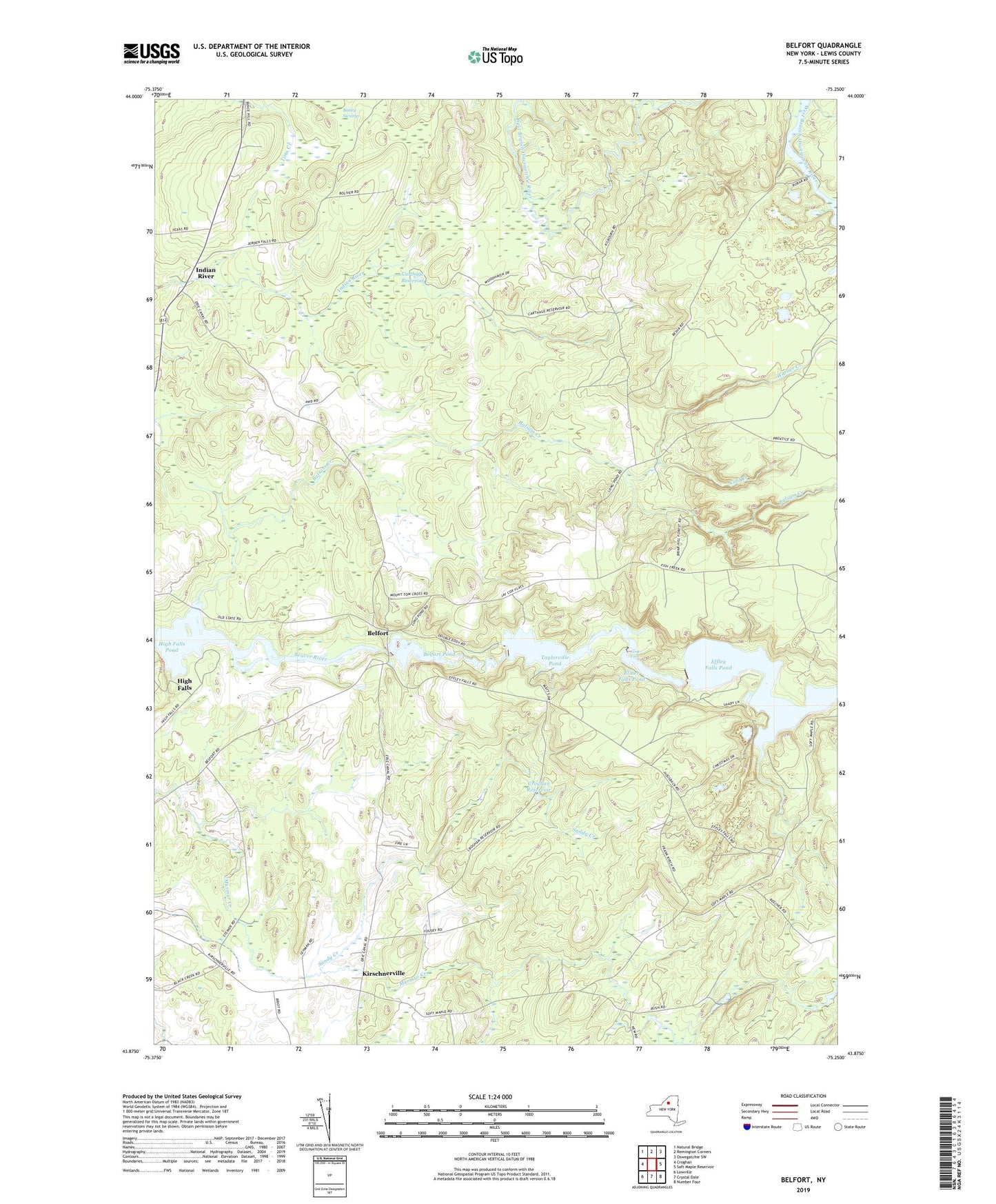
2019 topographic map quadrangle Belfort in the state of New York. Scale: 1:24000. Based on the newly updated USGS 7.5' US Topo map series, this map is in the following counties: Lewis. The map contains contour data, water features, and other items you are used to seeing on USGS maps, but also has updated roads and other features. This is the next generation of topographic maps. Printed on high-quality waterproof paper with UV fade-resistant inks.
Quads adjacent to this one:
West: Croghan
Northwest: Natural Bridge
North: Remington Corners
Northeast: Oswegatchie SW
East: Soft Maple Reservoir
Southeast: Number Four
South: Crystal Dale
Southwest: Lowville
Contains the following named places: Balsam Creek, Belfort, Belfort Pond, Bushs Corners, Carthage Reservoir, Cold Creek, Croghan Reservoir, Effley Falls Pond, Elmer Falls, Elmer Falls Pond, Henry School, High Falls, High Falls Pond, Indian River, Kirschnerville, Moser Farm, Saint Anthonys Church, Saint Vincent De Paul Church, Sandy Creek, Sweet School, Taylorville Pond, Town of Croghan, Warner Creek, ZIP Code: 13327