MyTopo
Lowville New York US Topo Map
Couldn't load pickup availability
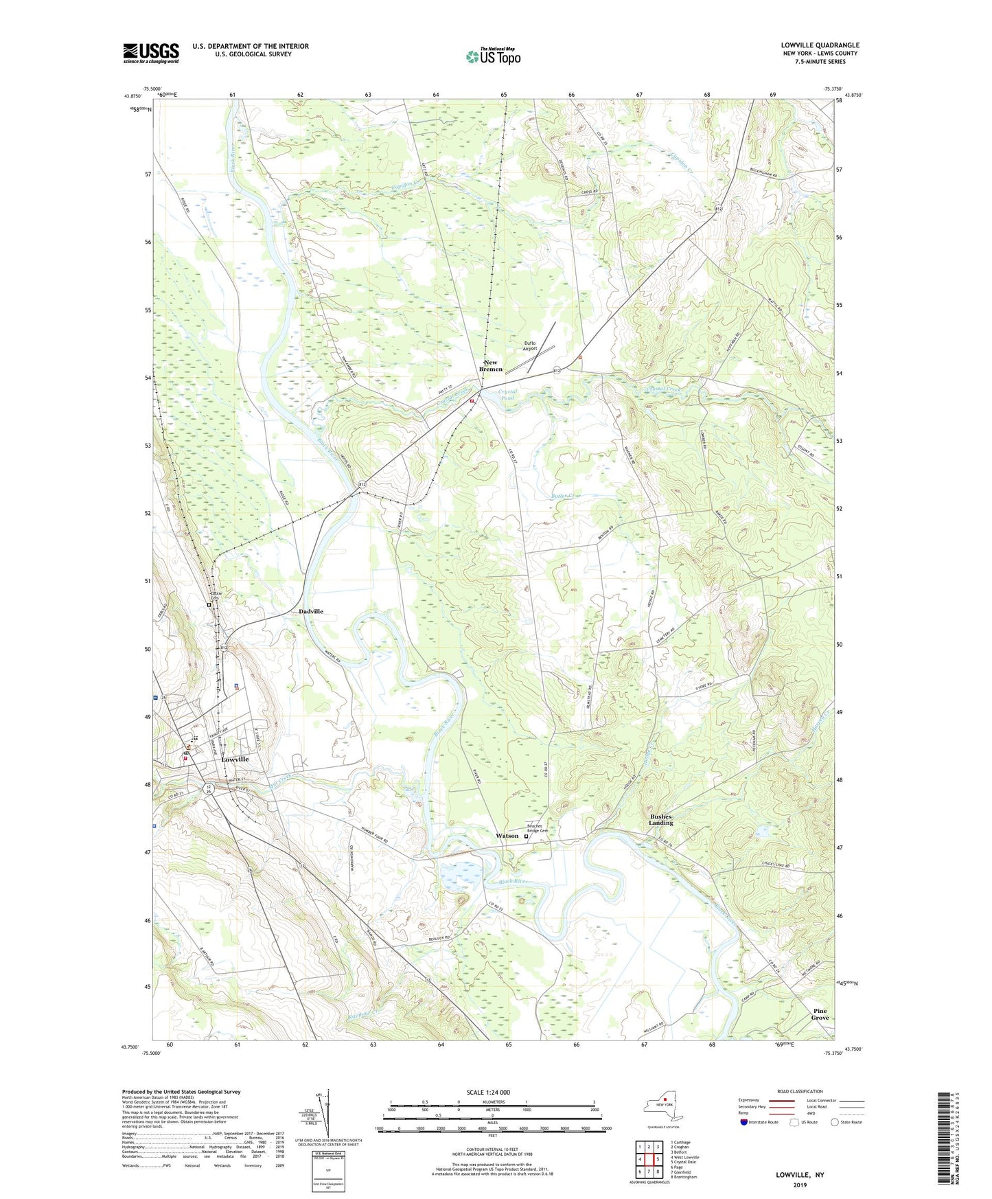
2023 topographic map quadrangle Lowville in the state of New York. Scale: 1:24000. Based on the newly updated USGS 7.5' US Topo map series, this map is in the following counties: Lewis. The map contains contour data, water features, and other items you are used to seeing on USGS maps, but also has updated roads and other features. This is the next generation of topographic maps. Printed on high-quality waterproof paper with UV fade-resistant inks.
Quads adjacent to this one:
West: West Lowville
Northwest: Carthage
North: Croghan
Northeast: Belfort
East: Crystal Dale
Southeast: Brantingham
South: Glenfield
Southwest: Page
This map covers the same area as the classic USGS quad with code o43075g4.
Contains the following named places: Beaches Bridge Cemetery, Brookside Senior Living Community, Bushes Landing, Butler Creek, Capidon Creek, Central School, Crystal Creek, Crystal Pond, Dadville, Duflo Airport, Ebblie Cemetery, Harvey Creek, Hodge Creek, Lewis County, Lewis County General Hospital, Lewis County General Hospital Residential Health Care Facility, Lewis County Search and Rescue Ambulance Service, Lowcille United Methodist Church, Lowville, Lowville Baptist Church, Lowville Elementary School, Lowville High School, Lowville Middle School, Lowville Post Office, Lowville Presbyterian Church, Lowville Volunteer Fire Department, Mill Creek, New Bremen, New Bremen Fire Department, Pine Grove, Rainbow Creek, Rhema Fellowship, Ross Farms, Saint Peter's Catholic Church, Saint Peters Catholic School, Saint Peters Church, The Church of Jesus Christ of Latter Day Saints, Trinity Episcopal Church, Tucker School, Village of Lowville, Watson