MyTopo
Oswegatchie SW New York US Topo Map
Couldn't load pickup availability
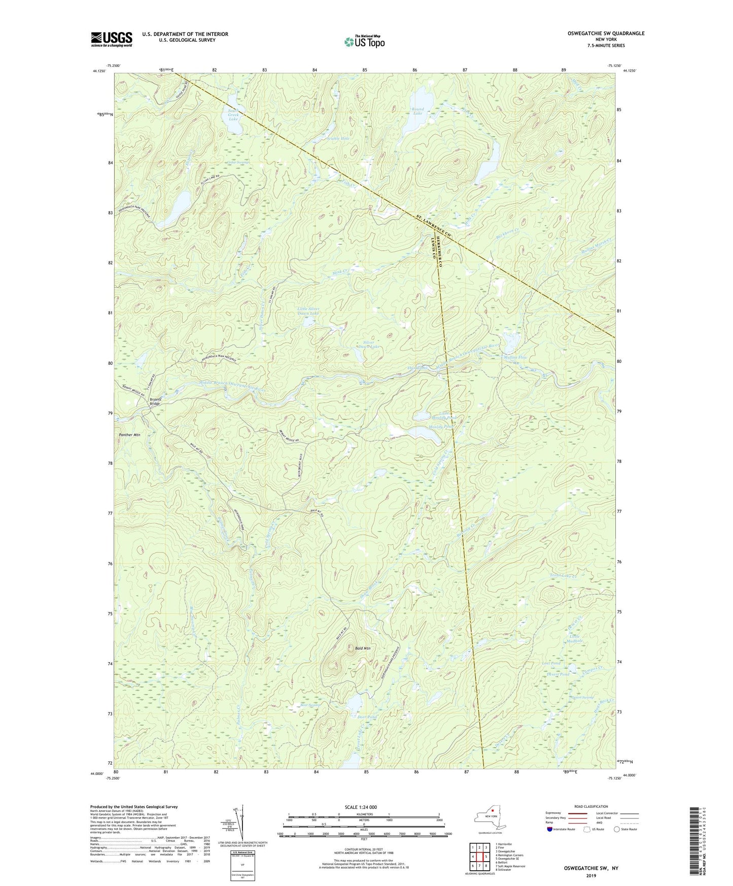
2023 topographic map quadrangle Oswegatchie SW in the state of New York. Scale: 1:24000. Based on the newly updated USGS 7.5' US Topo map series, this map is in the following counties: Lewis, Herkimer, St. Lawrence. The map contains contour data, water features, and other items you are used to seeing on USGS maps, but also has updated roads and other features. This is the next generation of topographic maps. Printed on high-quality waterproof paper with UV fade-resistant inks.
Quads adjacent to this one:
West: Remington Corners
Northwest: Harrisville
North: Fine
Northeast: Oswegatchie
East: Oswegatchie SE
Southeast: Stillwater
South: Soft Maple Reservoir
Southwest: Belfort
This map covers the same area as the classic USGS quad with code o44075a2.
Contains the following named places: Bald Mountain, Bear Swamp, Bryants Bridge, Buckhorn Creek, Burning Creek, Cedar Swamp, Cold Spring Creek, Compos Creek, Deer Pond, Desert Pond, Desert Swamp, Elijah Lake, Little Mouldy Pond, Little Mudhole, Little Silver Dawn Lake, Long Lake, Lost Pond, Mink Creek, Mouldy Pond, Mullins Flow, Mullins Marsh Creek, Palmer Creek, Round Lake, Scuttle Hole, Scuttle Hole Creek, Shaw Brook, Silver Dawn Creek, Silver Dawn Lake, South Greek Lake, The Tunnel, Trout Lake, Trout Lake Creek