MyTopo
Black Creek New York US Topo Map
Couldn't load pickup availability
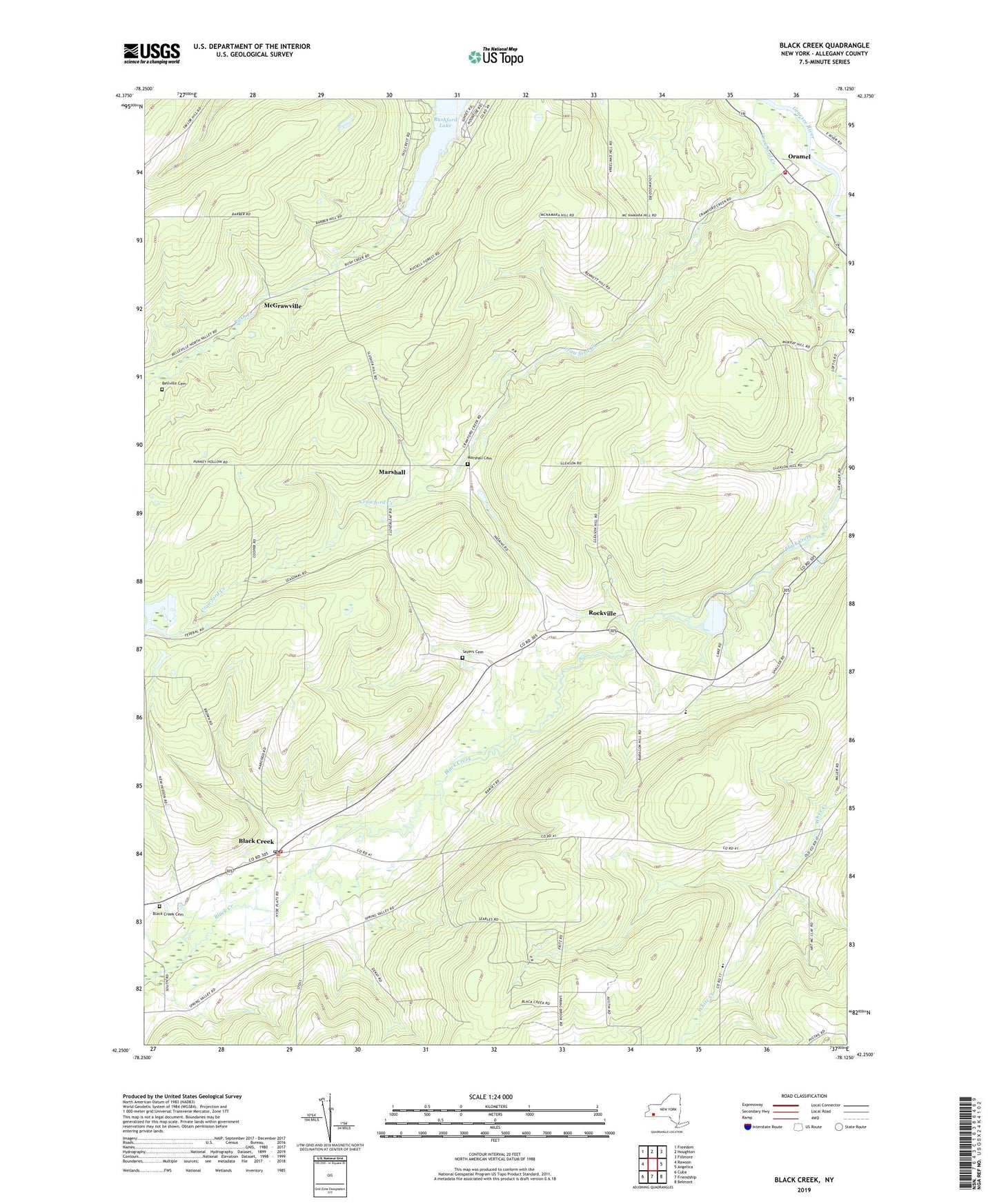
2023 topographic map quadrangle Black Creek in the state of New York. Scale: 1:24000. Based on the newly updated USGS 7.5' US Topo map series, this map is in the following counties: Allegany. The map contains contour data, water features, and other items you are used to seeing on USGS maps, but also has updated roads and other features. This is the next generation of topographic maps. Printed on high-quality waterproof paper with UV fade-resistant inks.
Quads adjacent to this one:
West: Rawson
Northwest: Freedom
North: Houghton
Northeast: Fillmore
East: Angelica
Southeast: Belmont
South: Friendship
Southwest: Cuba
This map covers the same area as the classic USGS quad with code o42078c2.
Contains the following named places: Bellville Cemetery, Bellville Wesleyan Church, Black Creek, Black Creek Cemetery, Black Creek Post Office, Camp Rushford, Crawford Creek, Friendship Amish School, Genesee Valley Canal, Hanging Bog, Hanging Bog Game Management Area, Marshall, Marshall Cemetery, McGrawville, New Hudson Volunteer Fire Company, Oramel, Oramel Fire Department, Rockville, Rockville Lake, Rush Creek, Sayers Cemetery, Town of Belfast, Valleyview Amish School, ZIP Codes: 14714, 14717