MyTopo
Belmont New York US Topo Map
Couldn't load pickup availability
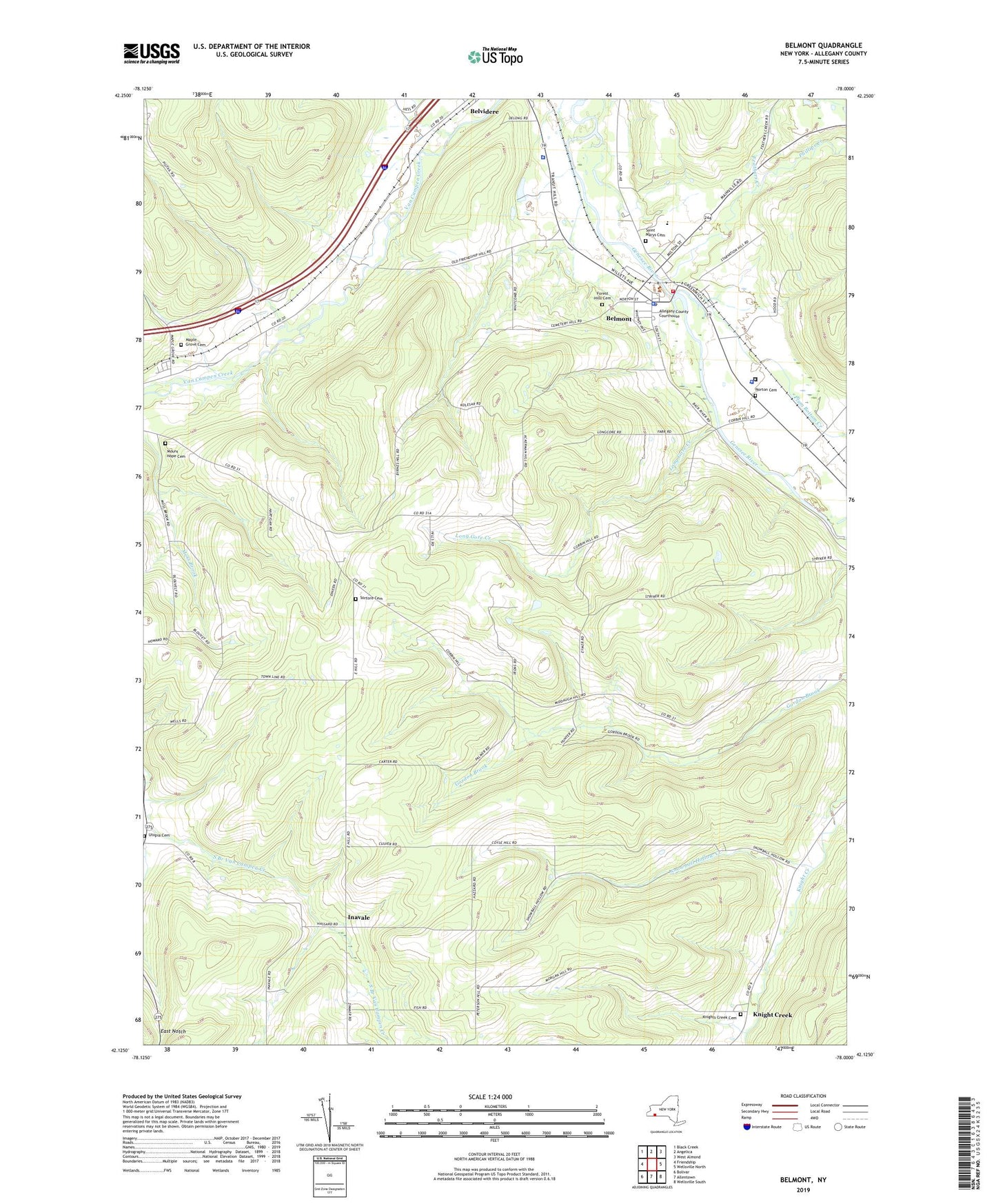
2023 topographic map quadrangle Belmont in the state of New York. Scale: 1:24000. Based on the newly updated USGS 7.5' US Topo map series, this map is in the following counties: Allegany. The map contains contour data, water features, and other items you are used to seeing on USGS maps, but also has updated roads and other features. This is the next generation of topographic maps. Printed on high-quality waterproof paper with UV fade-resistant inks.
Quads adjacent to this one:
West: Friendship
Northwest: Black Creek
North: Angelica
Northeast: West Almond
East: Wellsville North
Southeast: Wellsville South
South: Allentown
Southwest: Bolivar
This map covers the same area as the classic USGS quad with code o42078b1.
Contains the following named places: Amity Rescue Squad, Belmont, Belmont Fire Department, Belmont Literary and Historical Society Free Library, Belmont Post Office, Belmont United Methodist Church, Carnahan School, Cooley School, Corbin Hill School, East Notch, Feathers Creek, First Baptist Church, Forest Hills Cemetery, Francisco Farms, Friendship Rest Area, Genesee Valley Elementary School, Genesee Valley High School, Genesee Valley Middle School, Gospel Fellowship Church, Gospel Tabernacle, Higgins, Holy Family Church, Inavale, Knight Creek, Knights Creek Cemetery, Long Gore Creek, Maple Grove Cemetery, Maple Grove Mobile Home Estates, Middaugh School, Moss Brook, Mount Hope Cemetery, New York State Police Troop A Zone 4 Amity Station, Norton Cemetery, Phillips Creek, Plum Bottom Creek, Saint Marys Cemetery, School Number 4, School Number 9, Scott School, Snowball Hollow Creek, Sortore Cemetery, Town of Amity, Town of Scio, Utopia Cemetery, Valley View Estates, Village of Belmont