MyTopo
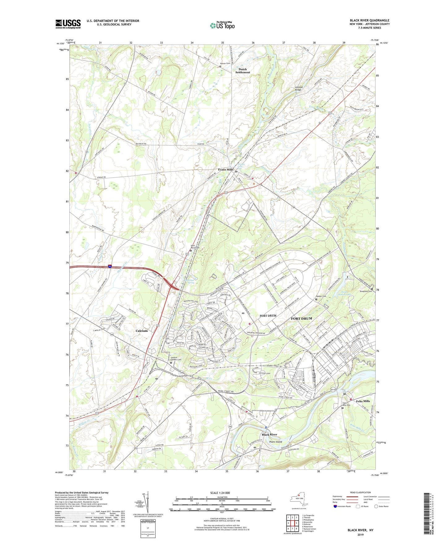
Black River New York US Topo Map
Couldn't load pickup availability
2019 topographic map quadrangle Black River in the state of New York. Scale: 1:24000. Based on the newly updated USGS 7.5' US Topo map series, this map is in the following counties: Jefferson. The map contains contour data, water features, and other items you are used to seeing on USGS maps, but also has updated roads and other features. This is the next generation of topographic maps. Printed on high-quality waterproof paper with UV fade-resistant inks.
Quads adjacent to this one:
West: Brownville
Northwest: La Fargeville
North: Theresa
Northeast: Philadelphia
East: Deferiet
Southeast: Copenhagen
South: Rutland Center
Southwest: Watertown
Contains the following named places: Anstead Bridge, Black River, Black River / Evans Mills Police Department, Black River Ambulance Squad, Black River Baptist Church, Black River Drive-In, Black River Fire Department, Black River Post Office, Black River School, Black River United Methodist Church, Calcium, Calcium Census Designated Place, Calcium Community Church, Calcium Fire Department, Calcium Post Office, Calcium Primary School, Dutch Settlement, Dutch Settlement School, Edgewood Court Mobile Home Park, Evans Mills, Evans Mills Fire Department, Evans Mills Post Office, Evans Mills Primary School, Evans Mills Public Library, Evans Mills United Methodist Church, Evans Mills Volunteer Ambulance Squad, Felts Mills, Felts Mills Cemetery, Felts Mills Census Designated Place, Felts Mills Creek, Felts Mills Fire Department, Felts Mills Post Office, Five Corners, Fort Drum Census Designated Place, Fort Drum Emergency Medical Service, Fort Drum Fire Department North Post, Fort Drum Fire Department South Post, Fort Drum Post Office, Gould Corners, Gracey Corners, Gracey Stoney Acres, Guthrie Medical Center, Hall Corners, Hoover Cemetery, Islamic Center of Northern New York, Kingdom Hall of Jehovahs Witnesses, Kiser Schoolhouse, La Raysville, Leray Mansion, LeRay Town Hall, Leray Trailer Park, Lowell Creek, New Testament Christian Church, North Star Spring, Northland Assembly of God, Northwoods Estates Mobile Home Park, Pamelia Four Corners, Pamelia Volunteer Fire and Rescue Department, Pleasant Creek, Pleasant Creek Falls, Poors Island, Quaker Cemetery, Ridgedale Mobile Home Park, Saint James Lake, Saint Mary's Catholic Church, Saint Marys Cemetery, Saint Paul's Catholic Church, Sanford Corners Cemetery, Sanfords Four Corners, School Number 1, School Number 13, School Number 15, School Number 2, School Number 3, Sheepfold Cemetery, Sweet Haven Holy Church of God Number 3, Town of Le Ray, Tri County Church of Christ, Trout Brook, Village of Black River, Village of Evans Mills, Wards Corners, West Creek, Westwood Corners, Young Farms, ZIP Codes: 13602, 13603, 13616, 13637