MyTopo
Deferiet New York US Topo Map
Couldn't load pickup availability
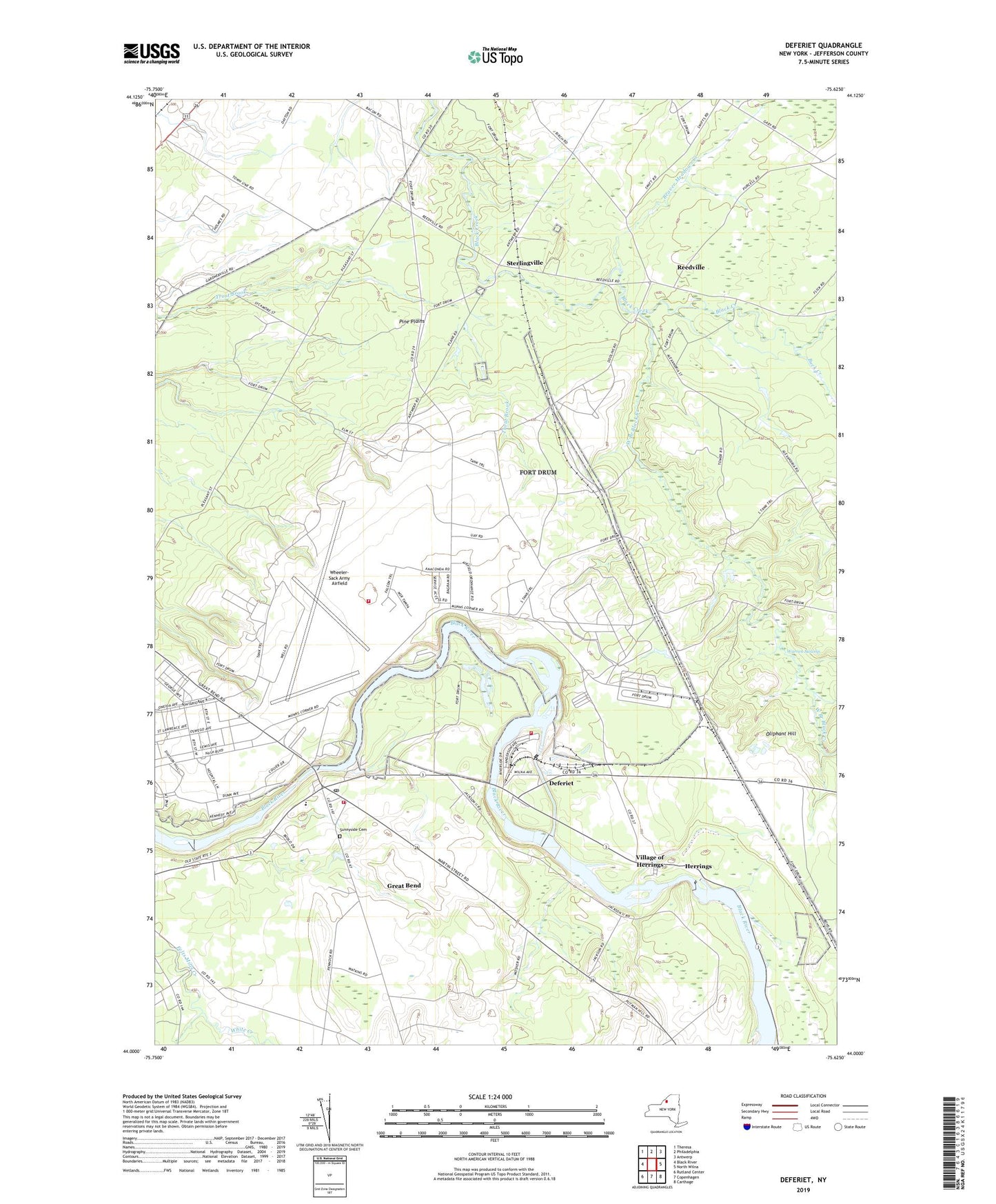
2023 topographic map quadrangle Deferiet in the state of New York. Scale: 1:24000. Based on the newly updated USGS 7.5' US Topo map series, this map is in the following counties: Jefferson. The map contains contour data, water features, and other items you are used to seeing on USGS maps, but also has updated roads and other features. This is the next generation of topographic maps. Printed on high-quality waterproof paper with UV fade-resistant inks.
Quads adjacent to this one:
West: Black River
Northwest: Theresa
North: Philadelphia
Northeast: Antwerp
East: North Wilna
Southeast: Carthage
South: Copenhagen
Southwest: Rutland Center
This map covers the same area as the classic USGS quad with code o44075a6.
Contains the following named places: Beaver Meadows Creek, CCC Camp, Christian Heritage School, City of Refuge Christian Church, Deferiet, Deferiet Union Church, Deferiet Volunteer Fire Company, Doolins Crossing, Fort Drum Fire Department Wheeler Sack Army Airfield, Great Bend, Great Bend Census Designated Place, Great Bend Post Office, Great Bend Volunteer Fire Department, Herrings, Herrings Census Designated Place, Herrings Village Wastewater Treatment Facility, Hubbard Crossing, Oliphant Hill, Pine Plains, Reedville, School Number 14, School Number 3, School Number 4, School Number 8, School Number 9, Sterlingville, Strickland Corners, Sunnyside Cemetery, Village of Deferiet, Village of Herrings, Warren Swamp, Watertown Korean United Methodist Church, West Branch Black Creek, Wheeler-Sack Army Airfield, White Creek, Woolworth Memorial United Methodist Church, ZIP Codes: 13628, 13638, 13643