MyTopo
Boylston Center New York US Topo Map
Couldn't load pickup availability
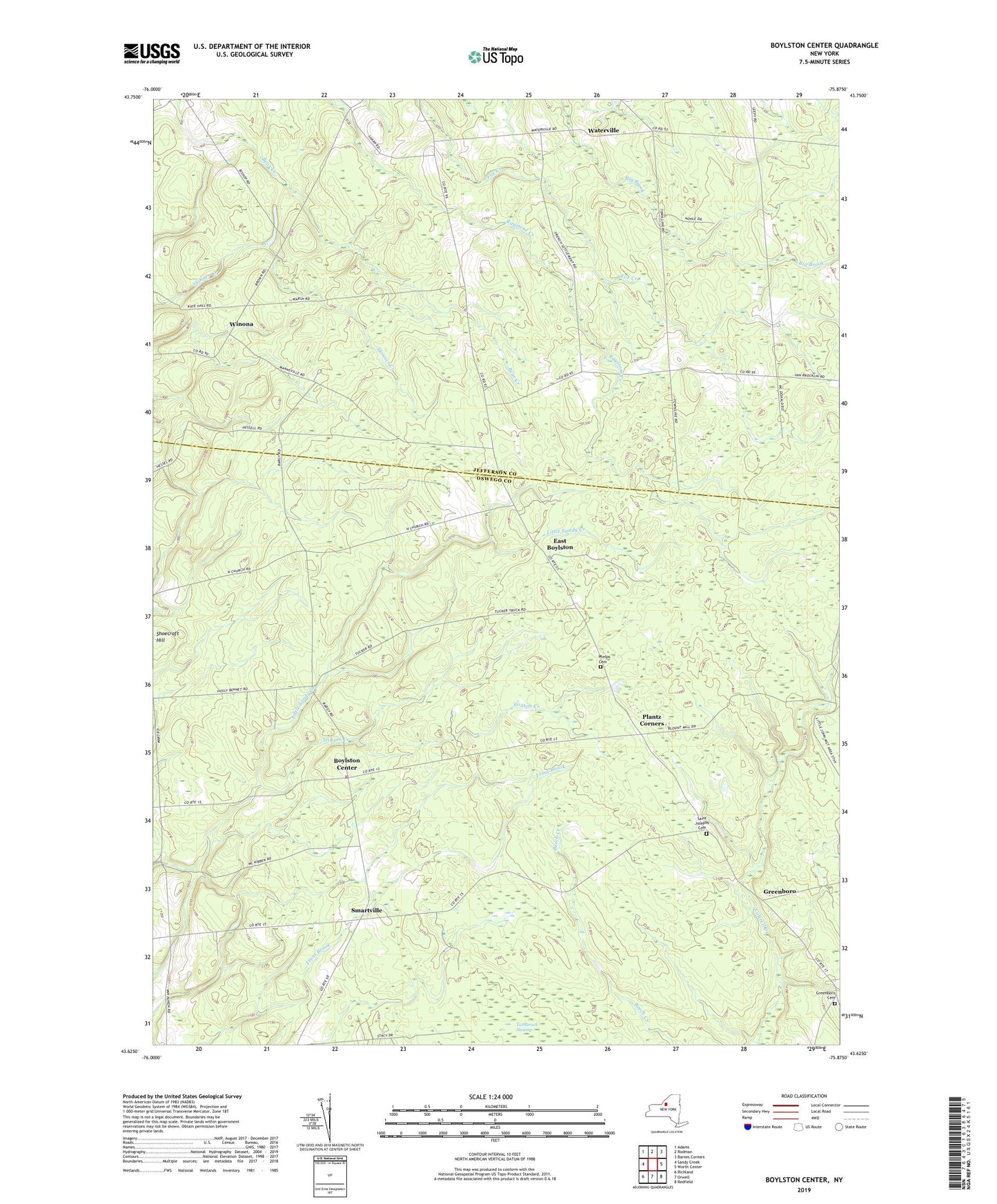
2019 topographic map quadrangle Boylston Center in the state of New York. Scale: 1:24000. Based on the newly updated USGS 7.5' US Topo map series, this map is in the following counties: Oswego, Jefferson. The map contains contour data, water features, and other items you are used to seeing on USGS maps, but also has updated roads and other features. This is the next generation of topographic maps. Printed on high-quality waterproof paper with UV fade-resistant inks.
Quads adjacent to this one:
West: Sandy Creek
Northwest: Adams
North: Rodman
Northeast: Barnes Corners
East: Worth Center
Southeast: Redfield
South: Orwell
Southwest: Richland
Contains the following named places: Boylston Center, Diamond, East Boylston, Frederick Corners, Greenboro, Greenboro Cemetery, Hemlock District, Littlejohn State Game Management Area, Phelps Cemetery, Plantz Corners, Saint Josephs Cemetery, Schjool Number 9, School Number 10, School Number 12, School Number 13, School Number 4, School Number 5, School Number 7, School Number 8, School Number 9, Smartville, Stinson Creek, Town of Boylston, Town of Lorraine, Union Church, Waterville, Winona, ZIP Code: 13083