MyTopo
Brisben New York US Topo Map
Couldn't load pickup availability
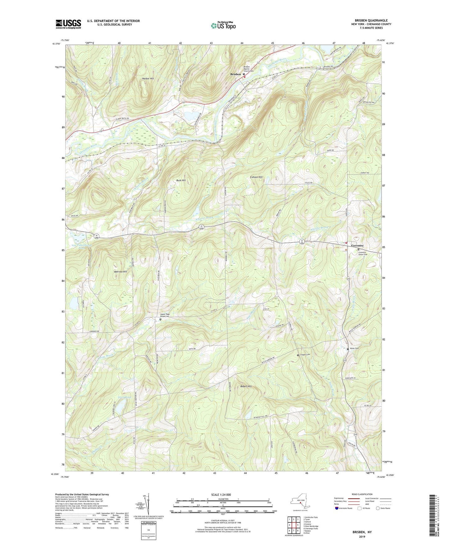
2019 topographic map quadrangle Brisben in the state of New York. Scale: 1:24000. Based on the newly updated USGS 7.5' US Topo map series, this map is in the following counties: Chenango. The map contains contour data, water features, and other items you are used to seeing on USGS maps, but also has updated roads and other features. This is the next generation of topographic maps. Printed on high-quality waterproof paper with UV fade-resistant inks.
Quads adjacent to this one:
West: Greene
Northwest: Smithville Flats
North: Tyner
Northeast: Oxford
East: West Bainbridge
Southeast: Afton
South: Belden
Southwest: Chenango Forks
Contains the following named places: Bobell Hill, Borden Pond, Brisben, Brisben Baptist Church, Brisben Baptist Church Cemetery, Brisben Fire Department House, Buck Hill, Chapel Cemetery, Chenango Valley Ranch, Cohoon Hill, Coventry, Coventry Union Cemetery, Coventry Volunteer Fire Company, Glen Road Brook, Greene Assembly of God, Harbor Hill, Johnson Corners, Little White Church, Mill Brook, Sacketts Harbor, School Number 13, School Number 24, Shadyside Farm, Spring Brook, Tillotson Creek, Town of Coventry, Truitt Pond, Upper Page Brook Cemetery, Van Valkenburgh Pond, Warn Lake, Watrous Hill, Wheeler Brook, Wylie Cemetery