MyTopo
Tyner New York US Topo Map
Couldn't load pickup availability
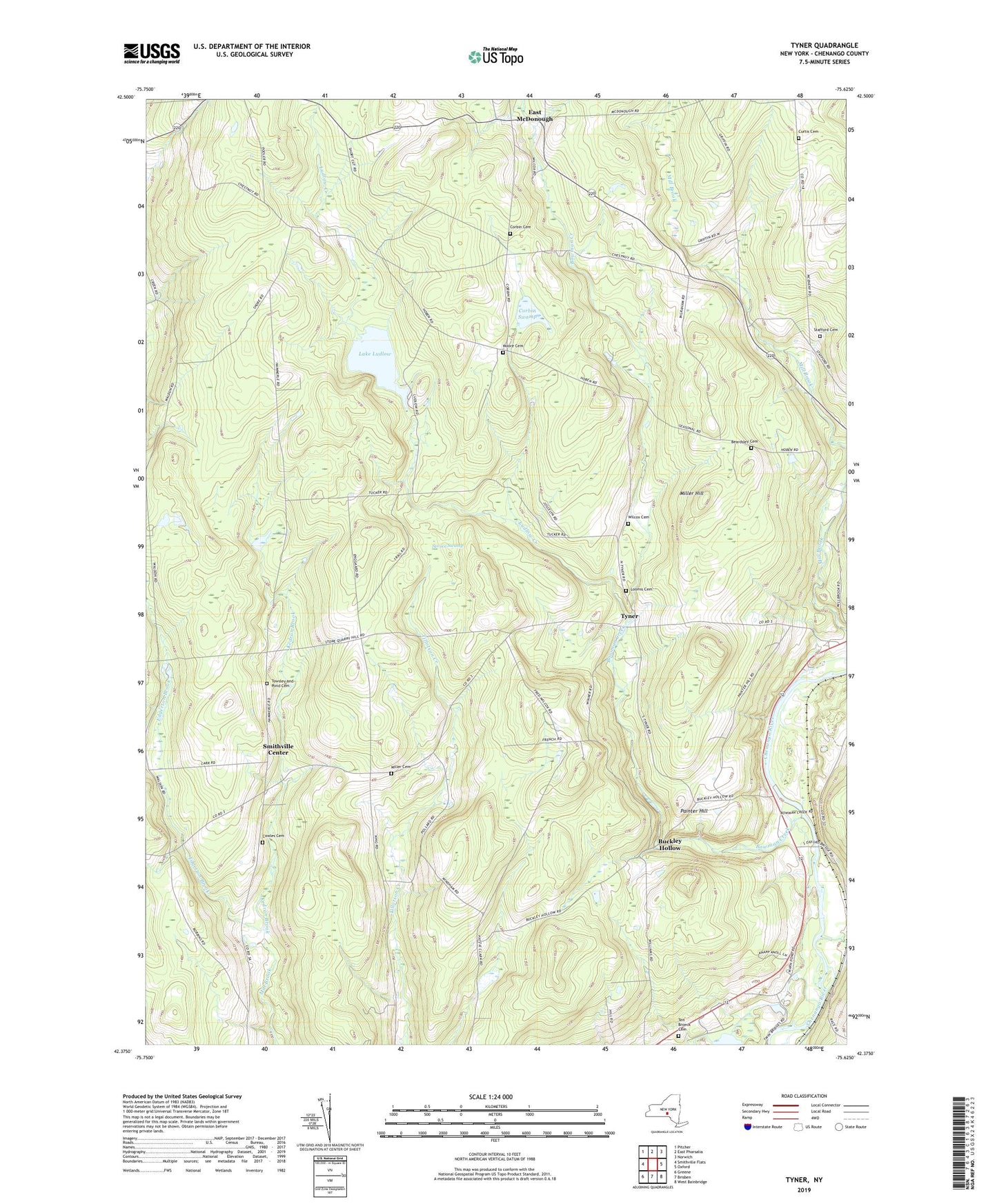
2023 topographic map quadrangle Tyner in the state of New York. Scale: 1:24000. Based on the newly updated USGS 7.5' US Topo map series, this map is in the following counties: Chenango. The map contains contour data, water features, and other items you are used to seeing on USGS maps, but also has updated roads and other features. This is the next generation of topographic maps. Printed on high-quality waterproof paper with UV fade-resistant inks.
Quads adjacent to this one:
West: Smithville Flats
Northwest: Pitcher
North: East Pharsalia
Northeast: Norwich
East: Oxford
Southeast: West Bainbridge
South: Brisben
Southwest: Greene
This map covers the same area as the classic USGS quad with code o42075d6.
Contains the following named places: Adams Corner, Bear Brook, Beardsley Cemetery, Bowman Creek, Buckley Hollow, Corbin Cemetery, Corbin Corner, Corbin Swamp, Cowles Cemetery, Curtis Cemetery, Dibble Corner, East McDonough, Eddy Brook, Edgerton Brook, Ingraham Corners, Kedron Brook, Lake Ludlow, Loomis Cemetery, Ludlow Creek, Miller Cemetery, Miller Hill, Moore Cemetery, Nortons Corners, Painter Hill, Smithville Center, Spruce Swamp, Stafford Cemetery, Ten Broeck Cemetery, Towsley and Pond Cemetery, Tyner, Wilcox Cemetery, Windham School, ZIP Code: 13830