MyTopo
Campbell New York US Topo Map
Couldn't load pickup availability
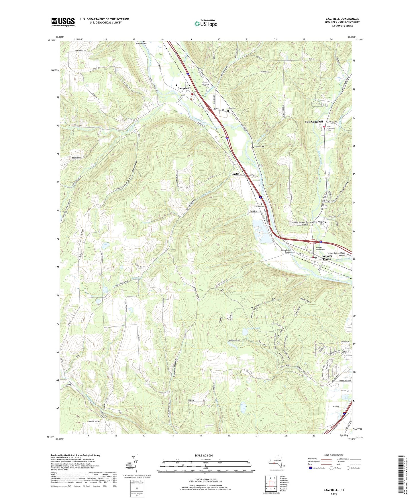
2019 topographic map quadrangle Campbell in the state of New York. Scale: 1:24000. Based on the newly updated USGS 7.5' US Topo map series, this map is in the following counties: Steuben. The map contains contour data, water features, and other items you are used to seeing on USGS maps, but also has updated roads and other features. This is the next generation of topographic maps. Printed on high-quality waterproof paper with UV fade-resistant inks.
Quads adjacent to this one:
West: Rathbone
Northwest: Bath
North: Savona
Northeast: Bradford
East: Corning
Southeast: Caton
South: Addison
Southwest: Borden
Contains the following named places: Balcom Cemetery, Burr Hollow, Campbell, Campbell - Savona Junior / Senior High School, Campbell Alliance Church, Campbell Census Designated Place, Campbell Fire Department, Campbell Post Office, Campbell Rest Area, Campbell United Methodist Church, Christian and Missionary Church, Coopers Plains, Coopers Plains Cemetery, Coopers Plains Census Designated Place, Coopers Plains Long Acres Fire Department, Coopers Plains Post Office, Curtis, Curtis Baptist Bible Church, Curtis Creek, Dry Run, East Campbell, East Campbell Cemetery, East Campbell Fire Department, Erwin Pond, Frank F Pierce Early Childhood Center, Frog Hollow, Green Hill School, Hidden Forest Mobile Home Park, Hillside Cemetery, Hope Cemetery, Kingdom Hall of Jehovahs Witnesses, McNutt Run, Michigan Creek, Mount Pleasant School, Nellie Ayres Memorial Park, Onawasa Creek, Saint Joseph Church, Seager Trailer Park, Smith Road Bridge, Stony Knoll School, Stony Run, Town Line School, Town of Addison, Town of Campbell, Town of Erwin, Weaver Hollow, Wolf Run, ZIP Codes: 14821, 14827, 14870