MyTopo
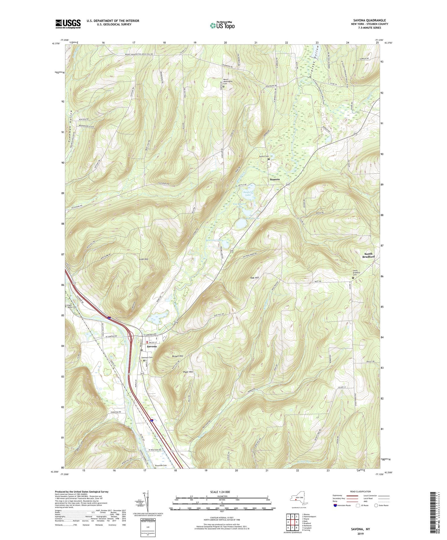
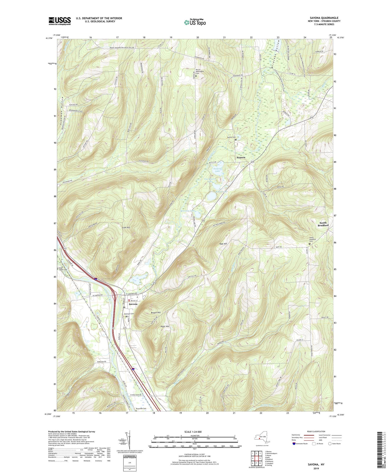
Savona New York US Topo Map
Couldn't load pickup availability
2023 topographic map quadrangle Savona in the state of New York. Scale: 1:24000. Based on the newly updated USGS 7.5' US Topo map series, this map is in the following counties: Steuben. The map contains contour data, water features, and other items you are used to seeing on USGS maps, but also has updated roads and other features. This is the next generation of topographic maps. Printed on high-quality waterproof paper with UV fade-resistant inks.
Quads adjacent to this one:
West: Bath
Northwest: Rheims
North: Hammondsport
Northeast: Wayne
East: Bradford
Southeast: Corning
South: Campbell
Southwest: Rathbone
This map covers the same area as the classic USGS quad with code o42077c2.
Contains the following named places: Birdseye Hollow, Brookwood Mobile Home Park, Brown Hill, Campbell - Savona Elementary School, Eagle Valley Cemetery, Green Meadow Acres Mobile Home Park, Irish Hill, Mount Washington Cemetery, Mount Washington Church, Mud Creek, Oak Hill, Peterson Lake, Platt Hill, Riverside Cemetery, Round Lake, Sanford Lake, Savona, Savona Estates Mobile Home Park, Savona Federated Church, Savona Fire Department, Savona Free Library, Savona Pit, Savona Post Office, Seamans Cemetery, Sonora, Sonora Cemetery, South Bradford, South Bradford Cemetery, Town of Bradford, Van Keuren Lake, Village of Savona, ZIP Code: 14879