MyTopo
Bradford New York US Topo Map
Couldn't load pickup availability
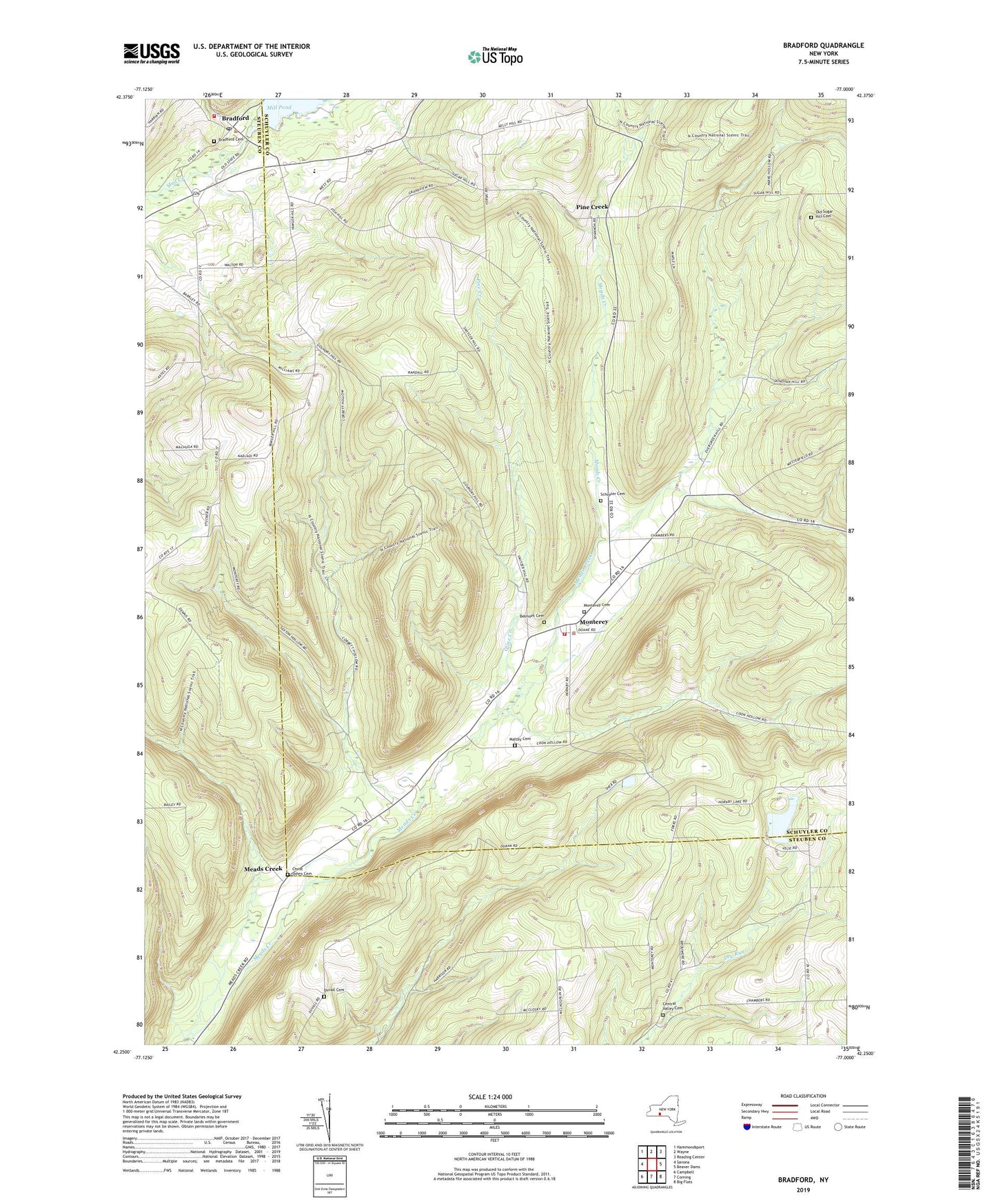
2023 topographic map quadrangle Bradford in the state of New York. Scale: 1:24000. Based on the newly updated USGS 7.5' US Topo map series, this map is in the following counties: Schuyler, Steuben. The map contains contour data, water features, and other items you are used to seeing on USGS maps, but also has updated roads and other features. This is the next generation of topographic maps. Printed on high-quality waterproof paper with UV fade-resistant inks.
Quads adjacent to this one:
West: Savona
Northwest: Hammondsport
North: Wayne
Northeast: Reading Center
East: Beaver Dams
Southeast: Big Flats
South: Corning
Southwest: Campbell
This map covers the same area as the classic USGS quad with code o42077c1.
Contains the following named places: Belmont Cemetery, Bradford, Bradford Baptist Church, Bradford Cemetery, Bradford Post Office, Bradford Volunteer Fire Company, Central Valley Cemetery, Christ Johns Cemetery, Cinnamon Lake, District Number 1 School, Duvall Cemetery, Maltby Cemetery, Meads Creek, Monterey, Monterey Cemetery, Monterey Volunteer Fire Company, Old Sugar Hill Cemetery, Pine Creek, Rose Hill Farm, Schuyler Cemetery, Star District School, Town of Orange, Ultralight Flight Farm, ZIP Codes: 14812, 14815