MyTopo
Cape Vincent North New York US Topo Map
Couldn't load pickup availability
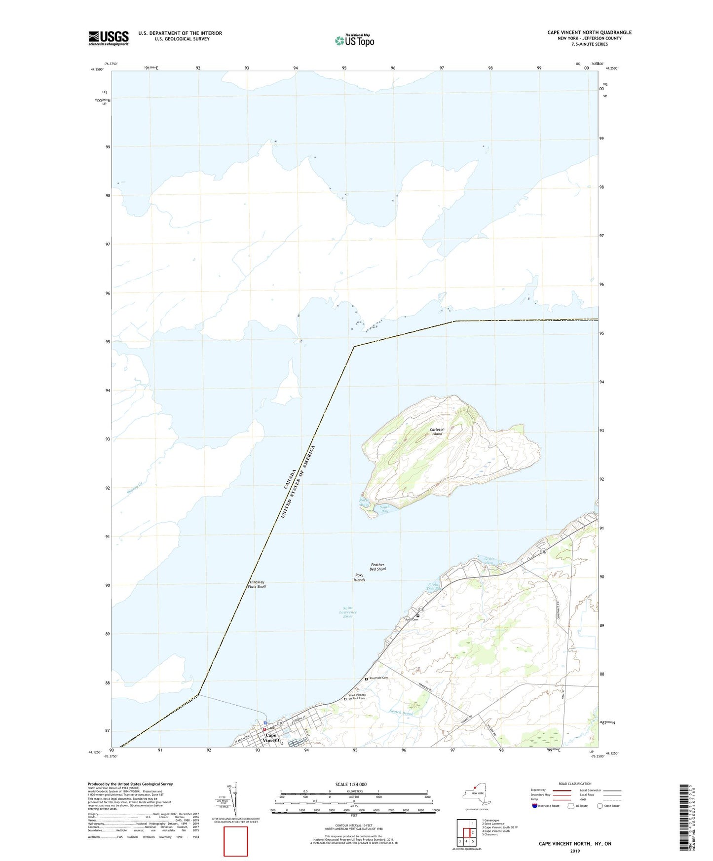
2023 topographic map quadrangle Cape Vincent North in the state of New York. Scale: 1:24000. Based on the newly updated USGS 7.5' US Topo map series, this map is in the following counties: Jefferson. The map contains contour data, water features, and other items you are used to seeing on USGS maps, but also has updated roads and other features. This is the next generation of topographic maps. Printed on high-quality waterproof paper with UV fade-resistant inks.
Quads adjacent to this one:
East: Saint Lawrence
Southeast: Chaumont
South: Cape Vincent South
Southwest: Cape Vincent South OE W
This map covers the same area as the classic USGS quad with code o44076b3.
Contains the following named places: Anchor Marina, Burnham Point State Park, Cape Vincent, Cape Vincent Central School, Cape Vincent Community Library, Cape Vincent Fire Department, Cape Vincent Police Department, Cape Vincent Post Office, Cape Vincent Water Works Pumping Station, Carleton Island, Carleton Lighthouse, Feather Bed Shoal, First Methodist Church, First Presbyterian Church, Grass Bay, Green Cedars Trailer Park, Hinckley Flats Shoal, Judd Cemetery, Lawrence J Docteur Dock, Le Petite Ciel Mobile Home Park, Leading Light, North Bay, Peos Bay, Poplar Tree Bay, Riverside Cemetery, Roxy Islands, Saint Vincent de Paul Cemetery, School Number 13, School Number 5, Scotch Brook, South Bay, Sunnybank, Sunset Trailer Park, United Church of Cape Vincent, Village of Cape Vincent, Willow Shores Marina