MyTopo
Cape Vincent South New York US Topo Map
Couldn't load pickup availability
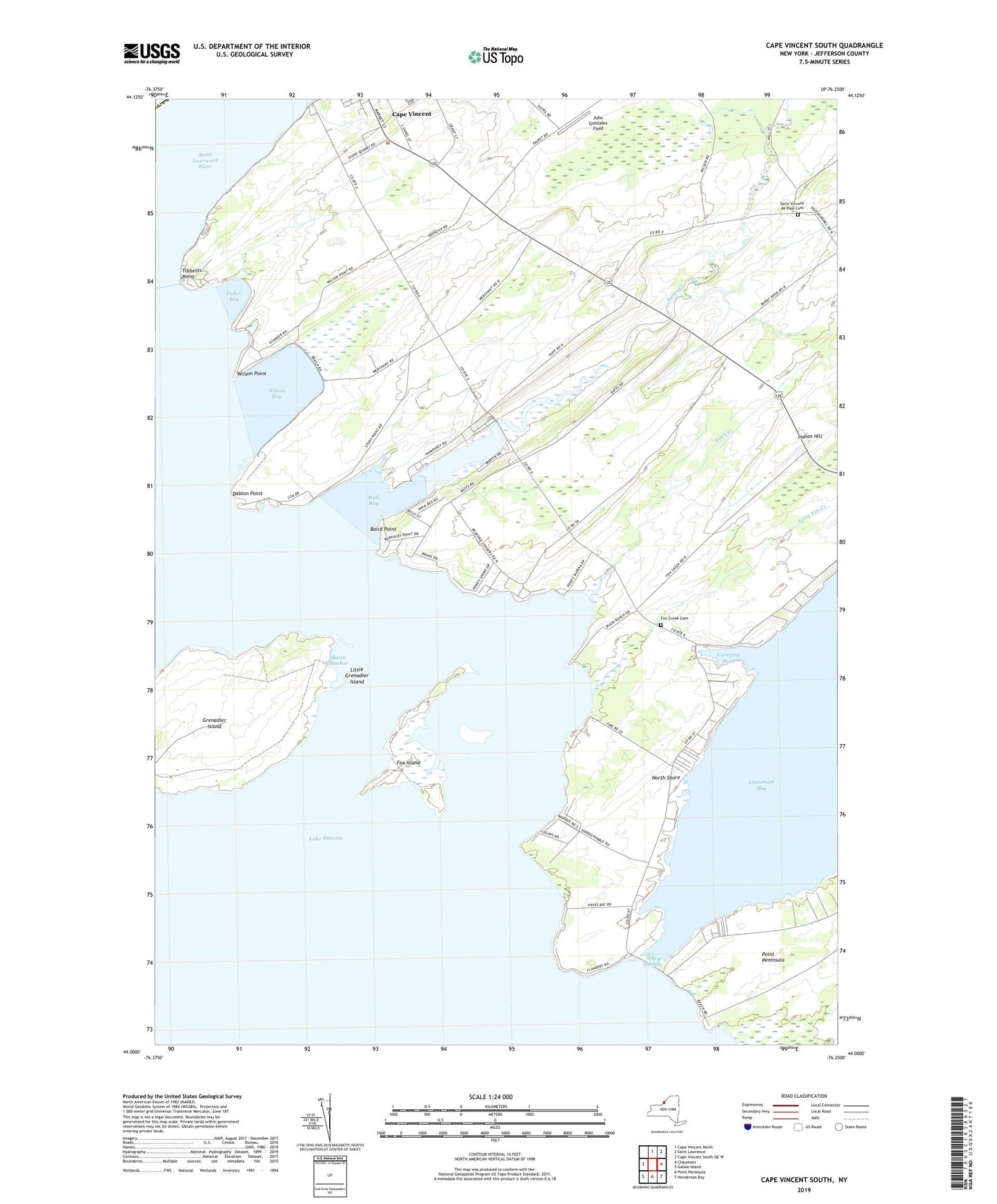
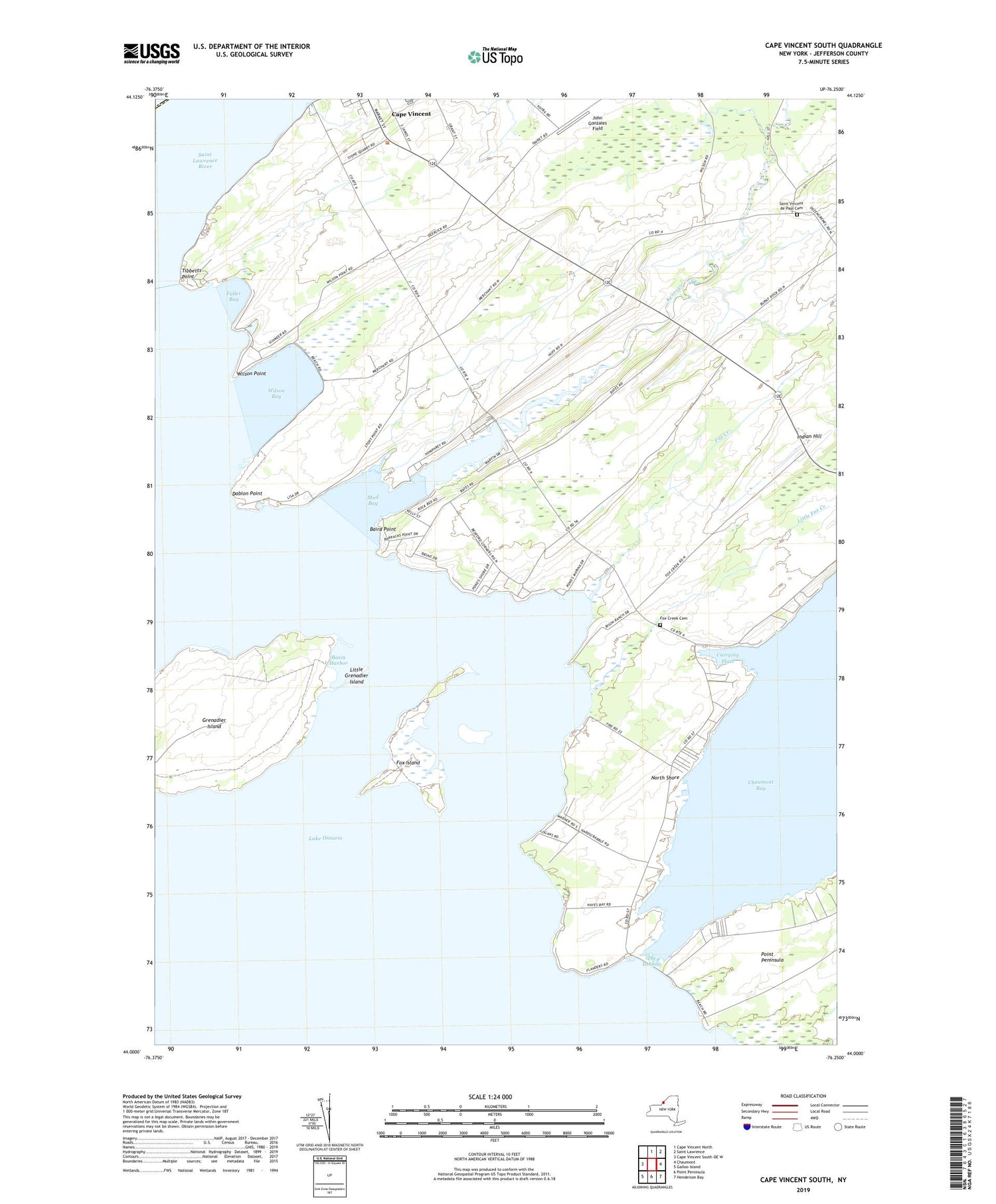
2019 topographic map quadrangle Cape Vincent South in the state of New York. Scale: 1:24000. Based on the newly updated USGS 7.5' US Topo map series, this map is in the following counties: Jefferson. The map contains contour data, water features, and other items you are used to seeing on USGS maps, but also has updated roads and other features. This is the next generation of topographic maps. Printed on high-quality waterproof paper with UV fade-resistant inks.
Quads adjacent to this one:
West: Cape Vincent South OE W
North: Cape Vincent North
Northeast: Saint Lawrence
East: Chaumont
Southeast: Henderson Bay
South: Point Peninsula
Southwest: Galloo Island
Contains the following named places: Baird Point, Basin Harbor, Bayview, Bedford Corners, Brimmers Marina, Cape Vincent Breakwater Light, Carrying Place, Dablon Monument, Dablon Point, Fox Creek, Fox Creek Cemetery, Fox Island, Fuller Bay, Grenadier Island, Indian Hill, Isthmus Marina, John Gonzales Field, Kents Creek, Little Fox Creek, Little Grenadier Island, Martins Marina, Mud Bay, North Shore, Ponds Corners, Ponds Marina, Saint Paul's Episcopal Church, Saint Vincent de Paul Cemetery, Saint Vincent De Paul Roman Catholic Church, School Number 12, School Number 13, School Number 15, School Number 16, School Number 4, School Number 7, School Number 8, School Number 9, Scott Marina, Snug Harbor Marina, The Isthmus, Tibbetts Point, Town of Cape Vincent, White Farms, Wilson Bay, Wilson Point, WKGG-FM (Cape Vincent), WMHI-FM (Cape Vincent), ZIP Code: 13618