MyTopo
Carlisle New York US Topo Map
Couldn't load pickup availability
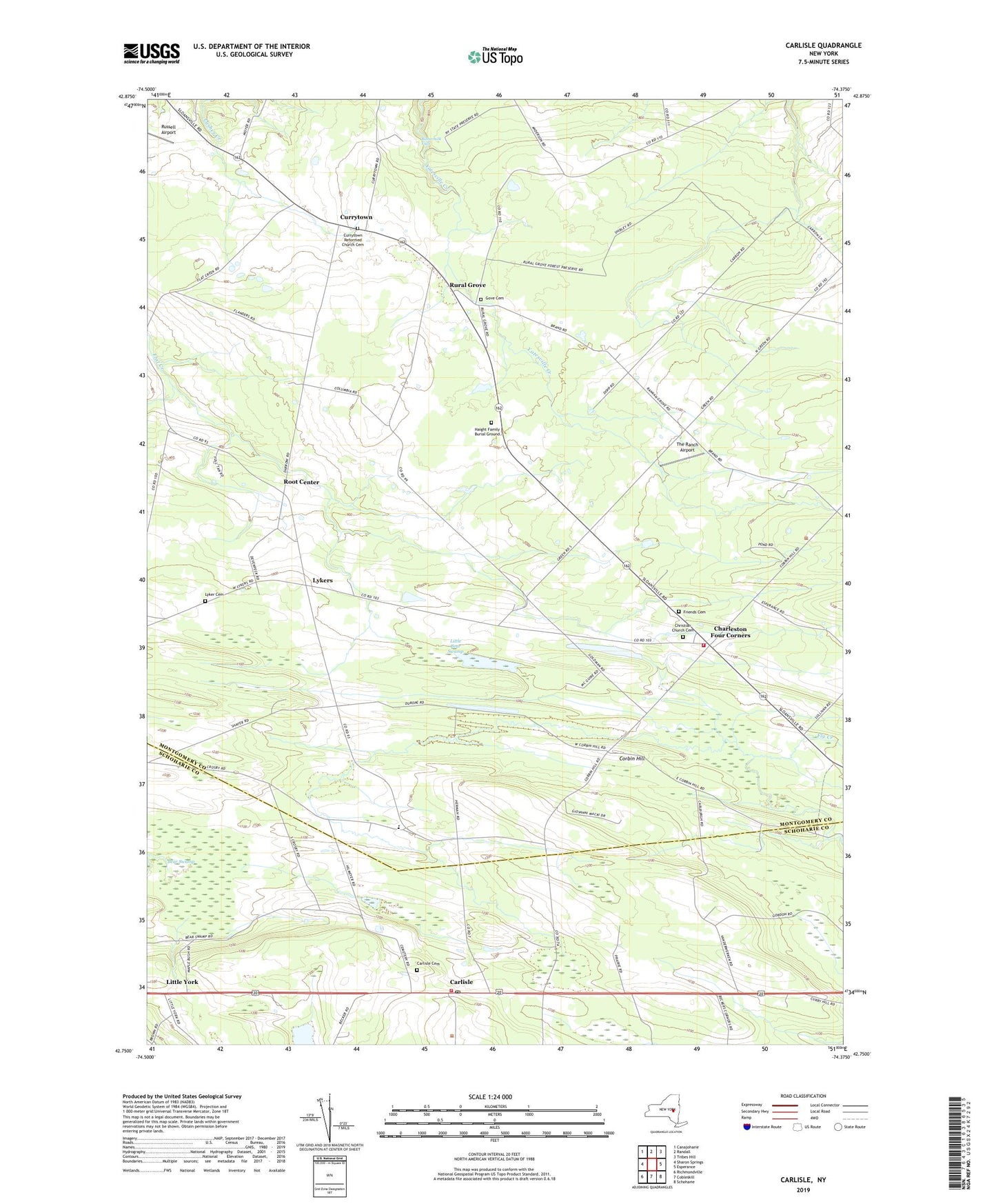
2023 topographic map quadrangle Carlisle in the state of New York. Scale: 1:24000. Based on the newly updated USGS 7.5' US Topo map series, this map is in the following counties: Montgomery, Schoharie. The map contains contour data, water features, and other items you are used to seeing on USGS maps, but also has updated roads and other features. This is the next generation of topographic maps. Printed on high-quality waterproof paper with UV fade-resistant inks.
Quads adjacent to this one:
West: Sharon Springs
Northwest: Canajoharie
North: Randall
Northeast: Tribes Hill
East: Esperance
Southeast: Schoharie
South: Cobleskill
Southwest: Richmondville
This map covers the same area as the classic USGS quad with code o42074g4.
Contains the following named places: Bear Swamp, Bonesteel School, Bratt School, Buttermilk Falls, Carlisle, Carlisle Cemetery, Carlisle Post Office, Carlisle Volunteer Fire Department, Charleston Four Corners, Charleston Volunteer Fire Department, Christian Church, Christian Church Cemetery, Corbin Hill, Corbin Hill School, Currytown, Currytown Farm, Currytown Reformed Church Cemetery, Friends Cemetery, Gove Cemetery, Haight Family Burial Ground, Hamilton School, Kilmartin Corners, Little Bear Swamp, Little York, Lyker Cemetery, Lykers, Maloney School, Root Center, Rural Grove, Russell Airport, School Number 11, School Number 2, School Number 5, The Ranch Airport, Town of Carlisle, Town of Root, ZIP Codes: 12031, 12160, 12166