MyTopo
Esperance New York US Topo Map
Couldn't load pickup availability
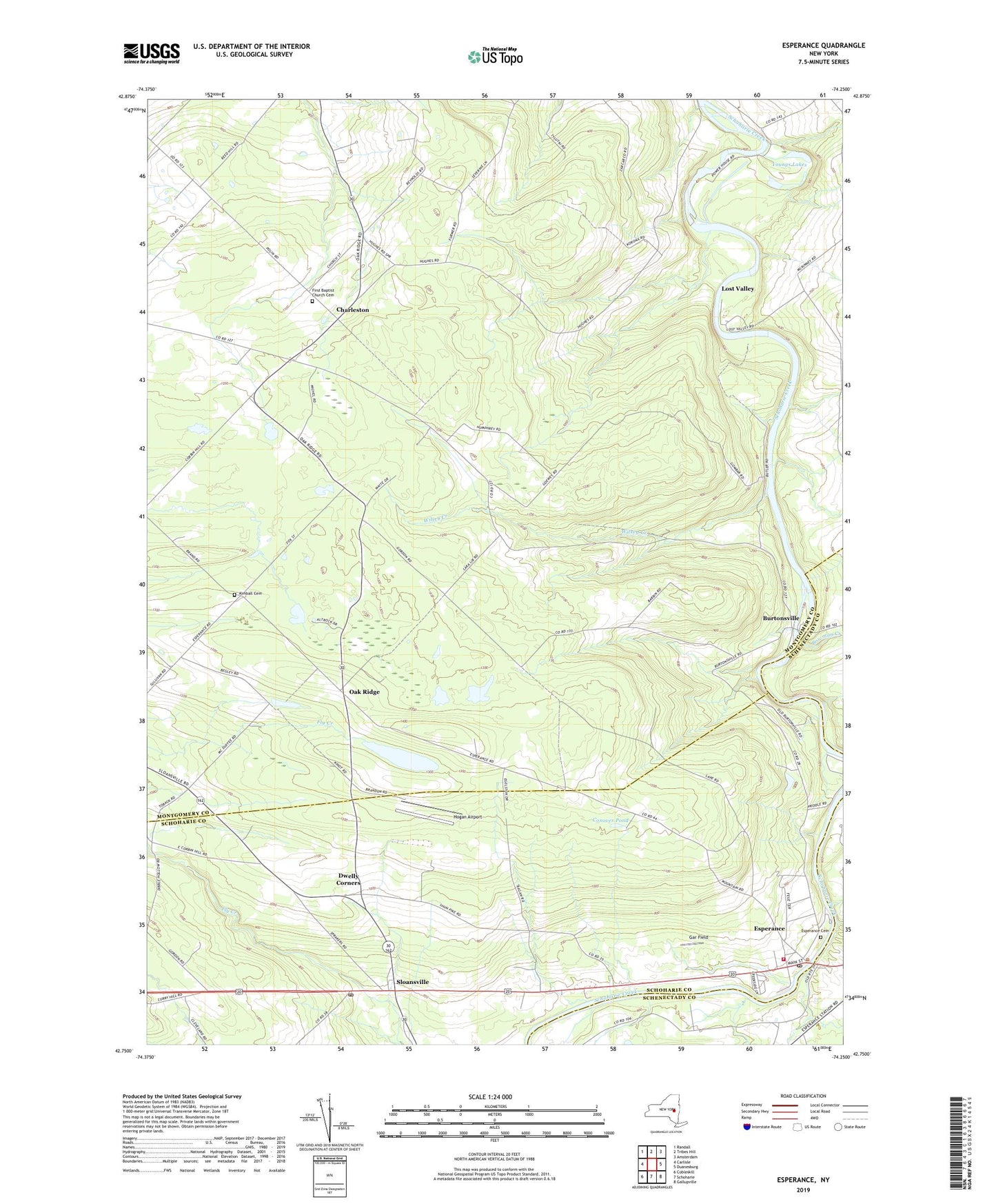
2023 topographic map quadrangle Esperance in the state of New York. Scale: 1:24000. Based on the newly updated USGS 7.5' US Topo map series, this map is in the following counties: Montgomery, Schoharie, Schenectady. The map contains contour data, water features, and other items you are used to seeing on USGS maps, but also has updated roads and other features. This is the next generation of topographic maps. Printed on high-quality waterproof paper with UV fade-resistant inks.
Quads adjacent to this one:
West: Carlisle
Northwest: Randall
North: Tribes Hill
Northeast: Amsterdam
East: Duanesburg
Southeast: Gallupville
South: Schoharie
Southwest: Cobleskill
This map covers the same area as the classic USGS quad with code o42074g3.
Contains the following named places: Bowman Creek, Burtonsville, Burtonsville School, Carytown School, Charleston, Conover Pond, Davis Corners, Dwelly Corners, Dwyer Farm, Esperance, Esperance Cemetery, Esperance Fire Department, Esperance Post Office, Esperance Town Hall, First Baptist Church Cemetery, Fox Corners, Gar Field, George Landis Arboretum, Hicks School, Hogan Airport, Holloway Brothers Farm, Kimball Cemetery, Lib Corners, Lost Valley, Market Corners, Mountanye School, Oak Ridge, Petty School, Rockwell Corners, Schoharie Creek Airport, School Number 4, School Number 7, School Number 9, Sloansville, Sloansville Post Office, Town of Charleston, Town of Esperance, Village of Esperance, Voorhees School, Wilsey Creek, Youngs Lakes, ZIP Code: 12066