MyTopo
Childwold New York US Topo Map
Couldn't load pickup availability
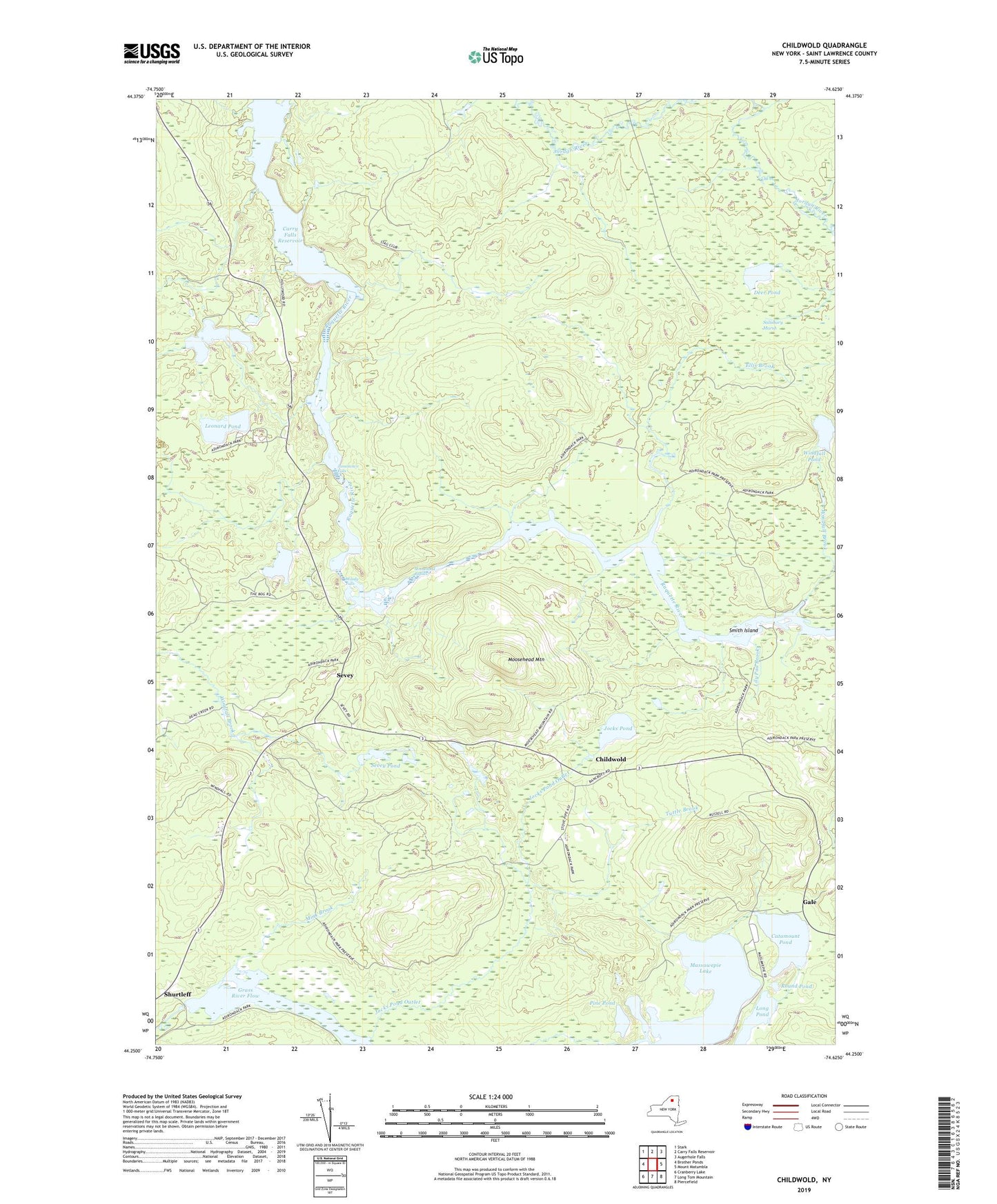
2019 topographic map quadrangle Childwold in the state of New York. Scale: 1:24000. Based on the newly updated USGS 7.5' US Topo map series, this map is in the following counties: St. Lawrence. The map contains contour data, water features, and other items you are used to seeing on USGS maps, but also has updated roads and other features. This is the next generation of topographic maps. Printed on high-quality waterproof paper with UV fade-resistant inks.
Quads adjacent to this one:
West: Brother Ponds
Northwest: Stark
North: Carry Falls Reservoir
Northeast: Augerhole Falls
East: Mount Matumbla
Southeast: Piercefield
South: Long Tom Mountain
Southwest: Cranberry Lake
Contains the following named places: Bear Brook, Camp Massawepie, Catamount Pond, Chandler Pond, Childwold, Childwold Park, Childwold School, Crooked Lake, Deer Pond, Ellis Brook, Gale, Grass River Flow, Halls Rapids, Hollywood School, Jamestown Falls, Jocks Pond, Jocks Pond Outlet, Leonard Pond, Lily Pad Brook, Long Pond, Long Rapids, Massawepie Lake, Mink Brook, Moody Falls, Moosehead Mountain, Moosehead Rapids, Pine Pond, Round Pond, Salisbury Marsh, Sevey, Sevey Corners, Sevey Pond, Shurtleff, Smith Island, Tuttle Brook, Windfall Brook, Windfall Pond, ZIP Code: 12922