MyTopo
Mount Matumbla New York US Topo Map
Couldn't load pickup availability
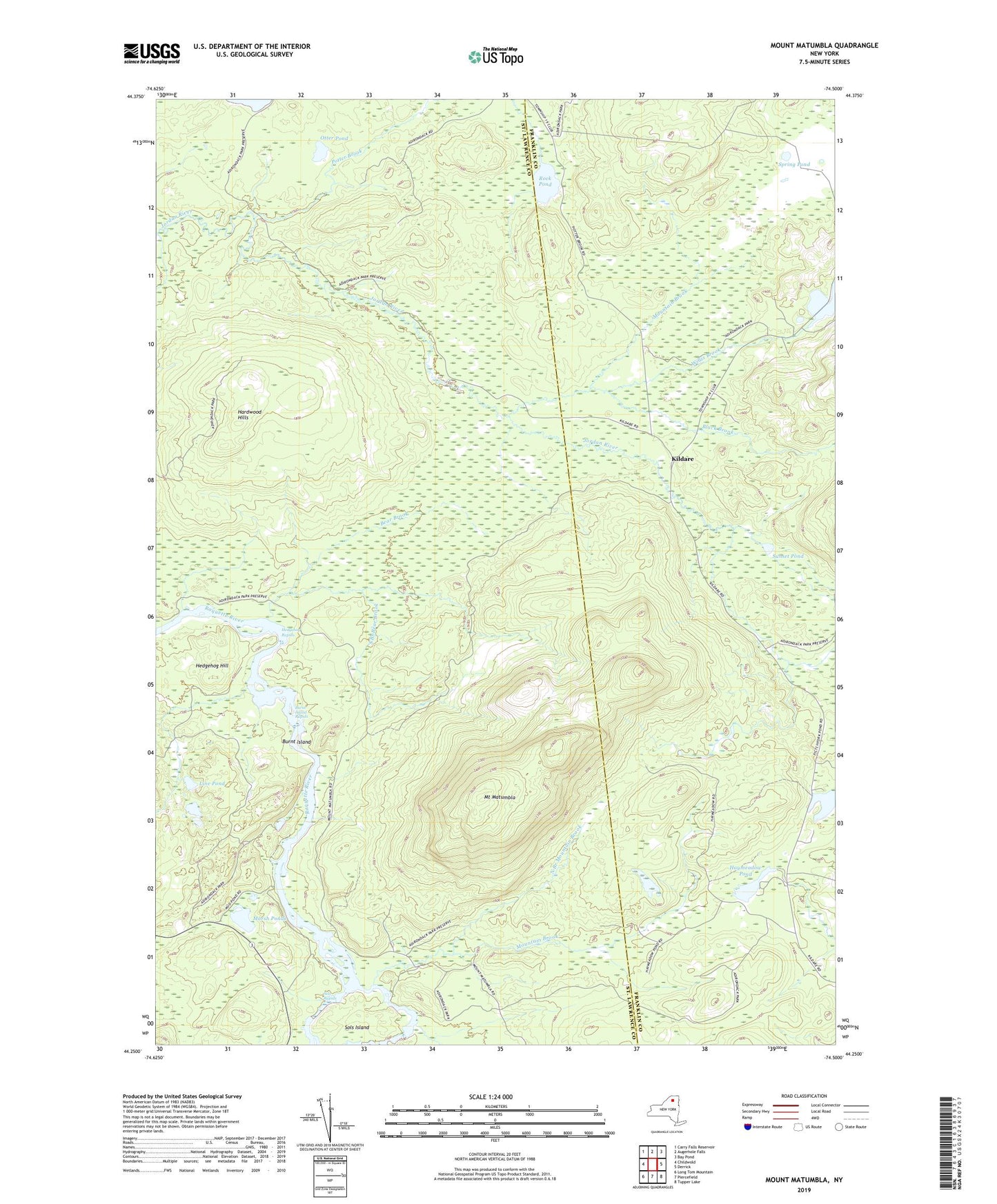
2023 topographic map quadrangle Mount Matumbla in the state of New York. Scale: 1:24000. Based on the newly updated USGS 7.5' US Topo map series, this map is in the following counties: St. Lawrence, Franklin. The map contains contour data, water features, and other items you are used to seeing on USGS maps, but also has updated roads and other features. This is the next generation of topographic maps. Printed on high-quality waterproof paper with UV fade-resistant inks.
Quads adjacent to this one:
West: Childwold
Northwest: Carry Falls Reservoir
North: Augerhole Falls
Northeast: Bay Pond
East: Derrick
Southeast: Tupper Lake
South: Piercefield
Southwest: Long Tom Mountain
This map covers the same area as the classic USGS quad with code o44074c5.
Contains the following named places: Bear Brook, Black Brook, Burnt Island, Burnt Island Rapids, Hardwood Hills, Haymeadow Pond, Hedgehog Hill, Hedgehog Rapids, Kildare, Line Pond, Marsh Ponds, Mount Matumbla, Mountain Brook, North Branch Mountain Brook, Otter Pond, Pitchfork Pond, Potter Brook, Rock Pond, Sols Island, Sols Rapids, South Branch Bear Brook, Spring Pond, Sunset Pond, Willis Brook, ZIP Code: 12973