MyTopo
Stark New York US Topo Map
Couldn't load pickup availability
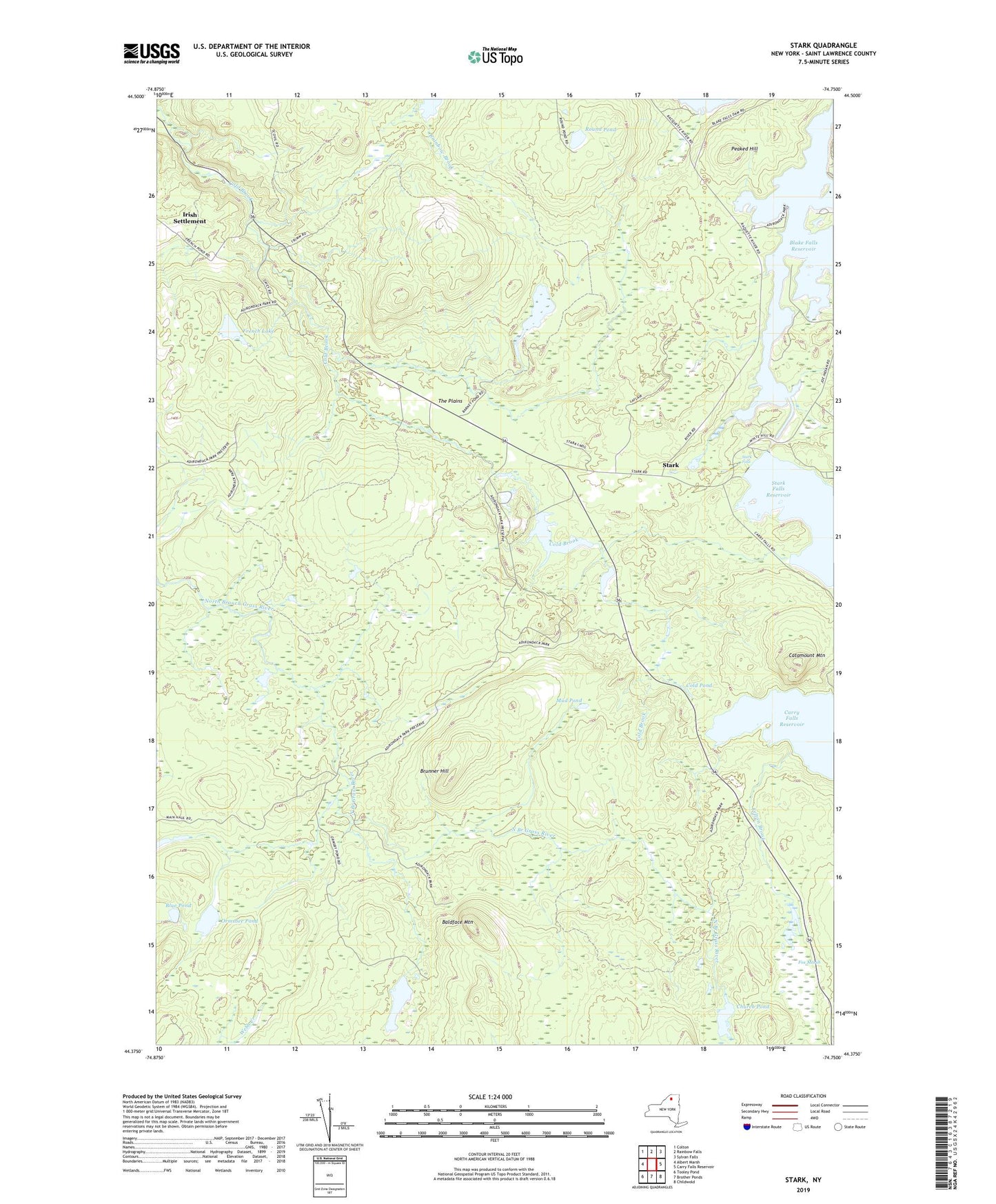
2023 topographic map quadrangle Stark in the state of New York. Scale: 1:24000. Based on the newly updated USGS 7.5' US Topo map series, this map is in the following counties: St. Lawrence. The map contains contour data, water features, and other items you are used to seeing on USGS maps, but also has updated roads and other features. This is the next generation of topographic maps. Printed on high-quality waterproof paper with UV fade-resistant inks.
Quads adjacent to this one:
West: Albert Marsh
Northwest: Colton
North: Rainbow Falls
Northeast: Sylvan Falls
East: Carry Falls Reservoir
Southeast: Childwold
South: Brother Ponds
Southwest: Tooley Pond
This map covers the same area as the classic USGS quad with code o44074d7.
Contains the following named places: Baldface Mountain, Barney Pond, Blake Falls Reservoir, Blue Pond, Brunner Hill, Catamount Mountain, Church Pond, Cold Pond, Felton Brook, Fox Marsh, French Lake, Granshue Club, Irish Settlement, Long Pond, McNeils Point Campsite, Mud Pond, Ormsbee Pond, Peaked Hill, Round Pond, Stark, Stark Falls, Stark Falls Dam, The Plains, Whispering Pines Camp, WNPI-TV (Norwood), ZIP Code: 13687