MyTopo
Piercefield New York US Topo Map
Couldn't load pickup availability
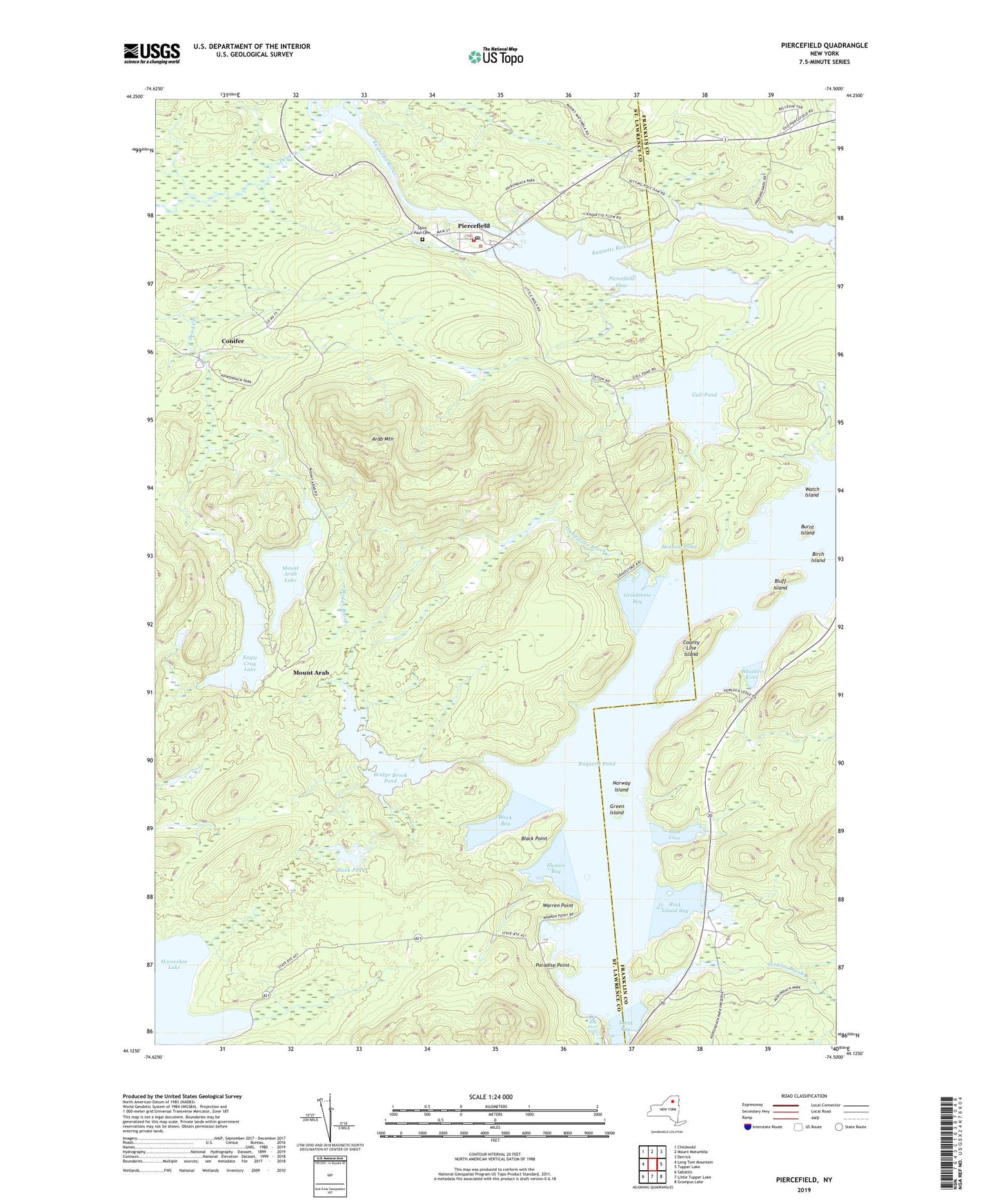
2023 topographic map quadrangle Piercefield in the state of New York. Scale: 1:24000. Based on the newly updated USGS 7.5' US Topo map series, this map is in the following counties: St. Lawrence, Franklin. The map contains contour data, water features, and other items you are used to seeing on USGS maps, but also has updated roads and other features. This is the next generation of topographic maps. Printed on high-quality waterproof paper with UV fade-resistant inks.
Quads adjacent to this one:
West: Long Tom Mountain
Northwest: Childwold
North: Mount Matumbla
Northeast: Derrick
East: Tupper Lake
Southeast: Grampus Lake
South: Little Tupper Lake
Southwest: Sabattis
This map covers the same area as the classic USGS quad with code k44074b5.
Contains the following named places: Arab Mountain, Birch Island, Black Bay, Black Point, Black Pond, Bluff Island, Bog River, Bog River Falls, Bridge Brook, Bridge Brook Pond, Burnt Island, Childwold Station, Conifer, County Line Island, Dead Creek, Eagle Crag Lake, Green Island, Grindstone Bay, Grindstone Brook, Gull Pond, Hamlin Bay, Horseshoe Lake, Jenkins Brook, Minnow Pond, Mount Arab, Mount Arab Lake, Mount Arab Station, Mountain Camp, Norway Island, Paradise Point, Piercefield, Piercefield Flow, Piercefield Post Office, Rock Island Bay, Saint Paul Cemetery, Setting Pole Dam, Slim Cove, South Bay, Town of Piercefield, Warren Point, Watch Island, Whistlers Cove