MyTopo
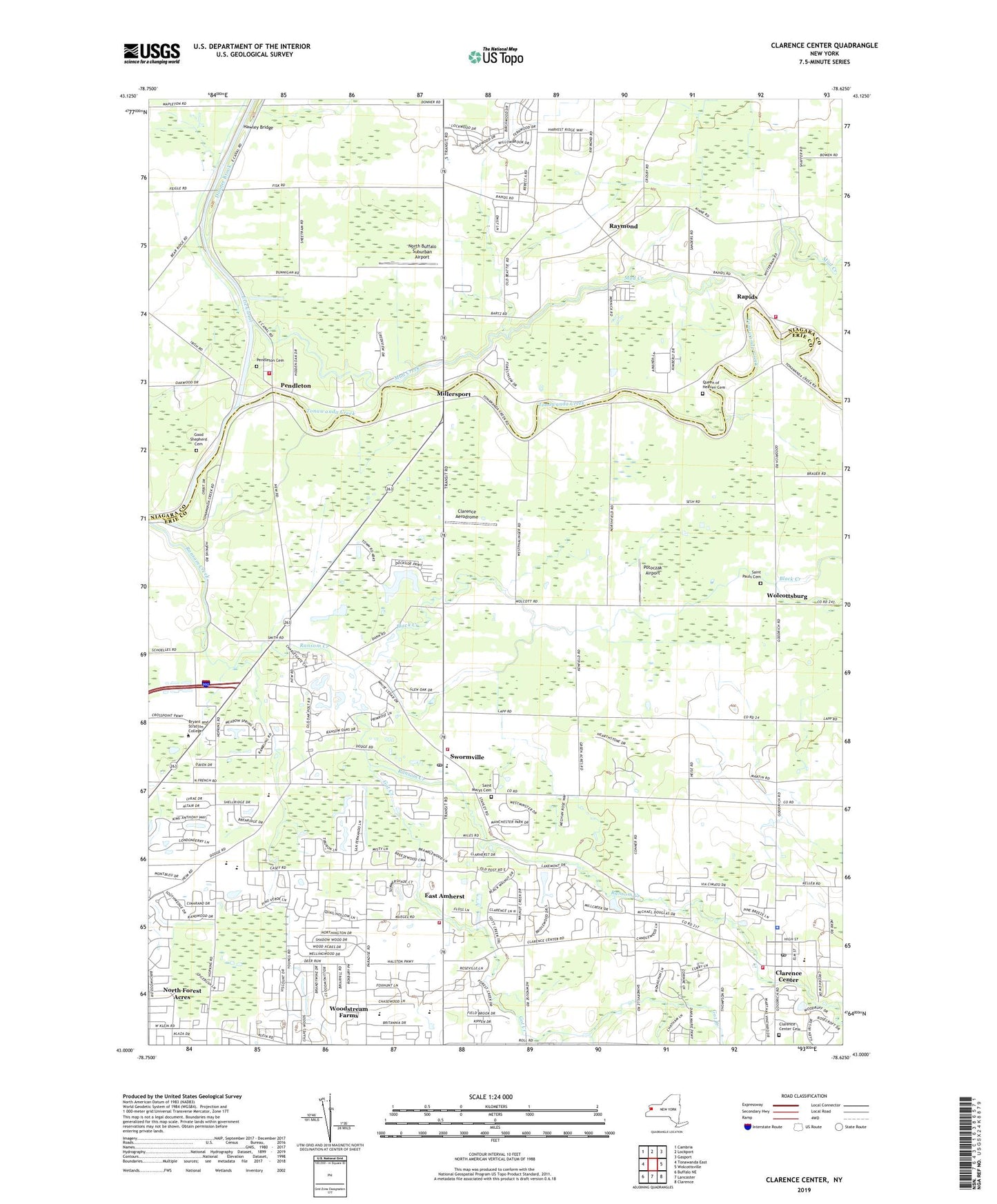
Clarence Center New York US Topo Map
Couldn't load pickup availability
2023 topographic map quadrangle Clarence Center in the state of New York. Scale: 1:24000. Based on the newly updated USGS 7.5' US Topo map series, this map is in the following counties: Erie, Niagara. The map contains contour data, water features, and other items you are used to seeing on USGS maps, but also has updated roads and other features. This is the next generation of topographic maps. Printed on high-quality waterproof paper with UV fade-resistant inks.
Quads adjacent to this one:
West: Tonawanda East
Northwest: Cambria
North: Lockport
Northeast: Gasport
East: Wolcottsville
Southeast: Clarence
South: Lancaster
Southwest: Buffalo NE
This map covers the same area as the classic USGS quad with code o43078a6.
Contains the following named places: Amherst Alliance Church, Amherst Church of Christ, Amherst Museum, Amherst Public Library Clearfield Branch, Asbury United Methodist Church, Badding Brothers Farm, Black Creek, Bristol Village Assisted Living Facility, Casey Middle School, Christian Faith Chapel, Clarence Aerodrome, Clarence Center, Clarence Center Cemetery, Clarence Center Census Designated Place, Clarence Center Elementary School, Clarence Center Post Office, Clarence Center United Methodist Church, Clarence Center Volunteer Fire Company, Dodge Elementary School, Donner Brook, East Amherst, East Amherst Post Office, East Amherst Volunteer Fire Department Station 1, ElderWood Assisted Living at Heathwood, Glen Oak Golf Course, Good Shepherd Cemetery, Good Shepherd Church, Good Shepherd School, Got Creek, Greenwood Golf Course, Hawley Bridge, Millersport, Mud Creek, Nike Site BU-09C, Nike Site BU-09L, Nite-Way Drive-In, North Buffalo Suburban Airport, North Forest Acres, Pendleton, Pendleton Cemetery, Pendleton Community Church, Potoczak Airport, Queen of Heaven Cemetery, Ransom Creek Community Church, Rapids, Rapids Bible Church, Rapids Census Designated Place, Rapids Mobile Home Park, Rapids Volunteer Fire Company Station 1, Raymond, Raymond Community Church, Saint Augustines Church, Saint Marys Cemetery, Saint Mary's Church, Saint Marys School, Saint Pauls Cemetery, Saint Pauls Church, Saint Stephen's United Church of Christ, School Number 10, School Number 12, School Number 17, School Number 4, School Number 5, School Number 6, School Number 7, School Number 8, School Number 9, Suburban Acres Mobile Home Park, Sulphur Springs Guard Lock, Swormville, Swormville Fire Company, Szulis Greenhouse, The Woodlands Mobile Home Park, Therings Garden and Greenhouse, Town of Clarence, Transit Drive-In, Transit Middle School, Transit Valley Country Club, Trinity Lutheran Church, Universal School, Wendelville Volunteer Fire Company Station 3, Williamsville East High School, Williamsville North High School, Wolcottsburg, Woodstream Farms, Zion Lutheran Church, ZIP Codes: 14032, 14051