MyTopo
Croghan New York US Topo Map
Couldn't load pickup availability
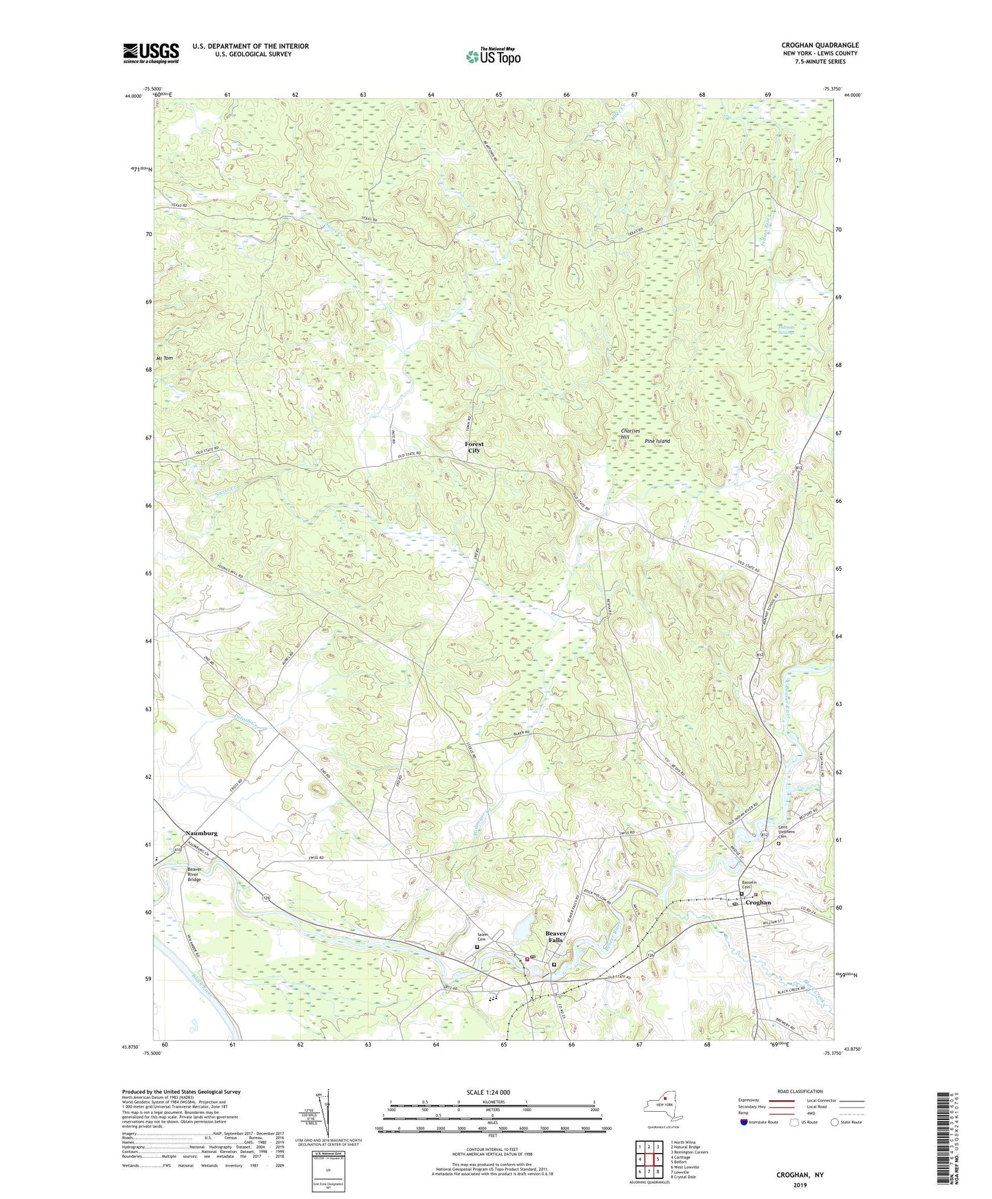
2019 topographic map quadrangle Croghan in the state of New York. Scale: 1:24000. Based on the newly updated USGS 7.5' US Topo map series, this map is in the following counties: Lewis. The map contains contour data, water features, and other items you are used to seeing on USGS maps, but also has updated roads and other features. This is the next generation of topographic maps. Printed on high-quality waterproof paper with UV fade-resistant inks.
Quads adjacent to this one:
West: Carthage
Northwest: North Wilna
North: Natural Bridge
Northeast: Remington Corners
East: Belfort
Southeast: Crystal Dale
South: Lowville
Southwest: West Lowville
Contains the following named places: Basselin Cemetery, Beaver Falls, Beaver Falls Fire Department, Beaver Falls Library, Beaver Falls New Cemetery, Beaver Falls Old Cemetery, Beaver Falls Post Office, Beaver River Bridge, Beaver River School, Black Creek, Charlies Hill, Croghan, Croghan Free Library, Croghan Post Office, Croghan Village Sewage Treatment Plant, Croghan Volunteer Fire Department, Forest City, Hall Dale Acres, Monnatt School, Murmur Creek, Naumburg, New Life Fellowship, Pine Grove Mennonite Church, Pine Island, Putman Swamp, Reynolds Creek, Saint Stephens Cemetery, Salem Christian Fellowship Church, Swiss Creek, Swiss Road School, Texas Road School, Village of Croghan, Widmeyer Creek, Wisner School, Zion Church, ZIP Codes: 13305, 13620