MyTopo
North Wilna New York US Topo Map
Couldn't load pickup availability
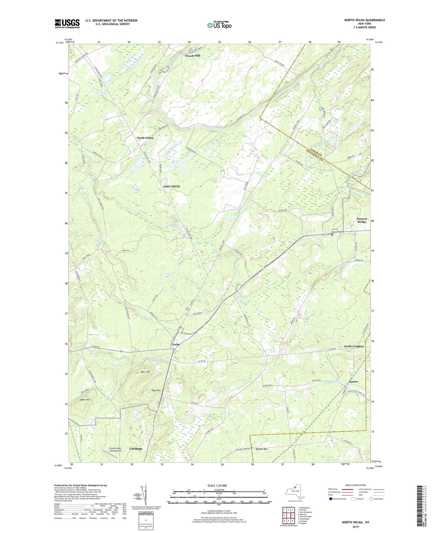
2023 topographic map quadrangle North Wilna in the state of New York. Scale: 1:24000. Based on the newly updated USGS 7.5' US Topo map series, this map is in the following counties: Jefferson, Lewis. The map contains contour data, water features, and other items you are used to seeing on USGS maps, but also has updated roads and other features. This is the next generation of topographic maps. Printed on high-quality waterproof paper with UV fade-resistant inks.
Quads adjacent to this one:
West: Deferiet
Northwest: Philadelphia
North: Antwerp
Northeast: Lake Bonaparte
East: Natural Bridge
Southeast: Croghan
South: Carthage
Southwest: Copenhagen
This map covers the same area as the classic USGS quad with code o44075a5.
Contains the following named places: Barr Hill, Boreas Mountain, Buck Creek, Countryman's Landing Strip, Cowan Corner, Devoice Corners, Fargo, Fort Drum, Gates Corners, Hewitt Park, Hosford School Number 7, Karter, Lewisburg, Lewisburg Corners, Ney Hill, North Croghan, North Wilna, Ormiston Corners, Sand Hill Cemetery, Sand Hill School Number 5, School Number 10, School Number 3, School Number 9, Town of Wilna, Ward Hill, Wilna Range, Woods Mill