MyTopo
West Lowville New York US Topo Map
Couldn't load pickup availability
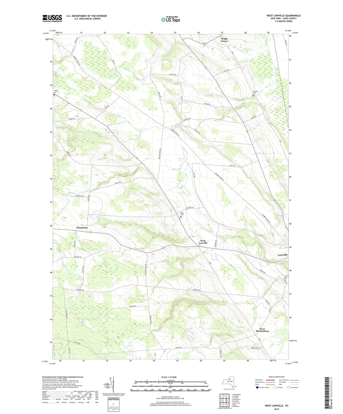
2023 topographic map quadrangle West Lowville in the state of New York. Scale: 1:24000. Based on the newly updated USGS 7.5' US Topo map series, this map is in the following counties: Lewis. The map contains contour data, water features, and other items you are used to seeing on USGS maps, but also has updated roads and other features. This is the next generation of topographic maps. Printed on high-quality waterproof paper with UV fade-resistant inks.
Quads adjacent to this one:
West: New Boston
Northwest: Copenhagen
North: Carthage
Northeast: Croghan
East: Lowville
Southeast: Glenfield
South: Page
Southwest: Sears Pond
This map covers the same area as the classic USGS quad with code o43075g5.
Contains the following named places: Briggs Corner, Cedars Golf Course, Fairview Cemetery, Gallup Cemetery, Harrisburg, Northern Quest Farm, Riverjack Ranch, School Number 11, School Number 12, School Number 13, School Number 14, School Number 16, School Number 2, School Number 3, School Number 4, School Number 5, School Number 6, School Number 7, School Number 9, Town of Lowville, Tug Hill Farm Airport, West Lowville, West Lowville Rural Cemetery, West Martinsburg, Windecker, Windy Acres, WLLG-FM (Lowville), ZIP Code: 13367