MyTopo
Cuba New York US Topo Map
Couldn't load pickup availability
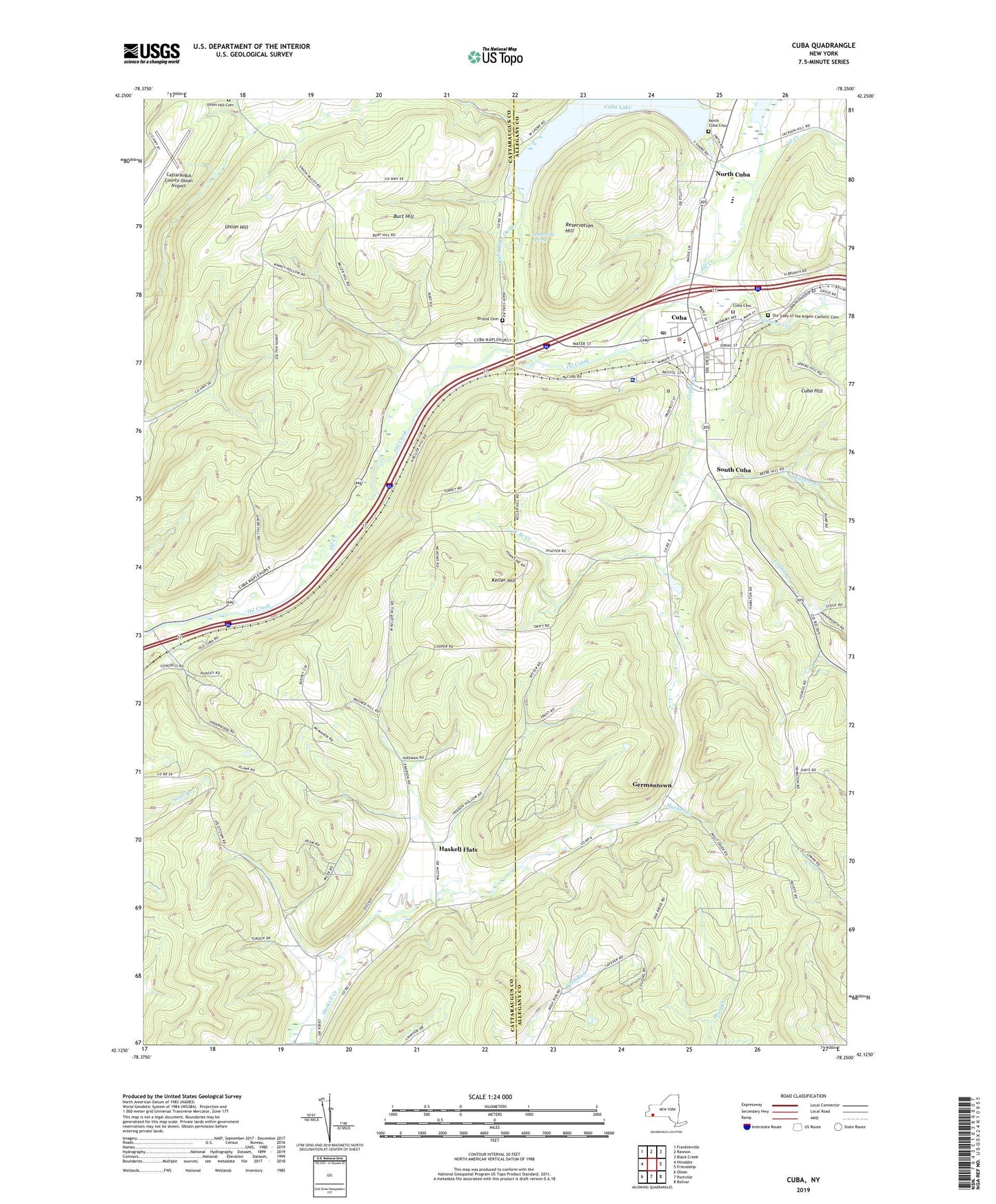
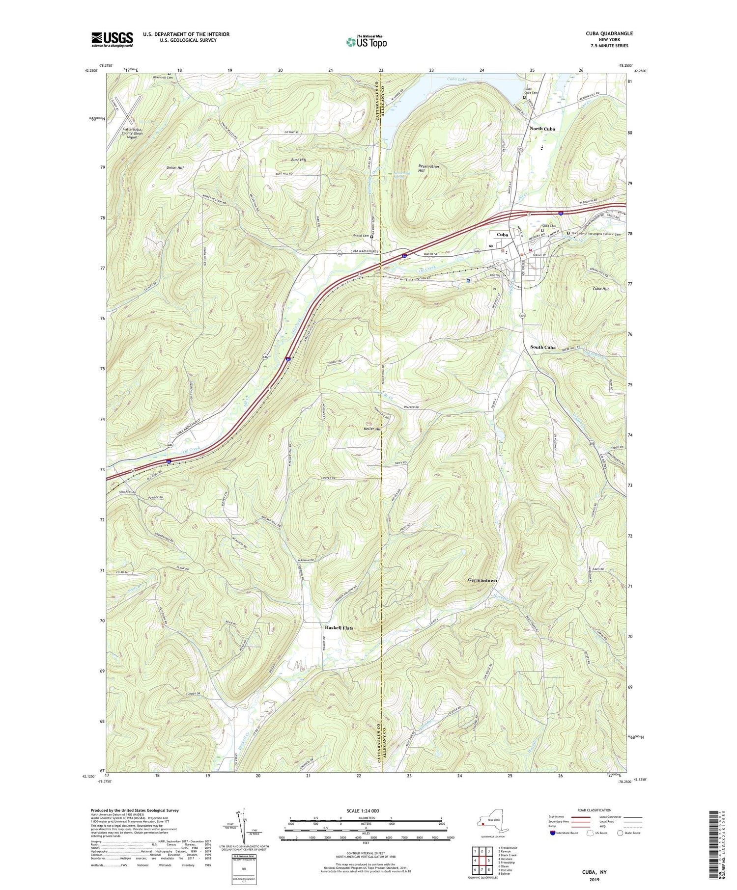
2019 topographic map quadrangle Cuba in the state of New York. Scale: 1:24000. Based on the newly updated USGS 7.5' US Topo map series, this map is in the following counties: Cattaraugus, Allegany. The map contains contour data, water features, and other items you are used to seeing on USGS maps, but also has updated roads and other features. This is the next generation of topographic maps. Printed on high-quality waterproof paper with UV fade-resistant inks.
Quads adjacent to this one:
West: Hinsdale
Northwest: Franklinville
North: Rawson
Northeast: Black Creek
East: Friendship
Southeast: Bolivar
South: Portville
Southwest: Olean
Contains the following named places: Bristol Cemetery, Burt Hill, Cattaraugus County-Olean Airport, Chamberlain Park, Christ Episcopal Church, Cuba, Cuba Ambulance Service, Cuba Cemetery, Cuba Circulating Library, Cuba Elementary School, Cuba Fire Department, Cuba Hill, Cuba Lake, Cuba Lake Outlet, Cuba Memorial Hospital, Cuba Memorial Hospital Heliport, Cuba Post Office, Cuba Town Police Department, Cuba Village Garage, Cuba-Rushford Central School, First Baptist Church, First Presbyterian Church, Genesee Park, Germantown, Griffin Creek, Haskell Flats, Hotel Kinney, Johnsons Creek, Keller Hill, Kirkpatrick Home For Childless Women, Main Street Historic District, North Cuba, North Cuba Cemetery, Oil Springs Reservation, Our Lady of the Angels Catholic Cemetery, Our Lady of the Angels Roman Catholic Church, Reservation Hill, Saint James Hotel, Seneca Oil Spring, South Cuba, South Street Historic District, Tannery Creek, Underwood Manor Assisted Living Center, Union Hill, Union Hill Cemetery, United Methodist Church of Cuba, Van Der Linden Pond, Village of Cuba, Water Way Hills Golf Course, West Branch Creek, Yardman Farm, ZIP Code: 14727