MyTopo
Franklinville New York US Topo Map
Couldn't load pickup availability
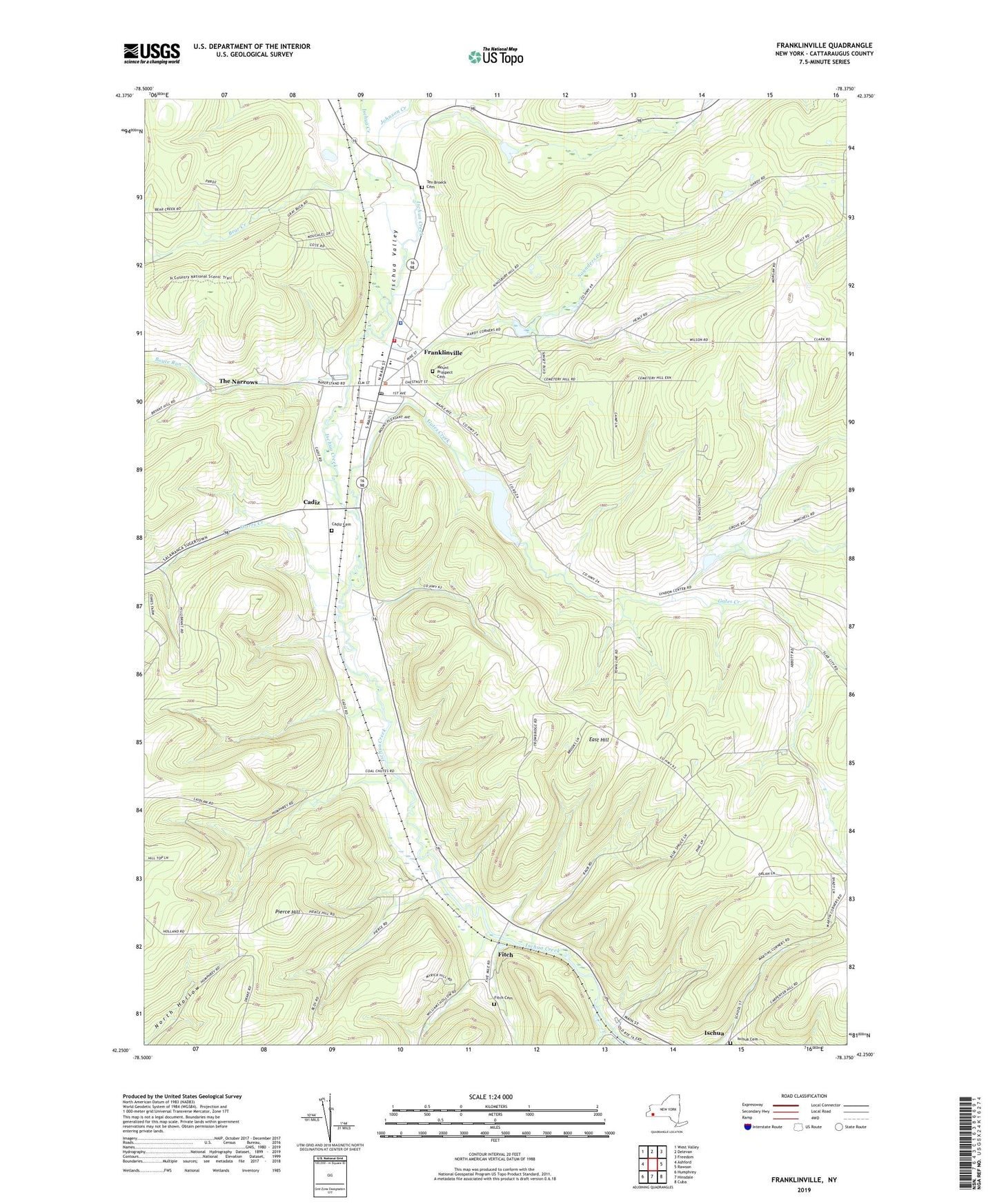
2023 topographic map quadrangle Franklinville in the state of New York. Scale: 1:24000. Based on the newly updated USGS 7.5' US Topo map series, this map is in the following counties: Cattaraugus. The map contains contour data, water features, and other items you are used to seeing on USGS maps, but also has updated roads and other features. This is the next generation of topographic maps. Printed on high-quality waterproof paper with UV fade-resistant inks.
Quads adjacent to this one:
West: Ashford
Northwest: West Valley
North: Delevan
Northeast: Freedom
East: Rawson
Southeast: Cuba
South: Hinsdale
Southwest: Humphrey
This map covers the same area as the classic USGS quad with code o42078c4.
Contains the following named places: Bear Creek, Blount Library, Boyce Run, Cadiz, Cadiz Cemetery, Christian and Missionary Alliance Church, East Hill, First Baptist Church, Fitch, Fitch Cemetery, Franklinville, Franklinville Elementary School, Franklinville Fire Department, Franklinville Free Methodist Church, Franklinville Junior - Senior High School, Franklinville Post Office, Gates Creek, Ischua Cemetery, Ischua Valley, Ischua Valley Country Club, Ishua Valley Estates Mobile Home Park, Johnson Creek, Mount Prospect Cemetery, Pierce Hill, Presbyterian Church, Saint Philomena Roman Catholic Church, Saunders Creek, Storrs Creek, Ten Broeck Cemetery, The Narrows, Town of Franklinville, Triple R Campground, Village of Franklinville, Woodhill Estates Mobile Home Park, ZIP Code: 14737