MyTopo
Hinsdale New York US Topo Map
Couldn't load pickup availability
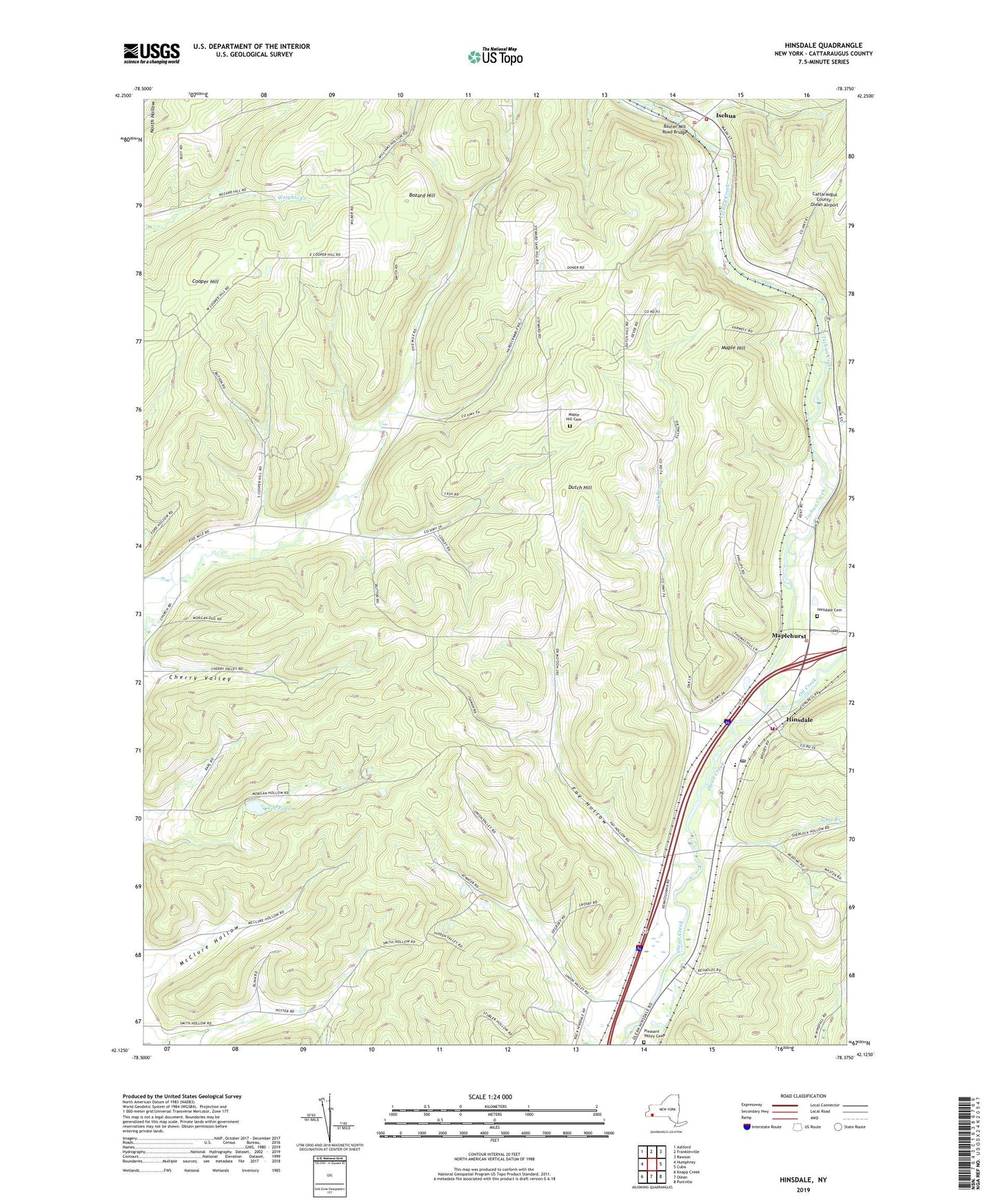
2023 topographic map quadrangle Hinsdale in the state of New York. Scale: 1:24000. Based on the newly updated USGS 7.5' US Topo map series, this map is in the following counties: Cattaraugus. The map contains contour data, water features, and other items you are used to seeing on USGS maps, but also has updated roads and other features. This is the next generation of topographic maps. Printed on high-quality waterproof paper with UV fade-resistant inks.
Quads adjacent to this one:
West: Humphrey
Northwest: Ashford
North: Franklinville
Northeast: Rawson
East: Cuba
Southeast: Portville
South: Olean
Southwest: Knapp Creek
This map covers the same area as the classic USGS quad with code o42078b4.
Contains the following named places: Baxter Mill Road Bridge, Bozard Hill, Cherry Valley, Childs Blueberry Farm, Dutch Hill, Farwell Hollow, Fay Hollow, Gull Brook, Hillview Village Mobile Home Park, Hinsdale, Hinsdale Cemetery, Hinsdale Central School, Hinsdale Maplehurst and Pleasant Valley Volunteer Fire Department, Hinsdale Post Office, Hinsdale United Methodist Church, Ischua, Ischua Creek, Ischua Fire Department, Ischua Union Church, Maple Hill, Maple Hill Cemetery, Maplehurst, Maplehurst Baptist Church, McClure Hollow, Oil Creek, Pleasant Valley Cemetery, Saint Helen Roman Catholic Church, Scott Branch, Smith Hollow, Town of Hinsdale, Town of Ischua, Union Valley, Union Valley Church, Vee Pond, ZIP Code: 14743