MyTopo
Stafford New York US Topo Map
Couldn't load pickup availability
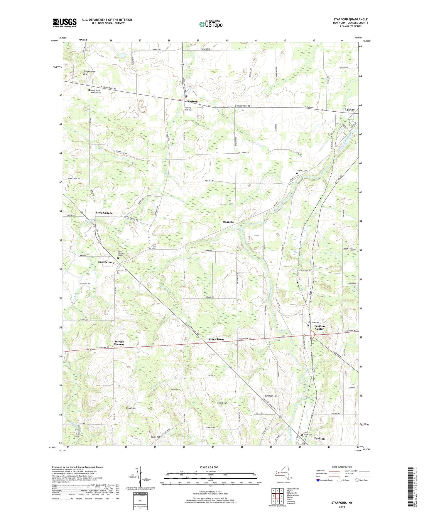
2023 topographic map quadrangle Stafford in the state of New York. Scale: 1:24000. Based on the newly updated USGS 7.5' US Topo map series, this map is in the following counties: Genesee. The map contains contour data, water features, and other items you are used to seeing on USGS maps, but also has updated roads and other features. This is the next generation of topographic maps. Printed on high-quality waterproof paper with UV fade-resistant inks.
Quads adjacent to this one:
West: Batavia South
Northwest: Batavia North
North: Byron
Northeast: Churchville
East: Le Roy
Southeast: Leicester
South: Wyoming
Southwest: Dale
This map covers the same area as the classic USGS quad with code o42078h1.
Contains the following named places: Batavia Drive-In, Bel-Air Ranch Health Camp, Burks Hill, Burleigh Hill, East Bethany, East Bethany Cemetery, East Bethany Presbyterian Church, Fairview Cemetery, Fargo Road Pioneer Cemetery, Immaculate Conception Church, Jug City Cemetery, Junction, Leroy Volunteer Ambulance Services, Little Canada, Millers Fruit Farm, Oatka Valley Cemetery, Pavilion, Pavilion Census Designated Place, Pavilion Center, Pavilion Post Office, Pavilion United Methodist Church, Roanoke, Roanoke Apple Farms, Saint Mary Church, Saint Pauls Episcopal Church, Scarff Hill, School Number 10, School Number 11, School Number 8, School Number 9, Skunk Hill, Stafford, Stafford Country Club, Stafford Post Office, Stafford Quarry, Stafford Rural Cemetery, Stafford Station, Stafford Village Four Corners Historic District, Stafford Volunteer Fire Department, Suicide Corners, Sweetland Pines Golf Course, Temperance Hill, Texaco Town, Top Of World Gardens And Greenhouse, Town of Pavilion, Town of Stafford, Transit Cemetery, Valley View Park, White Creek, ZIP Codes: 14143, 14525