MyTopo
Debar Mountain New York US Topo Map
Couldn't load pickup availability
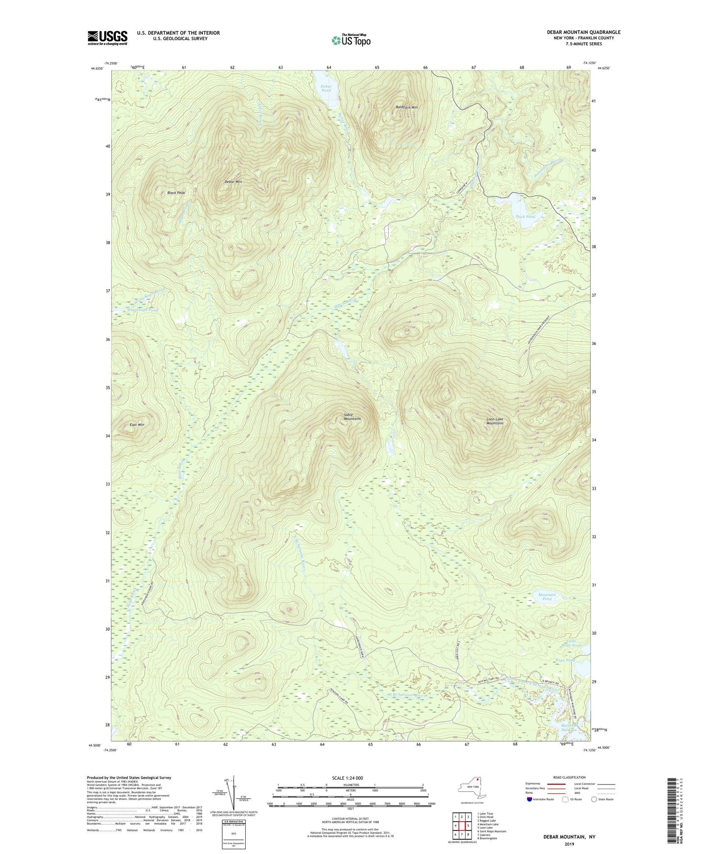
2019 topographic map quadrangle Debar Mountain in the state of New York. Scale: 1:24000. Based on the newly updated USGS 7.5' US Topo map series, this map is in the following counties: Franklin. The map contains contour data, water features, and other items you are used to seeing on USGS maps, but also has updated roads and other features. This is the next generation of topographic maps. Printed on high-quality waterproof paper with UV fade-resistant inks.
Quads adjacent to this one:
West: Meacham Lake
Northwest: Lake Titus
North: Owls Head
Northeast: Ragged Lake
East: Loon Lake
Southeast: Bloomingdale
South: Gabriels
Southwest: Saint Regis Mountain
Contains the following named places: Baldface Mountain, Black Peak, Debar Mountain, Debar Pond, Duck Pond, East Mountain, Hope Pond, Little Hope Pond, Loon Lake Mountains, Mountain Pond, Plumadore Brook, Rainbow Narrows, Sable Mountains, Winnebago Pond, ZIP Code: 12976