MyTopo
Bloomingdale New York US Topo Map
Couldn't load pickup availability
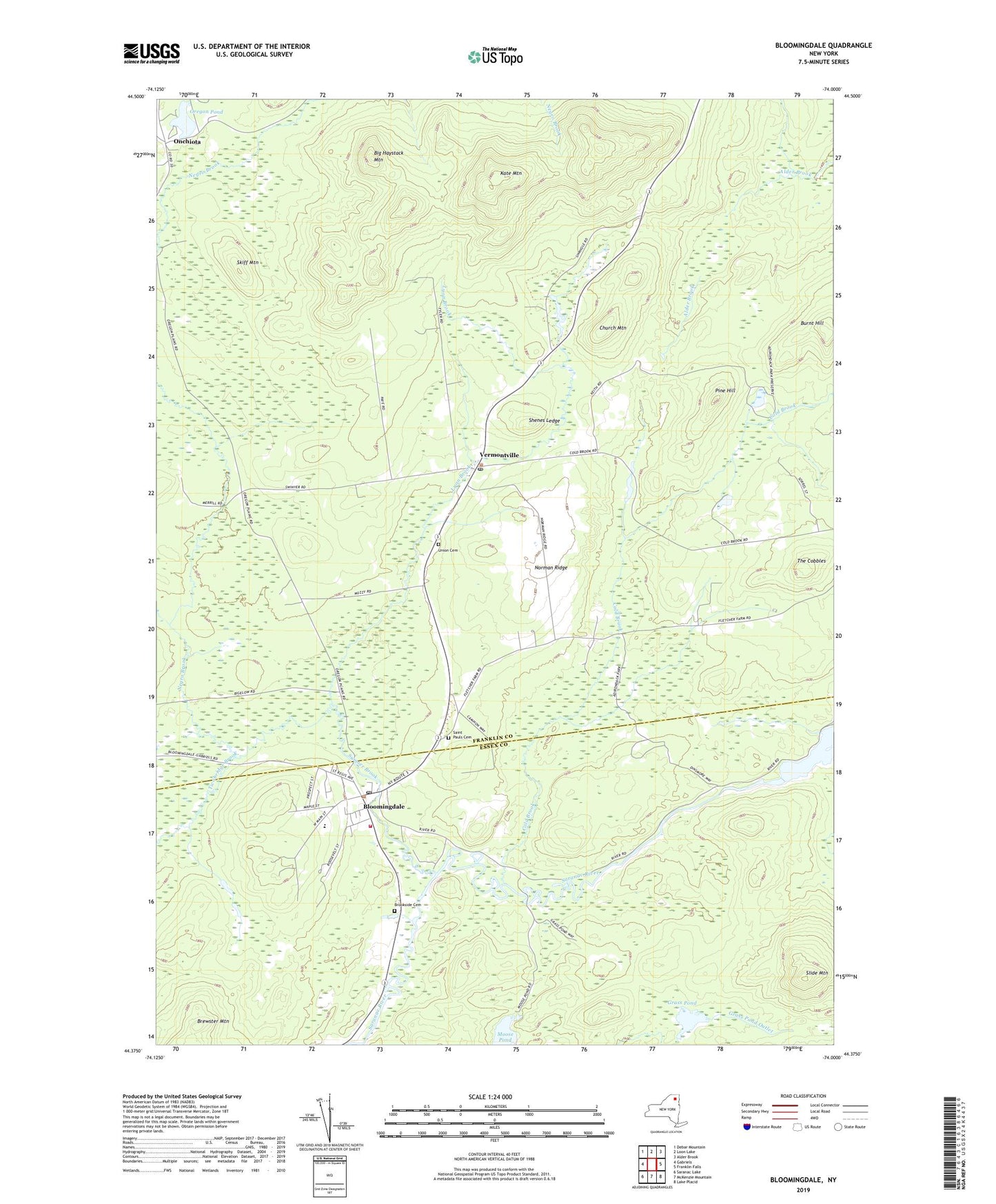
2023 topographic map quadrangle Bloomingdale in the state of New York. Scale: 1:24000. Based on the newly updated USGS 7.5' US Topo map series, this map is in the following counties: Franklin, Essex. The map contains contour data, water features, and other items you are used to seeing on USGS maps, but also has updated roads and other features. This is the next generation of topographic maps. Printed on high-quality waterproof paper with UV fade-resistant inks.
Quads adjacent to this one:
West: Gabriels
Northwest: Debar Mountain
North: Loon Lake
Northeast: Alder Brook
East: Franklin Falls
Southeast: Lake Placid
South: McKenzie Mountain
Southwest: Saranac Lake
This map covers the same area as the classic USGS quad with code k44074d1.
Contains the following named places: Big Haystack Mountain, Bloomingdale, Bloomingdale Post Office, Bloomingdale Volunteer Fire Company, Brewster Mountain, Brookside Cemetery, Burnt Hill, Church Mountain, Cold Brook, Grass Pond, Kate Mountain, Lyon Brook, Negro Brook, Norman Ridge, Onchiota, Oregon Pond, Pilgrim Holiness Church, Pine Hill, Pine Ridge Mobile Home Park, Rickerson Brook, Saint Armand Sewer District Wastewater Treatment Plant, Saint Pauls Cemetery, Shenes Ledge, Skiff Mountain, Slide Mountain, Sumner Brook, The Cobbles, Town of Saint Armand, Twobridge Brook, Union Cemetery, Vermontville, Vermontville Post Office, ZIP Code: 12913