MyTopo
Gabriels New York US Topo Map
Couldn't load pickup availability
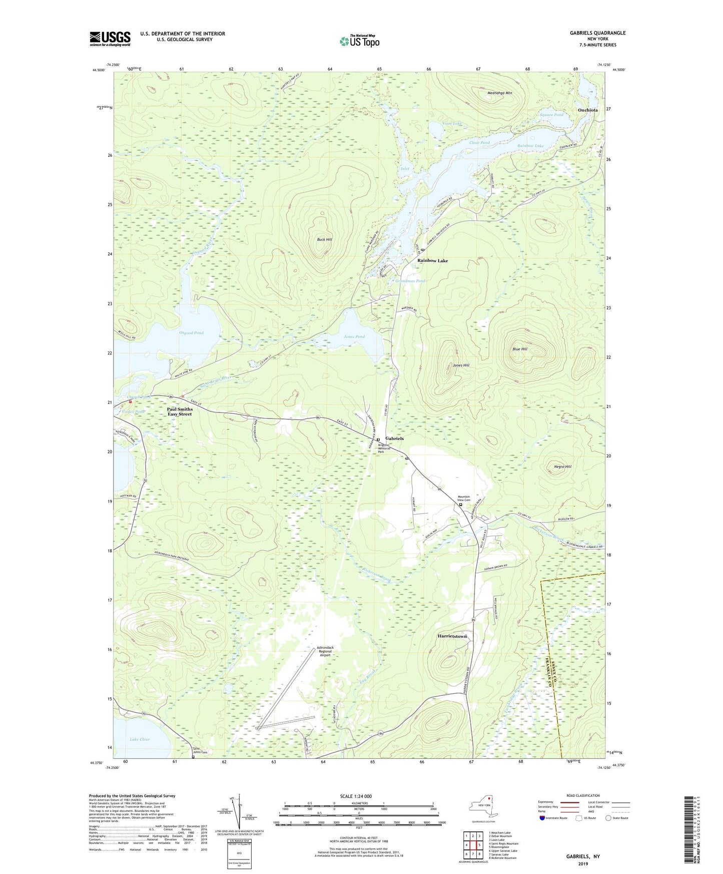
2023 topographic map quadrangle Gabriels in the state of New York. Scale: 1:24000. Based on the newly updated USGS 7.5' US Topo map series, this map is in the following counties: Franklin, Essex. The map contains contour data, water features, and other items you are used to seeing on USGS maps, but also has updated roads and other features. This is the next generation of topographic maps. Printed on high-quality waterproof paper with UV fade-resistant inks.
Quads adjacent to this one:
West: Saint Regis Mountain
Northwest: Meacham Lake
North: Debar Mountain
Northeast: Loon Lake
East: Bloomingdale
Southeast: McKenzie Mountain
South: Saranac Lake
Southwest: Upper Saranac Lake
Contains the following named places: Adirondack Regional Airport, Alumni Hall, Blue Hill, Brighton Memorial Park, Buck Hill, Camp Gabriels, Church Pond, Clear Pond, Cooler Pond, Freer Science Hall, Gabriels, Gabriels Post Office, Grandmas Pond, Harrietstown, Hillside Hall, Inlet, Jones Hill, Jones Pond, Loon Lake, Meenahga Mountain, Mountain View Cemetery, Negro Hill, Osgood Pond, Paul Smiths College, Paul Smiths Easy Street, Paul Smiths Gabriels Volunteer Fire Department, Rainbow Lake, Rainbow Lake Post Office, Saint Johns Cemetery, Saratoga Hall, Square Pond, The Flow, Town of Brighton, White Pine Camp, ZIP Code: 12939