MyTopo
Loon Lake New York US Topo Map
Couldn't load pickup availability
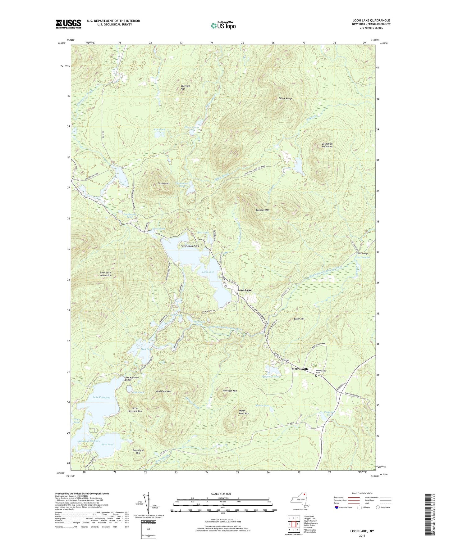
2023 topographic map quadrangle Loon Lake in the state of New York. Scale: 1:24000. Based on the newly updated USGS 7.5' US Topo map series, this map is in the following counties: Franklin. The map contains contour data, water features, and other items you are used to seeing on USGS maps, but also has updated roads and other features. This is the next generation of topographic maps. Printed on high-quality waterproof paper with UV fade-resistant inks.
Quads adjacent to this one:
West: Debar Mountain
Northwest: Owls Head
North: Ragged Lake
Northeast: Lyon Mountain
East: Alder Brook
Southeast: Franklin Falls
South: Bloomingdale
Southwest: Gabriels
This map covers the same area as the classic USGS quad with code o44074e1.
Contains the following named places: Baker Hill, Bass Lake, Buck Pond, Buck Pond Campsites, Buck Pond Hill, Carpenter Pond, Catamount, Catamount Pond, Club Pond, Daigneau Pond, Drew Pond, Elbow Brook, Elbow Ponds, Elbow Range, Elm Pond, Fishhole Pond, Goldsmith Mountains, Grass Pond, Haystack Mountain, Horse Head Point, Kushaqua Narrows, Lake Kushaqua, Lake Kushaqua Bridge, Line Pond, Little Haystack Mountain, Lookout Mountain, Loon Lake, Lost Channel, Marsh Pond, Marsh Pond Mountain, Merrillsville, Merrillsville Cemetery, Molasses Corners, Mountain Pond, Mud Pond, Mud Pond Mountain, Oregon Brook, Porkbarrel Pond, Slab Bridge, Sporting Hill, Town of Franklin, Washbourn Brook, White Fathers, ZIP Code: 12989