MyTopo
Dun Brook Mountain New York US Topo Map
Couldn't load pickup availability
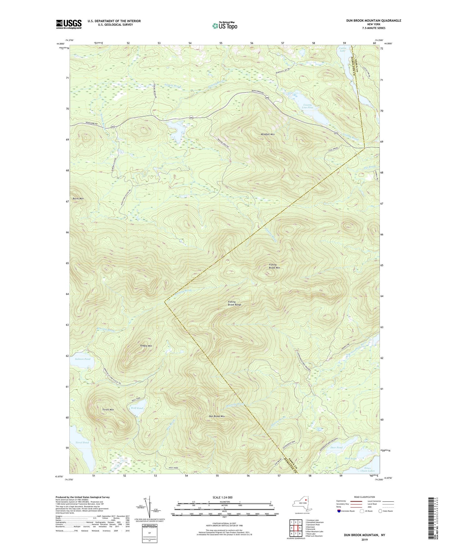
2019 topographic map quadrangle Dun Brook Mountain in the state of New York. Scale: 1:24000. Based on the newly updated USGS 7.5' US Topo map series, this map is in the following counties: Hamilton, Essex. The map contains contour data, water features, and other items you are used to seeing on USGS maps, but also has updated roads and other features. This is the next generation of topographic maps. Printed on high-quality waterproof paper with UV fade-resistant inks.
Quads adjacent to this one:
West: Deerland
Northwest: Grampus Lake
North: Kempshall Mountain
Northeast: Santanoni Peak
East: Newcomb
Southeast: Bad Luck Mountain
South: Rock Lake
Southwest: Blue Mountain Lake
Contains the following named places: Burnt Mountain, County Line Flow, Deer Pond, Donnelly Brook, Dun Brook Mountain, Fishing Brook Mountain, Fishing Brook Range, Lilypad Pond, Long Pond, Mud Pond, Roaring Brook, Salmon Pond, Sixmile Brook, Stanley Brook, Third Lake, Tirrel Pond, Tirrell Mountain, Tongue Mountain, Windfall Mountain, Wolf Pond