MyTopo
Newcomb New York US Topo Map
Couldn't load pickup availability
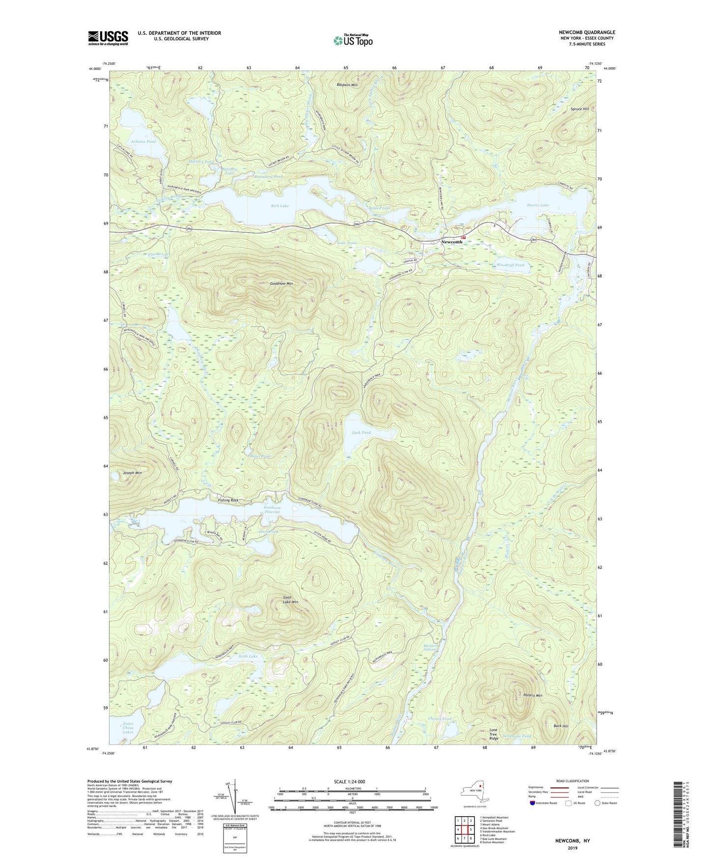
2023 topographic map quadrangle Newcomb in the state of New York. Scale: 1:24000. Based on the newly updated USGS 7.5' US Topo map series, this map is in the following counties: Essex. The map contains contour data, water features, and other items you are used to seeing on USGS maps, but also has updated roads and other features. This is the next generation of topographic maps. Printed on high-quality waterproof paper with UV fade-resistant inks.
Quads adjacent to this one:
West: Dun Brook Mountain
Northwest: Kempshall Mountain
North: Santanoni Peak
Northeast: Mount Adams
East: Vanderwhacker Mountain
Southeast: Dutton Mountain
South: Bad Luck Mountain
Southwest: Rock Lake
This map covers the same area as the classic USGS quad with code k43074h1.
Contains the following named places: Adjidaumo Flow, Arbutus Pond, Bates Pond, Belden Lake, Big Sucker Brook, Blackwell Stillwater, Boundary Pond, Buck Hill, Cheney Pond, Eighth Lake, Essex Chain Lakes, Fifth Lake, Fishing Brook, Fishing Rock, Flat Brook, Fourth Lake, Goodnow Flowage, Goodnow Mountain, Goodnow Pond, Goodnow River, Harris Lake, Joseph Mountain, Little Sucker Brook, Lodo Pond, Military Lake, Military Pond, Newcomb, Newcomb Volunteer Fire Department, North Branch Wolf Creek, Ord Falls, Otter Pond, Polaris Mountain, Rich Lake, Seventh Lake, Sixth Lake, Sixth Lake Mountain, West Branch Goodnow River, Wolf Creek, Woodruff Pond, Zack Pond, ZIP Code: 12852