MyTopo
Santanoni Peak New York US Topo Map
Couldn't load pickup availability
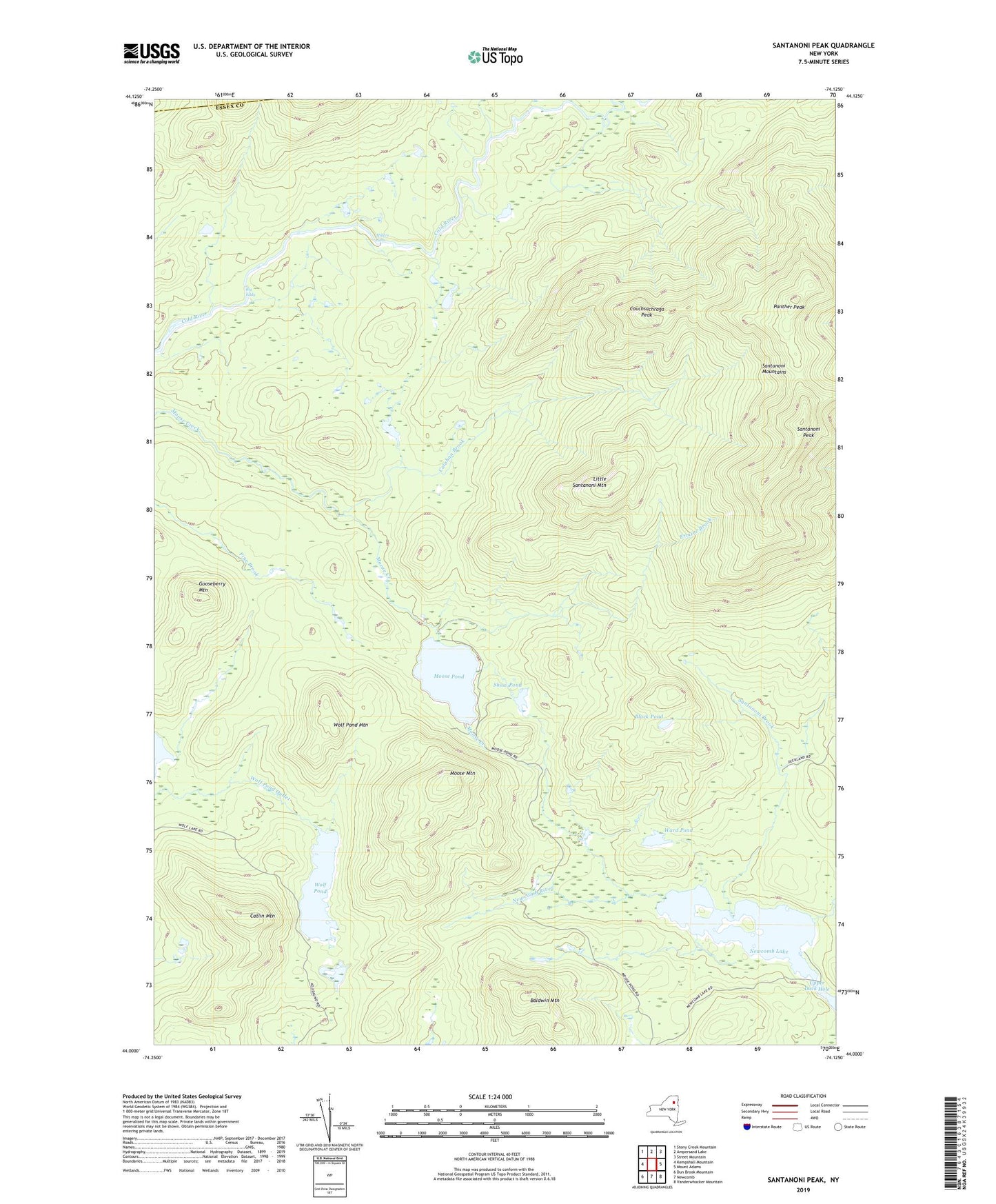
2023 topographic map quadrangle Santanoni Peak in the state of New York. Scale: 1:24000. Based on the newly updated USGS 7.5' US Topo map series, this map is in the following counties: Essex, Franklin. The map contains contour data, water features, and other items you are used to seeing on USGS maps, but also has updated roads and other features. This is the next generation of topographic maps. Printed on high-quality waterproof paper with UV fade-resistant inks.
Quads adjacent to this one:
West: Kempshall Mountain
Northwest: Stony Creek Mountain
North: Ampersand Lake
Northeast: Street Mountain
East: Mount Adams
Southeast: Vanderwhacker Mountain
South: Newcomb
Southwest: Dun Brook Mountain
This map covers the same area as the classic USGS quad with code k44074a1.
Contains the following named places: Adirondack State Park, Baldwin Mountain, Big Eddy, Black Pond, Calahan Brook, Catlin Mountain, Couchsachraga Peak, Ermine Brook, Gooseberry Mountain, Little Santanoni Mountain, Millers Falls, Moose Mountain, Moose Pond, Newcomb Lake, Panther Peak, Santanoni Brook, Santanoni Mountains, Santanoni Peak, Seward Brook, Shaw Pond, Sucker Brook, Town of Newcomb, Upper Duck Hole, Ward Pond, Wolf Pond, Wolf Pond Mountain