MyTopo
Kempshall Mountain New York US Topo Map
Couldn't load pickup availability
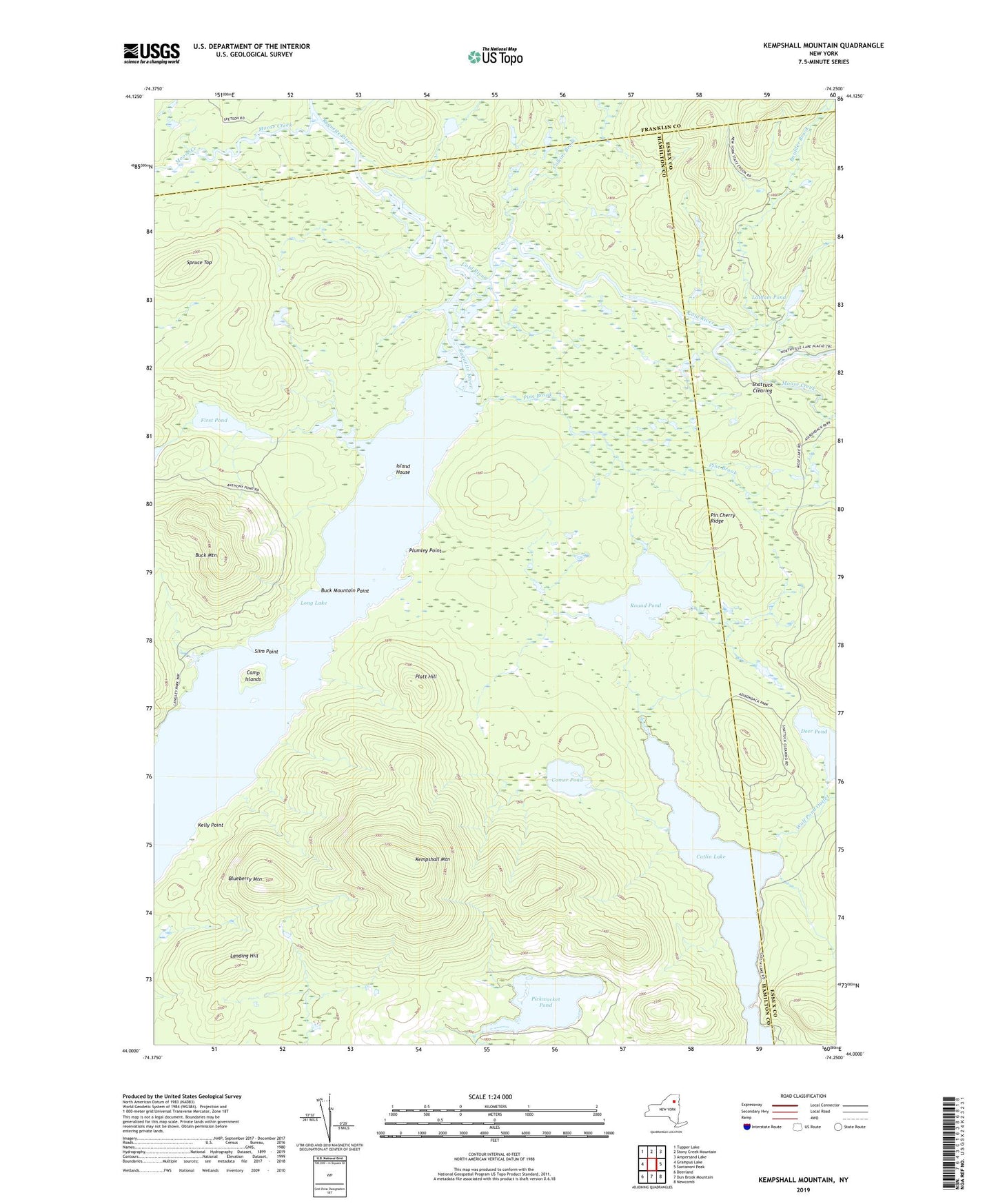
2023 topographic map quadrangle Kempshall Mountain in the state of New York. Scale: 1:24000. Based on the newly updated USGS 7.5' US Topo map series, this map is in the following counties: Hamilton, Essex, Franklin. The map contains contour data, water features, and other items you are used to seeing on USGS maps, but also has updated roads and other features. This is the next generation of topographic maps. Printed on high-quality waterproof paper with UV fade-resistant inks.
Quads adjacent to this one:
West: Grampus Lake
Northwest: Tupper Lake
North: Stony Creek Mountain
Northeast: Ampersand Lake
East: Santanoni Peak
Southeast: Newcomb
South: Dun Brook Mountain
Southwest: Deerland
This map covers the same area as the classic USGS quad with code k44074a3.
Contains the following named places: Blueberry Mountain, Boulder Brook, Buck Mountain, Buck Mountain Point, Calkins Brook, Camp Islands, Catlin Lake, Cold River, Comer Pond, Corner Pond, Deer Pond, First Pond, Island House, Kelly Point, Kempshall Mountain, Landing Hill, Latham Pond, Long Lake, Moose Creek, Pickwacket Pond, Pin Cherry Ridge, Pine Brook, Platt Hill, Plumley Point, Round Pond, Shattuck Clearing, Slim Point, Spruce Top, Wolf Pond Outlet