MyTopo
Farnham New York US Topo Map
Couldn't load pickup availability
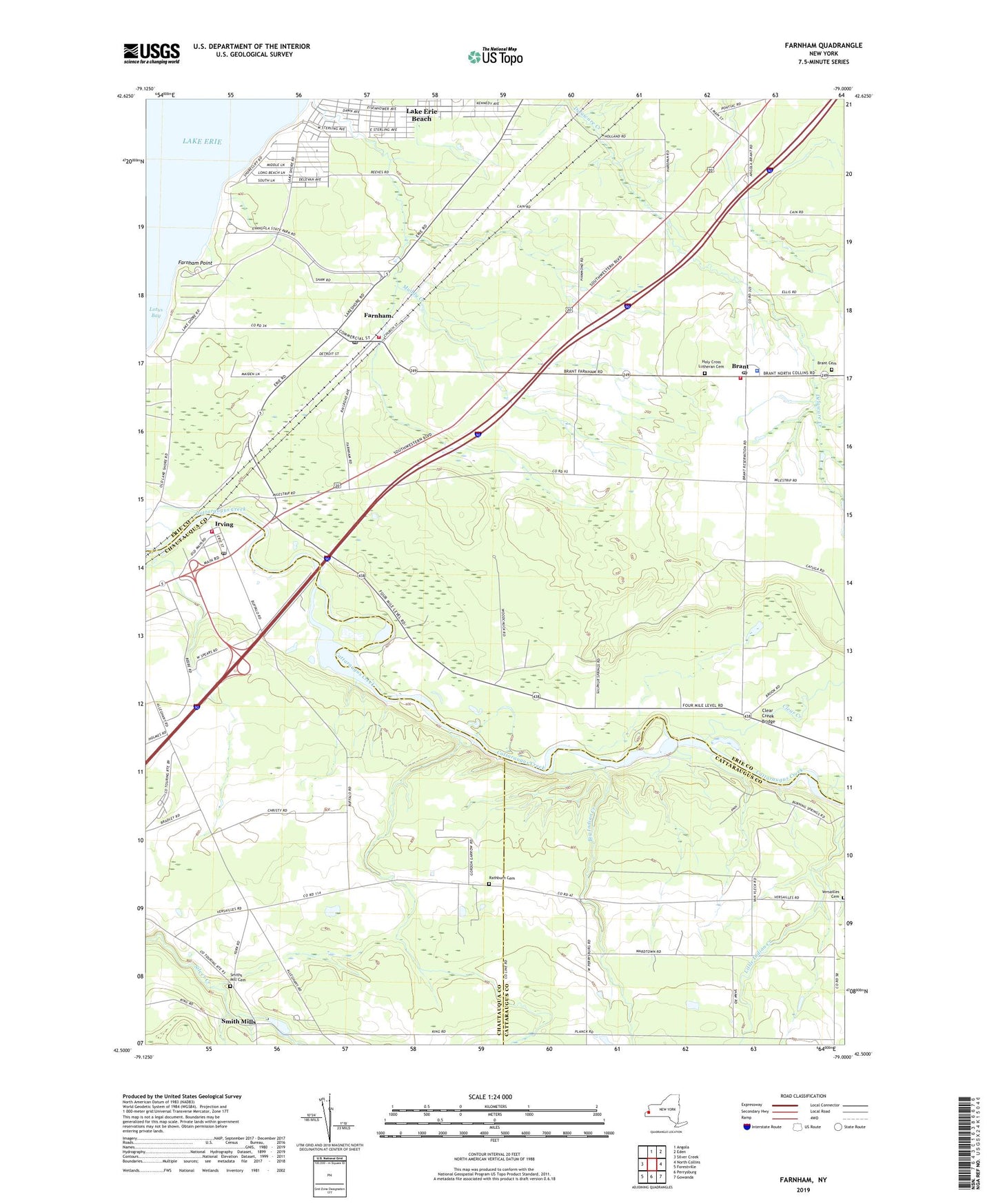
2023 topographic map quadrangle Farnham in the state of New York. Scale: 1:24000. Based on the newly updated USGS 7.5' US Topo map series, this map is in the following counties: Erie, Chautauqua, Cattaraugus. The map contains contour data, water features, and other items you are used to seeing on USGS maps, but also has updated roads and other features. This is the next generation of topographic maps. Printed on high-quality waterproof paper with UV fade-resistant inks.
Quads adjacent to this one:
West: Silver Creek
North: Angola
Northeast: Eden
East: North Collins
Southeast: Gowanda
South: Perrysburg
Southwest: Forestville
This map covers the same area as the classic USGS quad with code o42079e1.
Contains the following named places: Angola Lake Shore Addition, Big Indian Creek, Brant, Brant Cemetery, Brant Elementary School, Brant Post Office, Brant Volunteer Fire Company 1, Camp Forty Acres, Cattaraugus Creek Bridge, Cattaraugus Reservation, Clear Creek, Clear Creek Bridge, District Number 2 School, Evangola State Park, Farnham, Farnham Point, Farnham Post Office, Farnham Volunteer Fire Department, Gage Chapel, Good Shepard Church, Good Shepherd Church, Holy Cross Lutheran Cemetery, Irving, Irving Fire Department, Irving Post Office, Kingdom Hall of Jehovah's Witnesses, Lake Erie Beach, Lake Erie Beach Census Designated Place, Lotus Bay, Mount Zion Church, Our Lady of Mount Carmel Church, Pleasant Valley Baptist Church, Rathburn Cemetery, Rose Brook Golf Course, Saint Anthony's Roman Catholic Church, Silver Creek Toll Plaza, Smiths Mill Cemetery, Steiger Farms, Town of Brant, United Mission, Vacco Farms, Versailles Cemetery, Village of Farnham, West Creek Mobile Home Park, ZIP Codes: 14061, 14081