MyTopo
Fillmore New York US Topo Map
Couldn't load pickup availability
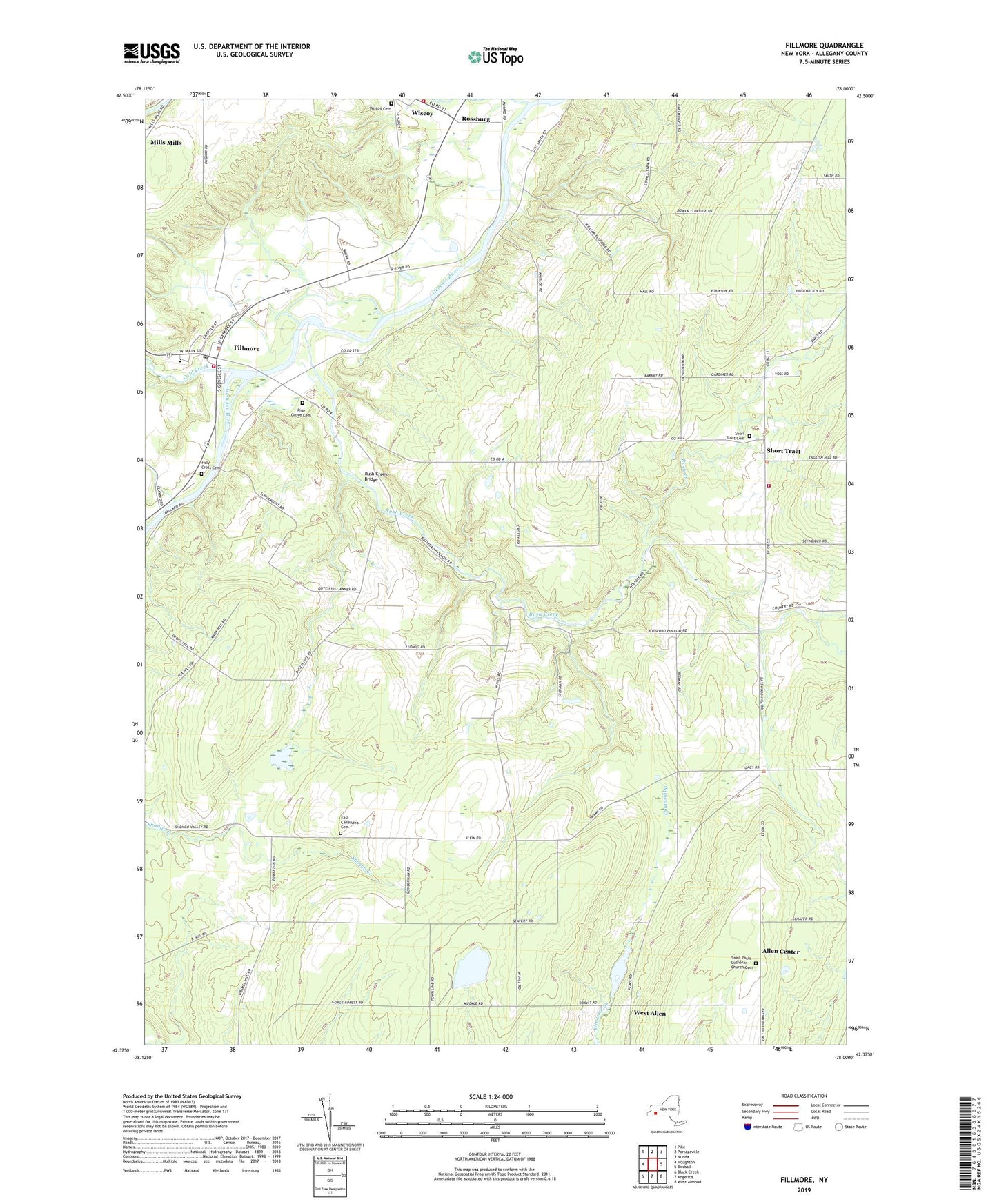
2019 topographic map quadrangle Fillmore in the state of New York. Scale: 1:24000. Based on the newly updated USGS 7.5' US Topo map series, this map is in the following counties: Allegany. The map contains contour data, water features, and other items you are used to seeing on USGS maps, but also has updated roads and other features. This is the next generation of topographic maps. Printed on high-quality waterproof paper with UV fade-resistant inks.
Quads adjacent to this one:
West: Houghton
Northwest: Pike
North: Portageville
Northeast: Nunda
East: Birdsall
Southeast: West Almond
South: Angelica
Southwest: Black Creek
Contains the following named places: Allen Center, Central School, Cold Creek, East Caneadea Cemetery, East Caneadea Church, Fillmore, Fillmore Census Designated Place, Fillmore Fire Department, Fillmore Post Office, Granger, Hank Miller Memorial Field, Holy Cross Cemetery, Hume Town Hall, New York State Police Fillmore Station, Pine Grove Cemetery, Riverland Dairy Farms, Rossburg, Rush Creek, Rush Creek Bridge, Saint Patricks Church, Saint Pauls Church, Saint Pauls Lutheran Church Cemetery, Short Tract, Short Tract Cemetery, Short Tract Fire Company, Town of Allen, Town of Granger, Wesleyan Church, West Allen, Wide Awake Club Library, Wiscoy - Rossburg Fire Company, Wiscoy Cemetery, Wiscoy Creek, ZIP Code: 14735