MyTopo
Birdsall New York US Topo Map
Couldn't load pickup availability
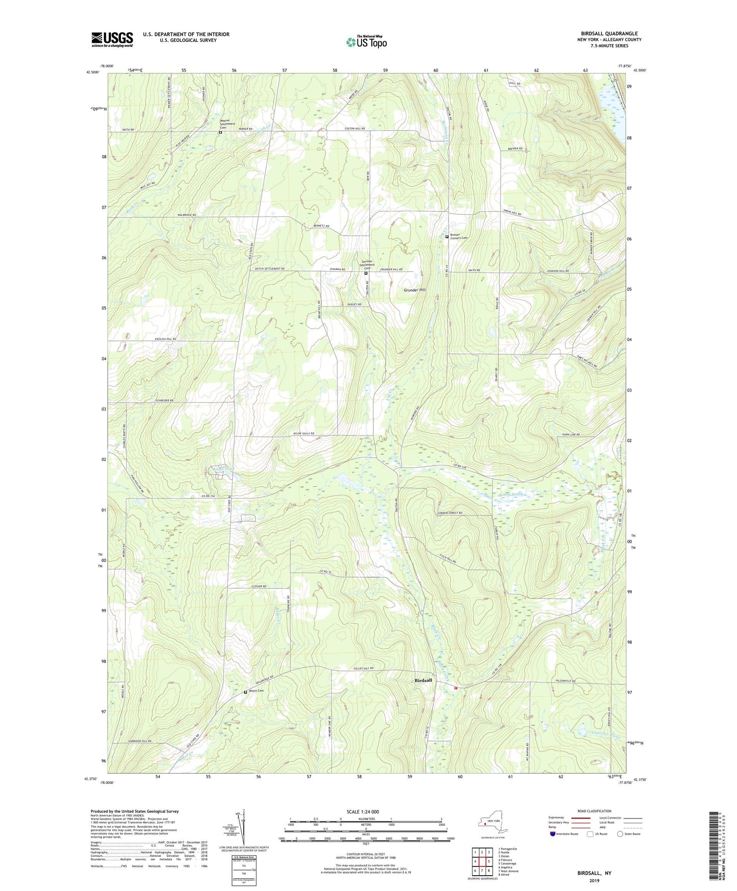
2023 topographic map quadrangle Birdsall in the state of New York. Scale: 1:24000. Based on the newly updated USGS 7.5' US Topo map series, this map is in the following counties: Allegany. The map contains contour data, water features, and other items you are used to seeing on USGS maps, but also has updated roads and other features. This is the next generation of topographic maps. Printed on high-quality waterproof paper with UV fade-resistant inks.
Quads adjacent to this one:
West: Fillmore
Northwest: Portageville
North: Nunda
Northeast: Ossian
East: Canaseraga
Southeast: Alfred
South: West Almond
Southwest: Angelica
This map covers the same area as the classic USGS quad with code o42077d8.
Contains the following named places: Birdsall, Birdsall Community Church, Birdsall Fire Department, Brewer Corners, Brewer Corners Cemetery, Centre, Fry Creek, German Settlement Cemetery, Grove Church, Grunder Hill, Jones Pond, Keaney Swamp, School Number 1, School Number 12, School Number 17, School Number 5, School Number 6, School Number 9, State Road, Thorntree School, Town of Birdsall, Town of Grove, Weaver Settlement Cemetery, White Cemetery, ZIP Code: 14884