MyTopo
Nunda New York US Topo Map
Couldn't load pickup availability
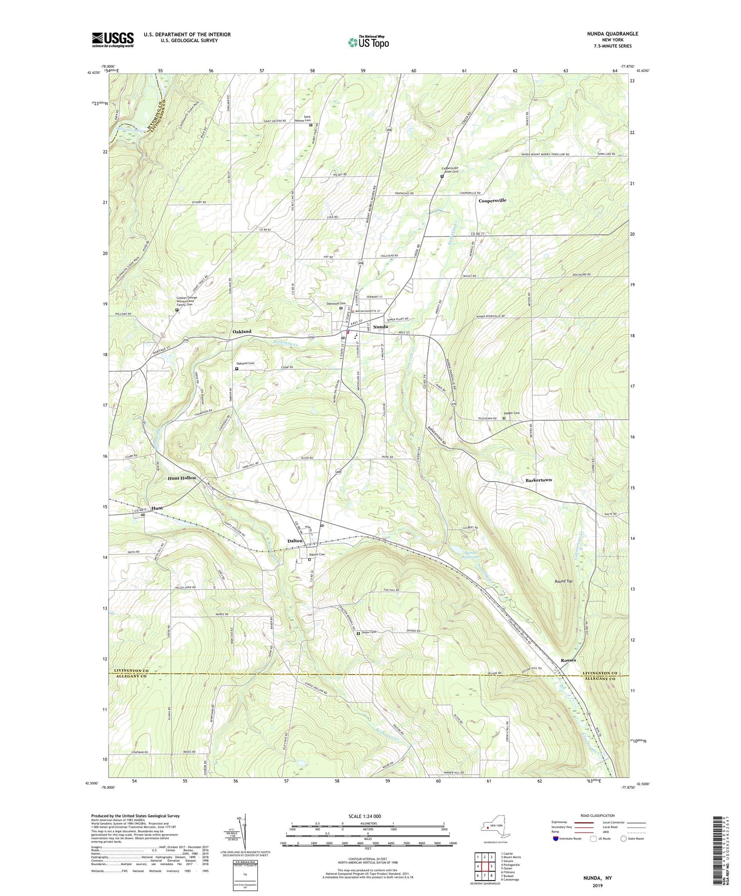
2023 topographic map quadrangle Nunda in the state of New York. Scale: 1:24000. Based on the newly updated USGS 7.5' US Topo map series, this map is in the following counties: Livingston, Allegany, Wyoming. The map contains contour data, water features, and other items you are used to seeing on USGS maps, but also has updated roads and other features. This is the next generation of topographic maps. Printed on high-quality waterproof paper with UV fade-resistant inks.
Quads adjacent to this one:
West: Portageville
Northwest: Castile
North: Mount Morris
Northeast: Sonyea
East: Ossian
Southeast: Canaseraga
South: Birdsall
Southwest: Fillmore
This map covers the same area as the classic USGS quad with code o42077e8.
Contains the following named places: Barkertown, Colonel George Williams And Family Cemetery, Coopersville, Coopersville - Jones Cemetery, Dalton, Dalton Assembly of God, Dalton Cemetery, Dalton Census Designated Place, Dalton Elementary School, Dalton Post Office, Dalton United Methodist Church, Dan Mar Ranch, Holy Angels Church, Hunt, Hunt Baptist Church, Hunt Census Designated Place, Hunt Hollow, Hunt Post Office, Keshequa Middle School, Keshequa Senior High School, Lawson Pit, Lewis, Newville Creek, Nunda, Nunda Fire Department, Nunda Junction, Nunda Post Office, Nunda Reservoir, Nunda Rod and Gun Club, Nunda United Methodist Church, Nunda Village Sewage Treatment Plant, Oakhill Farm And Ranch, Oakland, Oakland Cemetery, Oakland Wesleyan Church, Oakwood Cemetery, Rattlesnake Hill State Wildlife Management Area, Roll-N-View Farm, Rosses, Round Top, Saint Helena Cemetery, Seager Cemetery, Town of Nunda, Town of Portage, Trinity Church of Nunda, Triple Creek Golf Club, Union Cemetery, Village of Nunda, Woodlynn Hills Golf Course, ZIP Code: 14517