MyTopo
Five Ponds New York US Topo Map
Couldn't load pickup availability
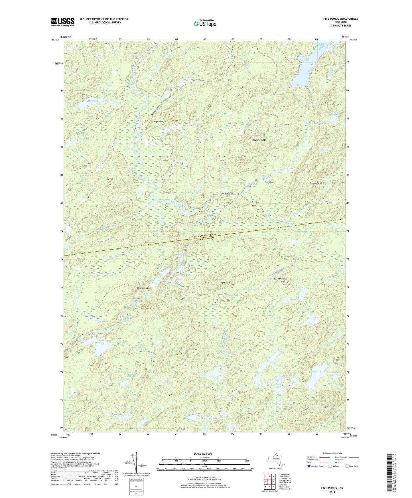
2019 topographic map quadrangle Five Ponds in the state of New York. Scale: 1:24000. Based on the newly updated USGS 7.5' US Topo map series, this map is in the following counties: St. Lawrence, Herkimer. The map contains contour data, water features, and other items you are used to seeing on USGS maps, but also has updated roads and other features. This is the next generation of topographic maps. Printed on high-quality waterproof paper with UV fade-resistant inks.
Quads adjacent to this one:
West: Oswegatchie SE
Northwest: Oswegatchie
North: Newton Falls
Northeast: Cranberry Lake
East: Wolf Mountain
Southeast: Nehasane Lake
South: Beaver River
Southwest: Stillwater
Contains the following named places: Big Five, Big Shallow, Boiling Spring, Buck Brook, Buck Pond, Cage Lake Outlet, Cracker Pond, Dead Creek, Dead Creek Flow, Five Ponds, Gal Pond, Glasby Creek, Glasby Pond, Grassy Pond, Greenfield Mountain, Griffin Rapids, Gull Lake, Hammer Creek, High Falls, High Rock, Hitchins Pond, Hyde Pond, Inlet, Janacks Landing Shelter, Little Crooked Lake, Little Duck Pond, Little Five, Little Shallow, Lone Duck Pond, Muir Pond, Otter Pond, Oven Lake, Panther Mountain, Partlow Mountain, Riley Ponds, Robinson River, Roundtop Mountain, Sliding Falls, Streeter Fishpond, The Plains, Threemile Mountain, Toad Pond, Washbowl, West Pond, Wolf Pond, Wolf Pond Outlet, ZIP Code: 13695