MyTopo
Wolf Mountain New York US Topo Map
Couldn't load pickup availability
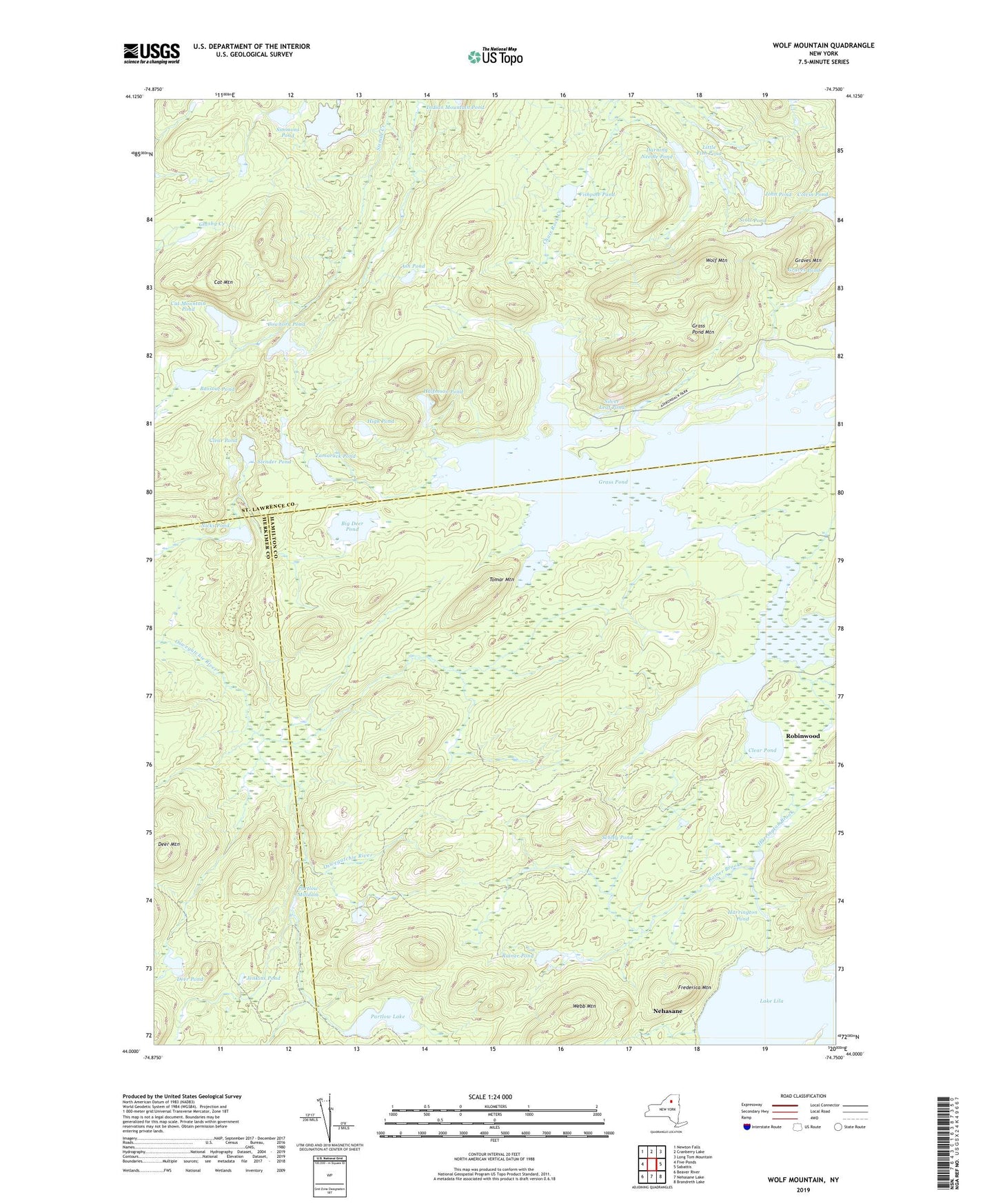
2023 topographic map quadrangle Wolf Mountain in the state of New York. Scale: 1:24000. Based on the newly updated USGS 7.5' US Topo map series, this map is in the following counties: Hamilton, St. Lawrence, Herkimer. The map contains contour data, water features, and other items you are used to seeing on USGS maps, but also has updated roads and other features. This is the next generation of topographic maps. Printed on high-quality waterproof paper with UV fade-resistant inks.
Quads adjacent to this one:
West: Five Ponds
Northwest: Newton Falls
North: Cranberry Lake
Northeast: Long Tom Mountain
East: Sabattis
Southeast: Brandreth Lake
South: Nehasane Lake
Southwest: Beaver River
This map covers the same area as the classic USGS quad with code o44074a7.
Contains the following named places: Ash Pond, Ash Pond Trail, Bassout Pond, Big Deer Pond, Big Deer Pond Trail, Bog Lake, Cat Mountain, Cat Mountain Pond, Clear Pond, Colvin Pond, Cowhorn Pond, Darning Needle Pond, Deer Mountain, Deer Pond, Fishpole Pond, Frederica Mountain, Grass Pond, Grass Pond Mountain, Graves Mountain, Graves Pond, Halfmoon Pond, Harrington Brook, Harrington Pond, High Pond, Jenkins Pond, John Pond, Lake Lila, Little Fish Pond, Nehasane, Nicks Pond, Olmstead Pond, Partlow Lake, Partlow Milldam, Rainer Brook, Rainer Pond, Schley Pond, Scott Pond, Silver Leaf Pond, Simmons Pond, Sixmile Creek Trail, Slender Pond, Spruce Island, Tamarack Pond, The Loop, Tomar Mountain, Tomar Pond, Webb Mountain, Wolf Mountain